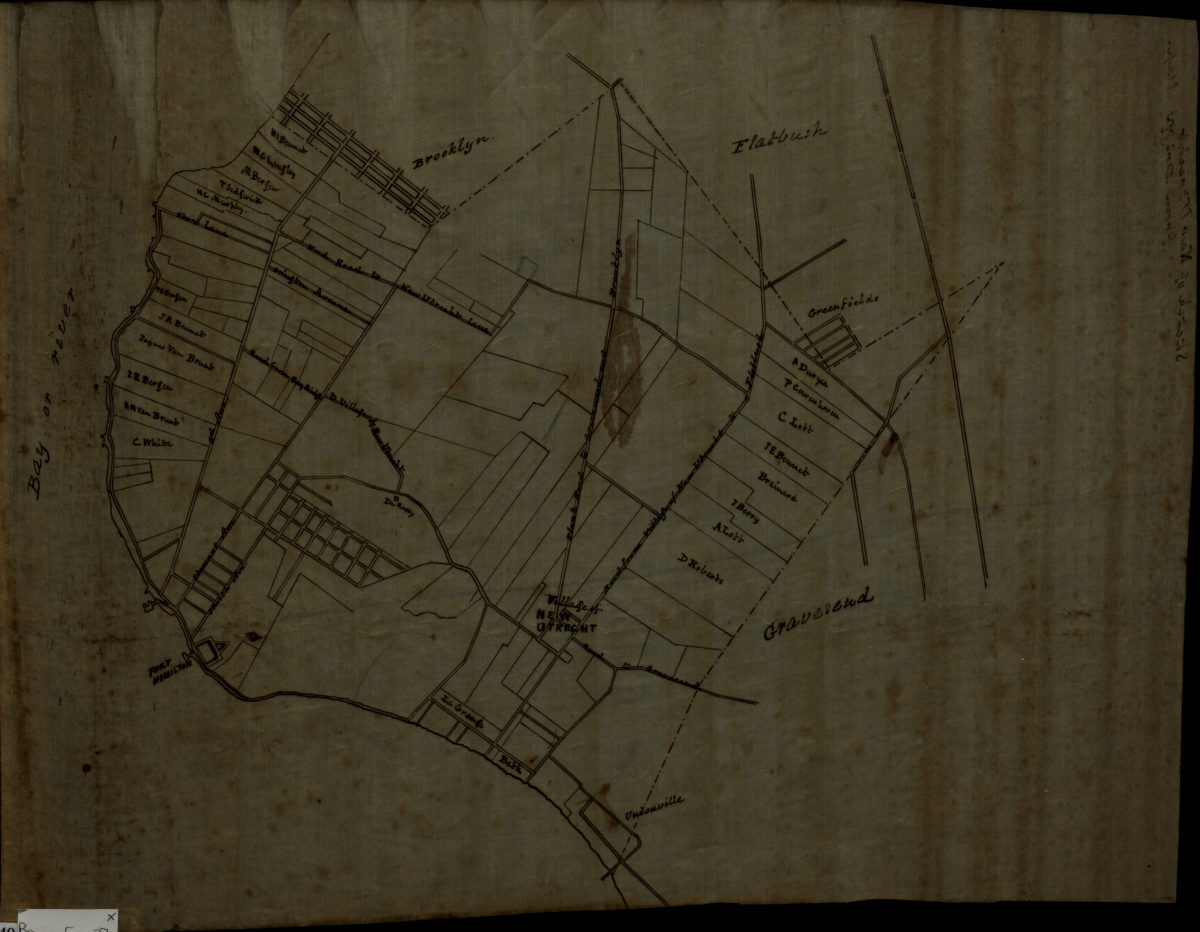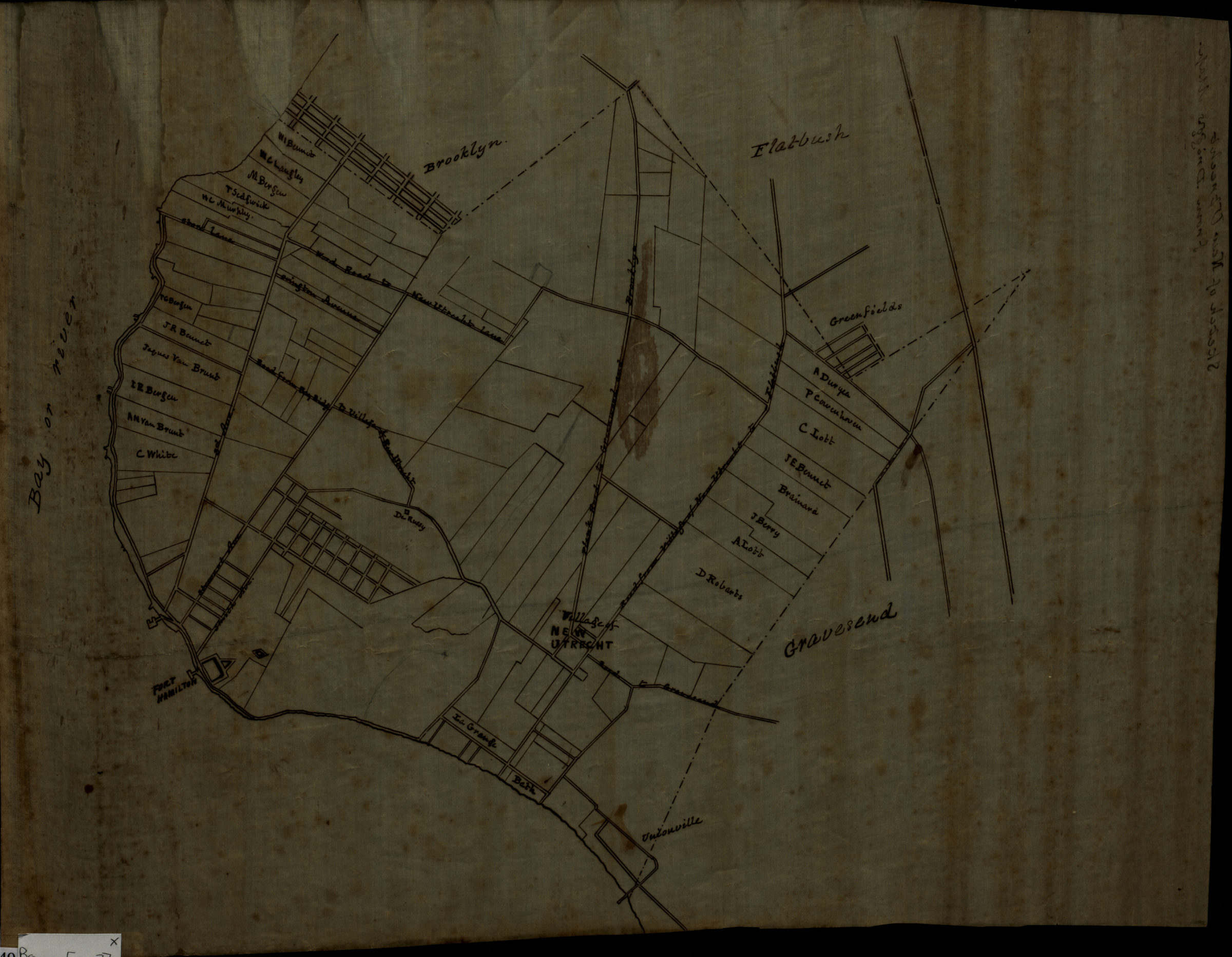
Sketch of New Utrecht from Dripps map [18??]
Map No. Bergen-[18--?]w.Fl
Verso title. Covers town of New Utrecht in modern-day Bay Ridge, Fort Hamilton, Dyker Heights, Sunset Park, Borough Park, Bensonhurst, and Bath Beach. Shows property and the names of some landowners. Cataloger unable to determine date of situation or original map from which this copy is made. Attributed to Teunis G. Bergen, based on handwriting on piece.
Subjects
Places
Map area shown
Relation
Full catalog recordSize
36 × 45 cmDownload
Low Resolution Image
Creator
Bergen, Teunis G.,Publisher
Brooklyn Historical SocietyCitation
Sketch of New Utrecht from Dripps map; [18??], Map Collection, Bergen-[18--?]w.Fl; Brooklyn Historical Society.Scale
Scale not givenLoading zoom image...