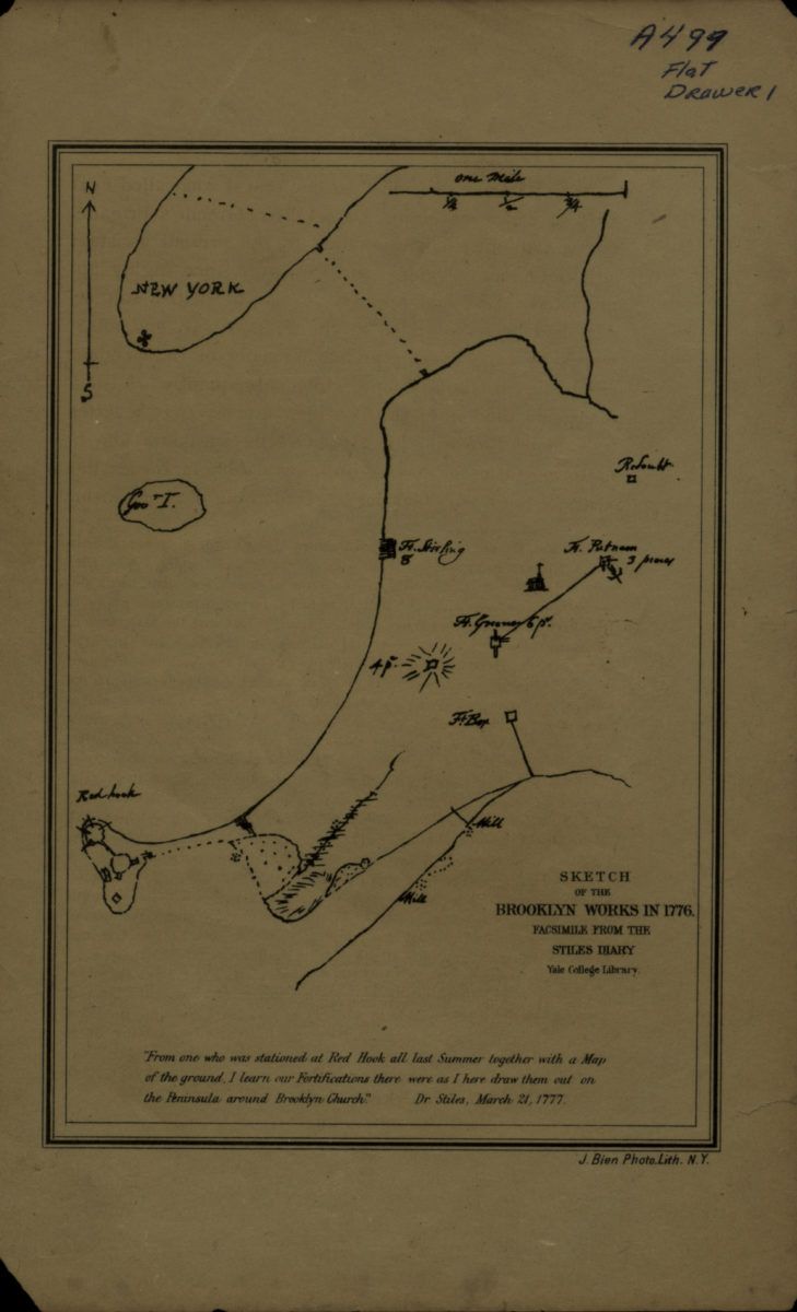
Sketch of the Brooklyn Works in 1776 [18??]
Map No. Rev. War-1776 (18--?).Fl
Facsimile of manuscript map from the Stiles Diary. Covers Brooklyn north from Red Hook to the Navy Yard. Also covers Governors Island and a portion of Lower Manhattan. Shows forts and mills. Relief shown pictorially and by hachures. Includes note.
Map area shown
Genre
Military mapsRelation
Full catalog recordSize
17 × 12 cmDownload
Low Resolution Image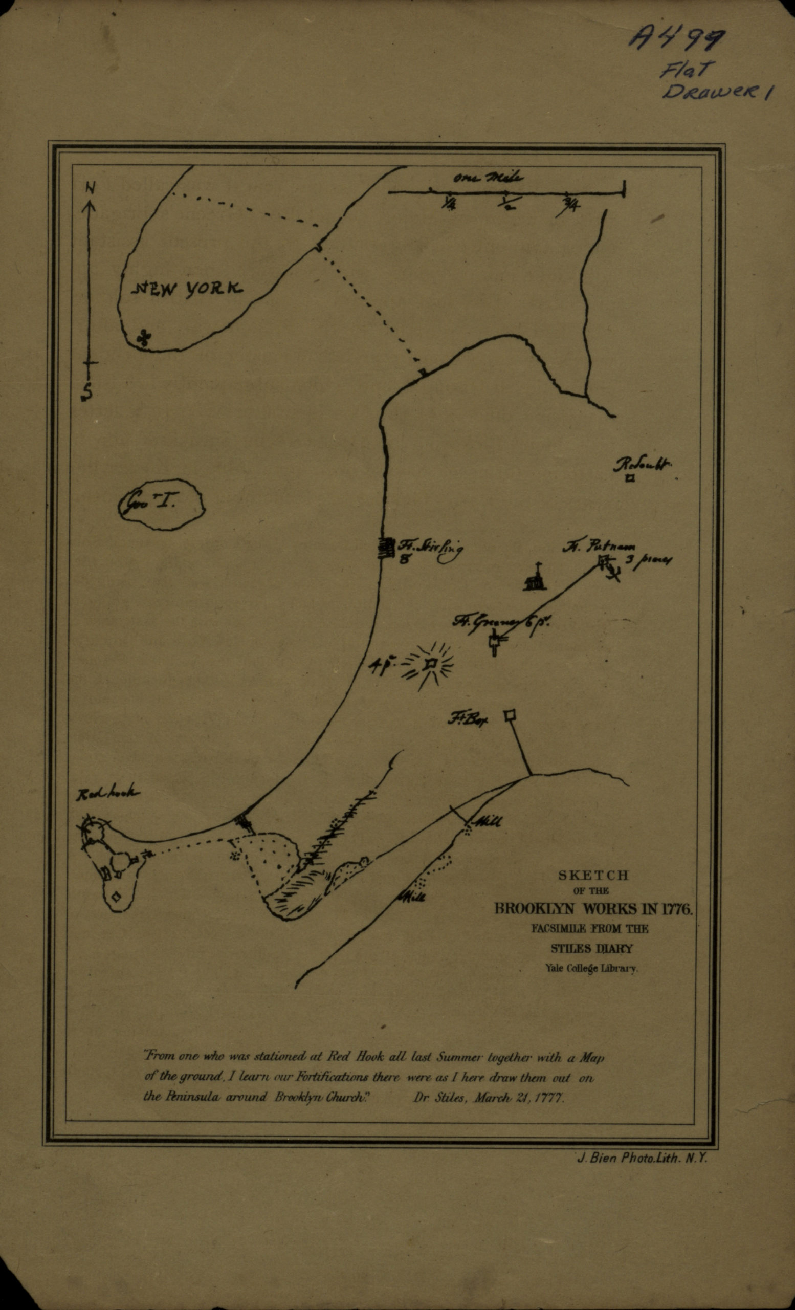
Creator
Stiles, Ezra,Publisher
Brooklyn Historical SocietyCitation
Sketch of the Brooklyn Works in 1776; [18??], Map Collection, Rev. War-1776 (18--?).Fl; Brooklyn Historical Society.Scale
Scale [ca. 1:38,255]Loading zoom image...