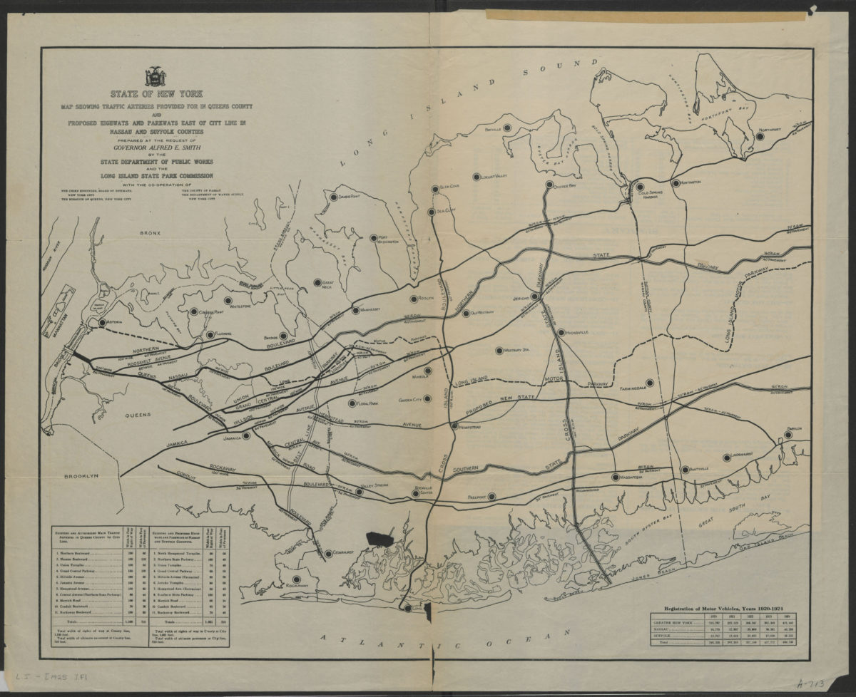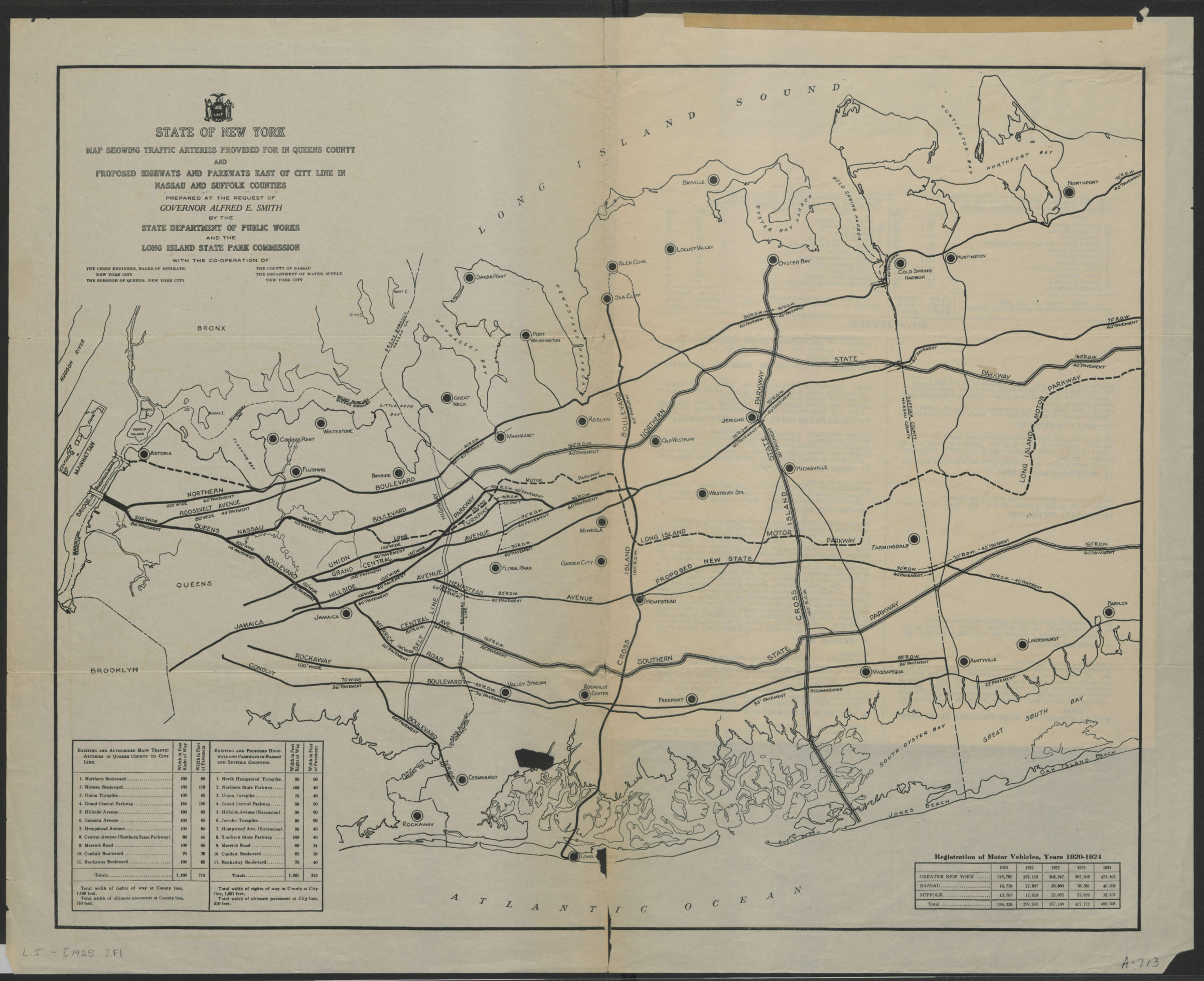
State of New York map showing traffic arteries provided for in Queens County and proposed highways and parkways east of city line in Nassau and Suffolk Counties: prepared at the request of Governor Alfred E. Smith [1925]
Map No. L.I.-[1925].Fl
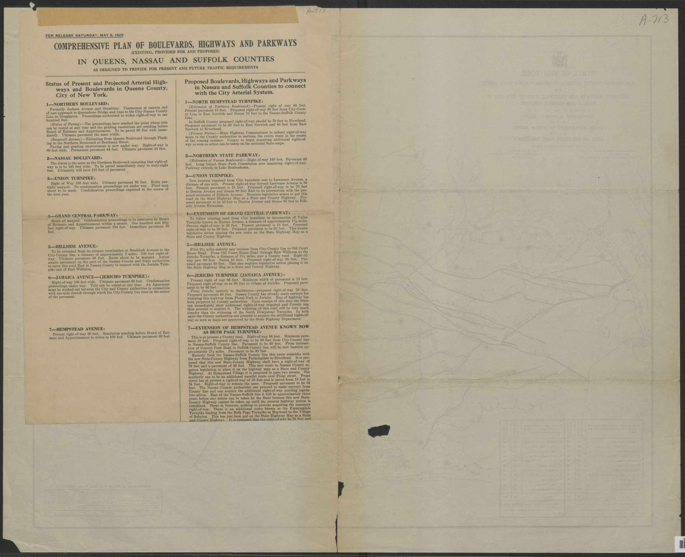
Shows existing and proposed roads. Accompanied by Comprehensive plan of boulevards, highways and parkways (existing, provided for and proposed) in Queens, Nassau and Suffolk Counties as designed to provide for present and future traffic requirements (1 sheet 75 cm). At head of sheet: “For release Saturday, May 9, 1925.”
Map area shown
Genre
Road mapsRelation
Full catalog recordSize
48 × 60 cmDownload
Low Resolution Image
Creator
New York (State); Department of Public Works,Publisher
Brooklyn Historical SocietyCitation
State of New York map showing traffic arteries provided for in Queens County and proposed highways and parkways east of city line in Nassau and Suffolk Counties: prepared at the request of Governor Alfred E. Smith; [1925], Map Collection, L.I.-[1925].Fl; Brooklyn Historical Society.Scale
Scale not givenLoading zoom image...