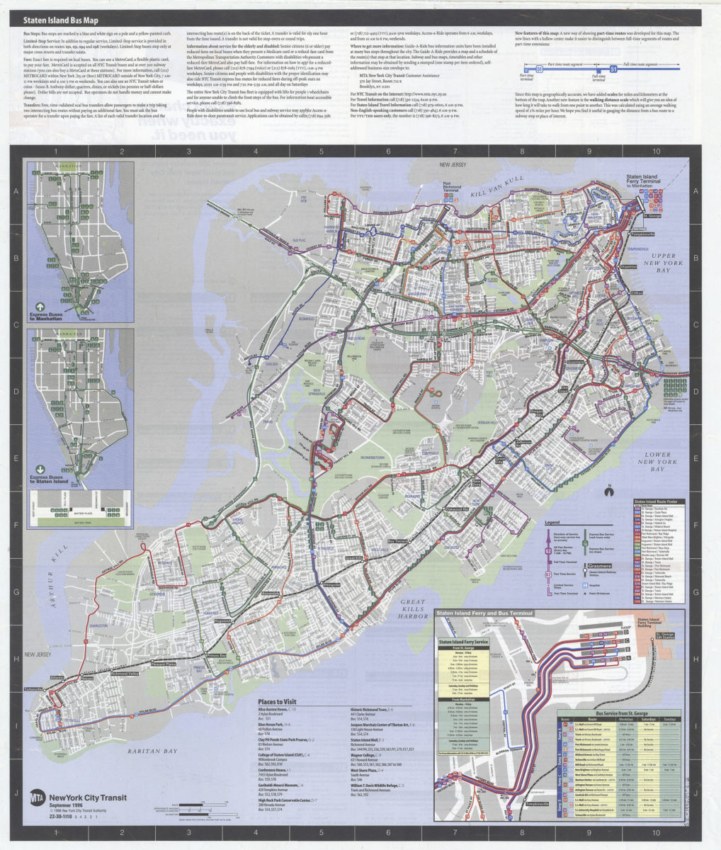
Staten Island bus map: MTA, New York City Transit [ca. 1996]
Map No. S.I.-1996.Fl
“Updated for fall service changes.” Includes text, 3 insets, index to places of interest, ferry/bus schedules, and color-coded bus-route directory. On verso: Bus-route directory with time/frequency tables, “MTA Staten Island Railway” route map, and advertisement. “22-30-1010. 5 4 3 2 1.”
Map area shown
Genre
Transportation mapsRelation
Full catalog recordSize
64 × 54 cmDownload
Low Resolution Image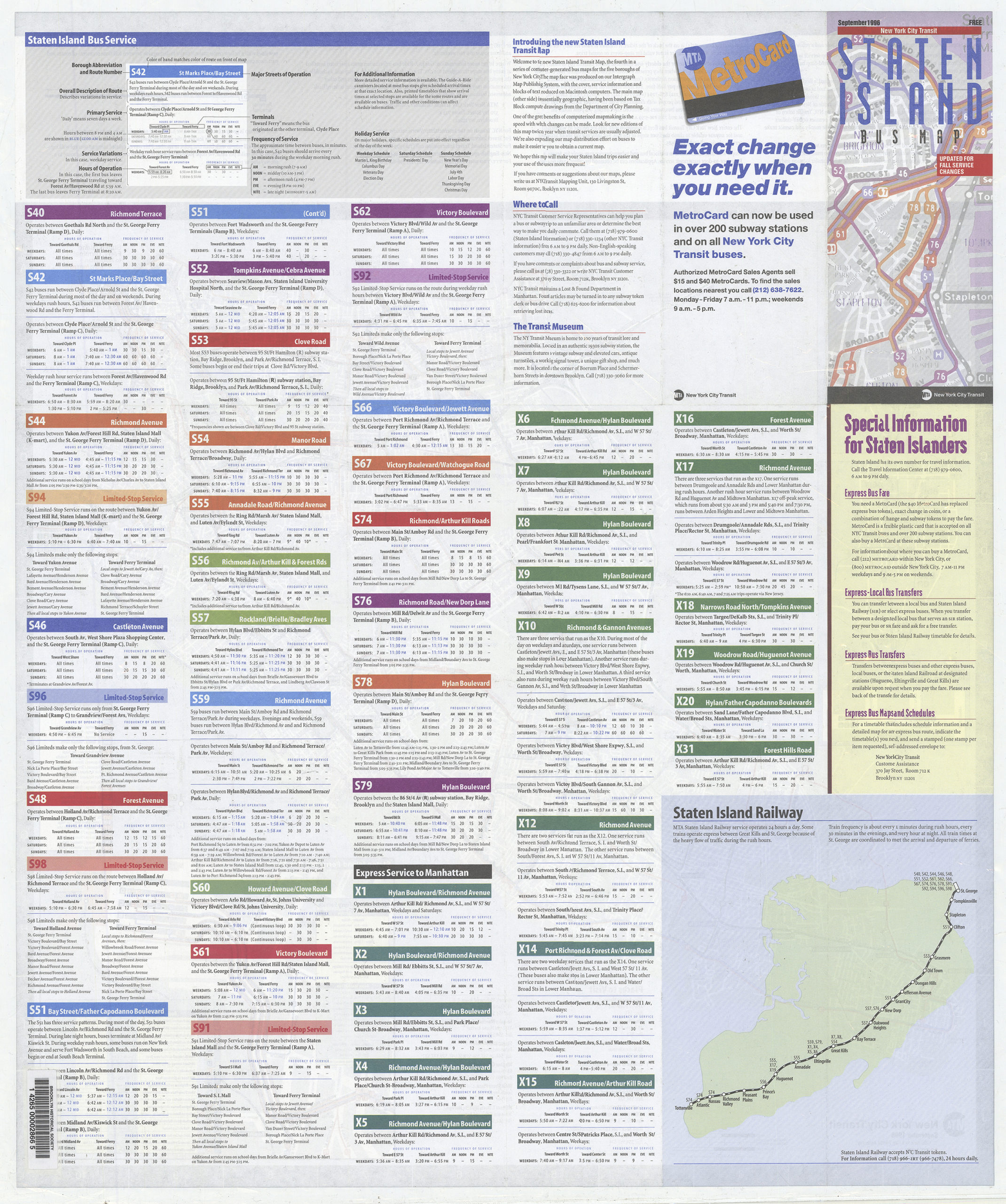
Creator
New York City Transit Authority,Publisher
Brooklyn Historical SocietyCitation
Staten Island bus map: MTA, New York City Transit; [ca. 1996], Map Collection, S.I.-1996.Fl; Brooklyn Historical Society.Scale
Scale [ca. 1:45,000]Loading zoom image...