
Steele’s new map of the city of Buffalo: compiled form reliable records and corrected by actual surveys shewing the extent & boundaries of the several blocks, also exhibiting the proposed harbor and canal improvements 1850
Map No. NYS-1850.Fl
Shows churches, public buildings, hotels, railroads, slips, and docks. Depths shown by soundings and isolines. Includes ill. (bracketed by title), and index.
Map area shown
Genre
Bathymetric mapsRelation
Full catalog recordSize
52 × 48 cmDownload
Low Resolution Image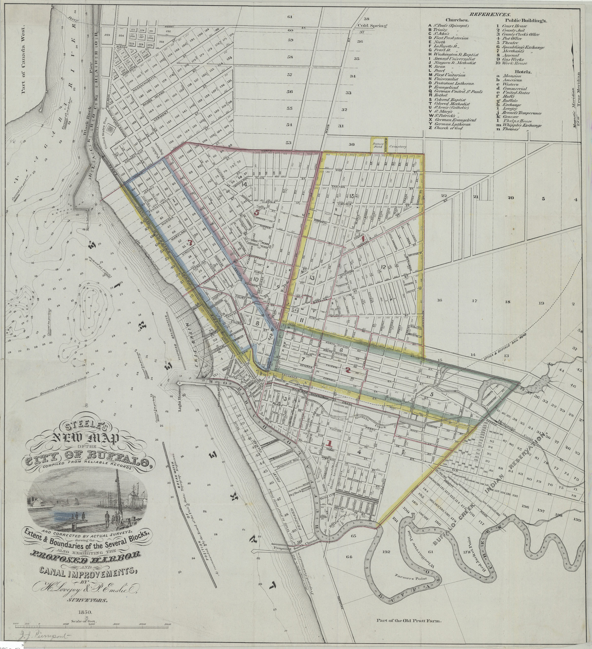
Creator
Lovejoy, H.,Publisher
Brooklyn Historical SocietyCitation
Steele’s new map of the city of Buffalo: compiled form reliable records and corrected by actual surveys shewing the extent & boundaries of the several blocks, also exhibiting the proposed harbor and canal improvements; 1850, Map Collection, NYS-1850.Fl; Brooklyn Historical Society.Scale
Scale [ca. 1:14,400]Loading zoom image... 