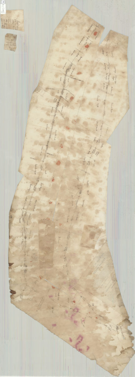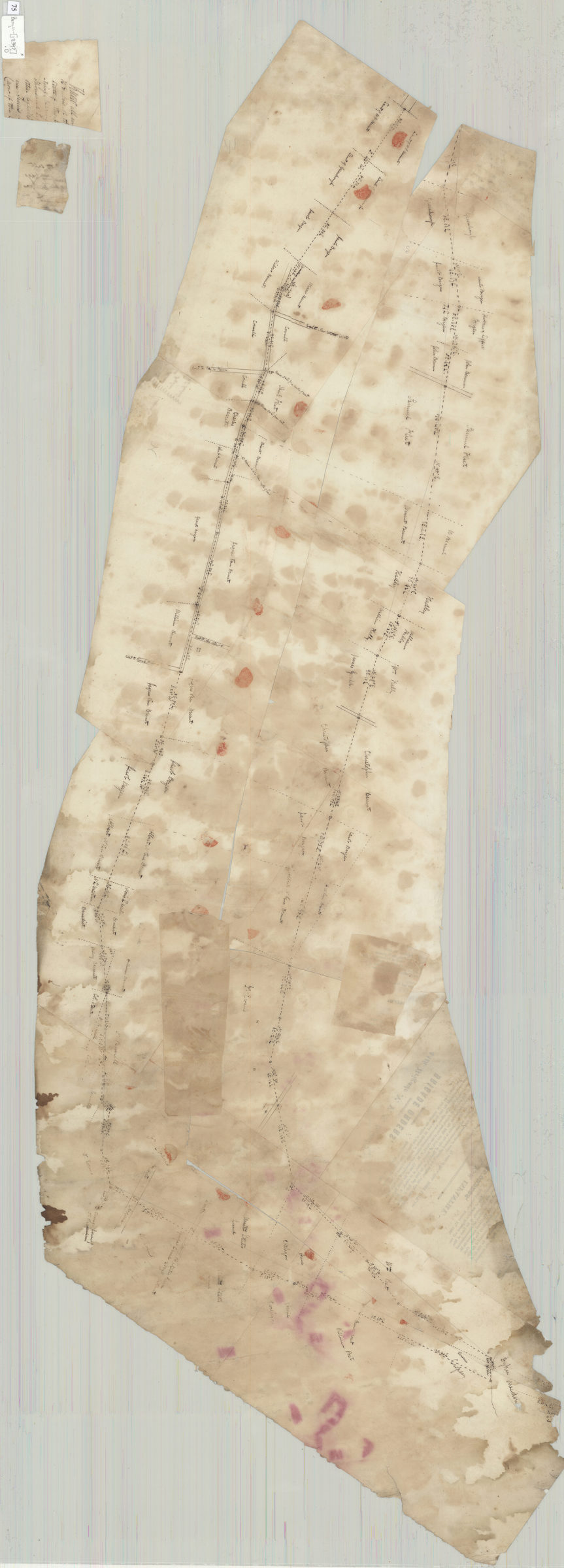

[Survey map of 2 proposed routes north from Dyker Meadow in the town of New Utrecht] [1839]
Map No. Bergen-[1839?].O
Map of area north of Dyker Meadow in modern-day Fort Hamilton and Bay Ridge. Shows proposed routes, property lines, and names of landowners. Title devised by cataloger. Attributed to Teunis G. Bergen, based on handwriting. Irregularly shaped. On verso–“Survey of route for a road from Brooklyn to Washington Park & La Grangge, 1839.” Cataloger unable to determine relationship of this text to map. Encapsulated with 2 sheets containing fragments of text.
Subjects
Places
Map area shown
Genre
Cadastral mapsRelation
Full catalog recordSize
43 × 139 cmDownload
Low Resolution Image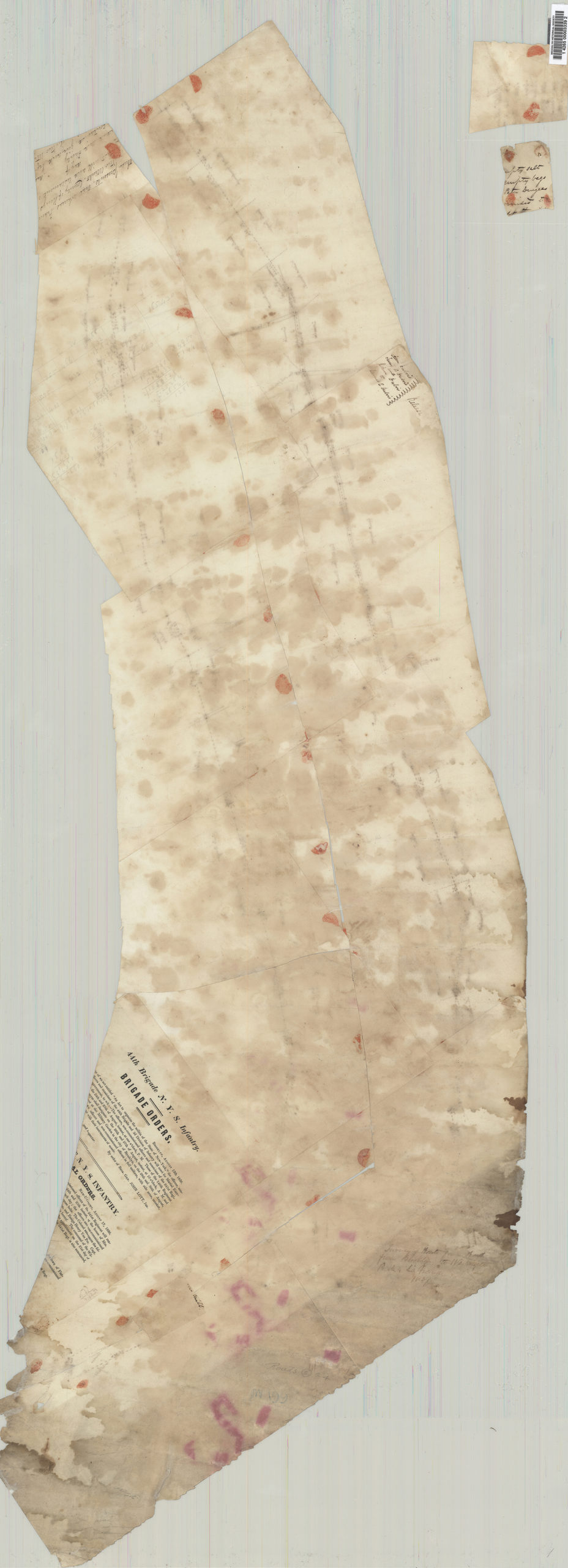
Creator
Bergen, Teunis G.,Publisher
Brooklyn Historical SocietyCitation
[Survey map of 2 proposed routes north from Dyker Meadow in the town of New Utrecht]; [1839], Map Collection, Bergen-[1839?].O; Brooklyn Historical Society.Scale
Scale not givenLoading zoom image...