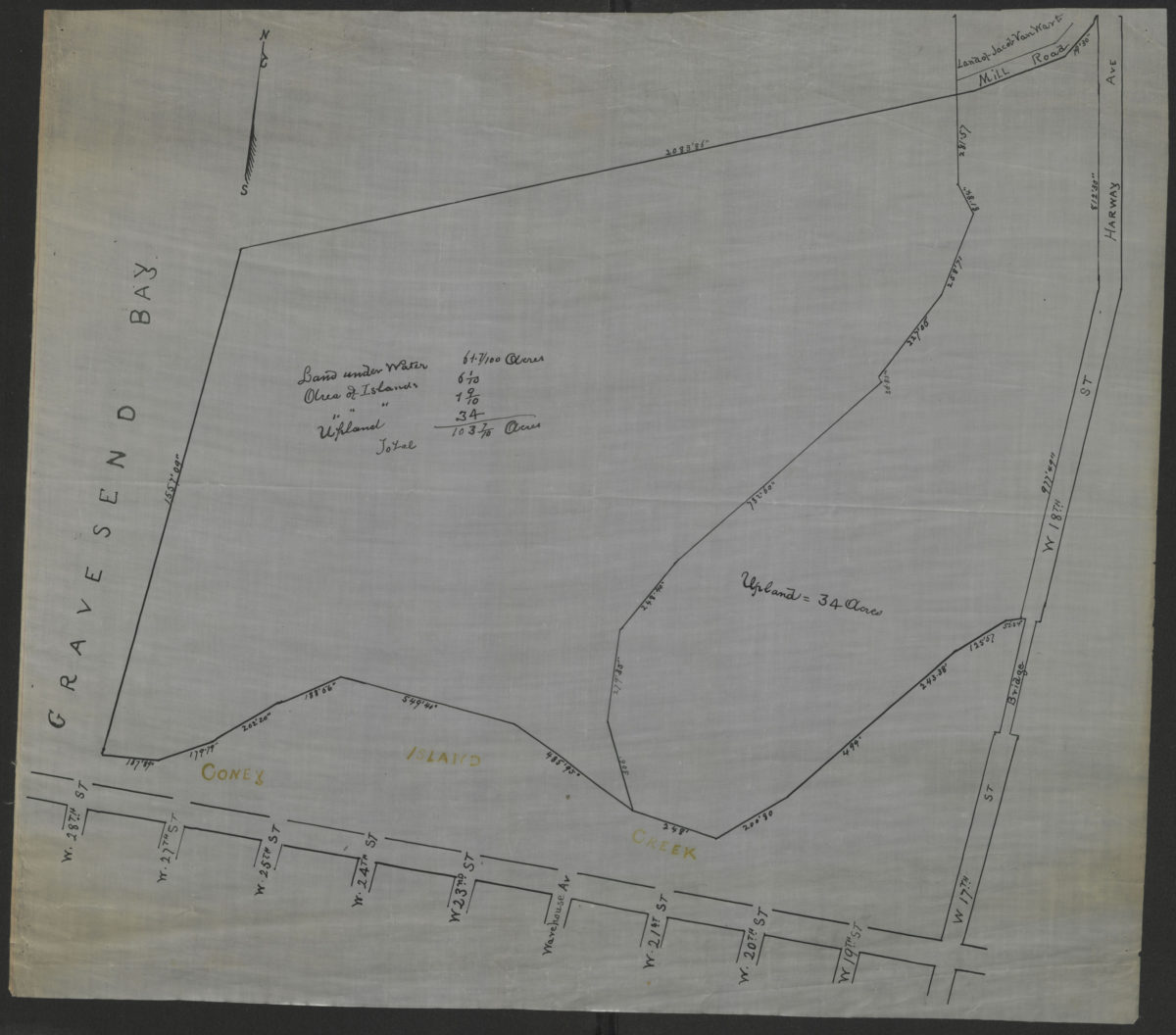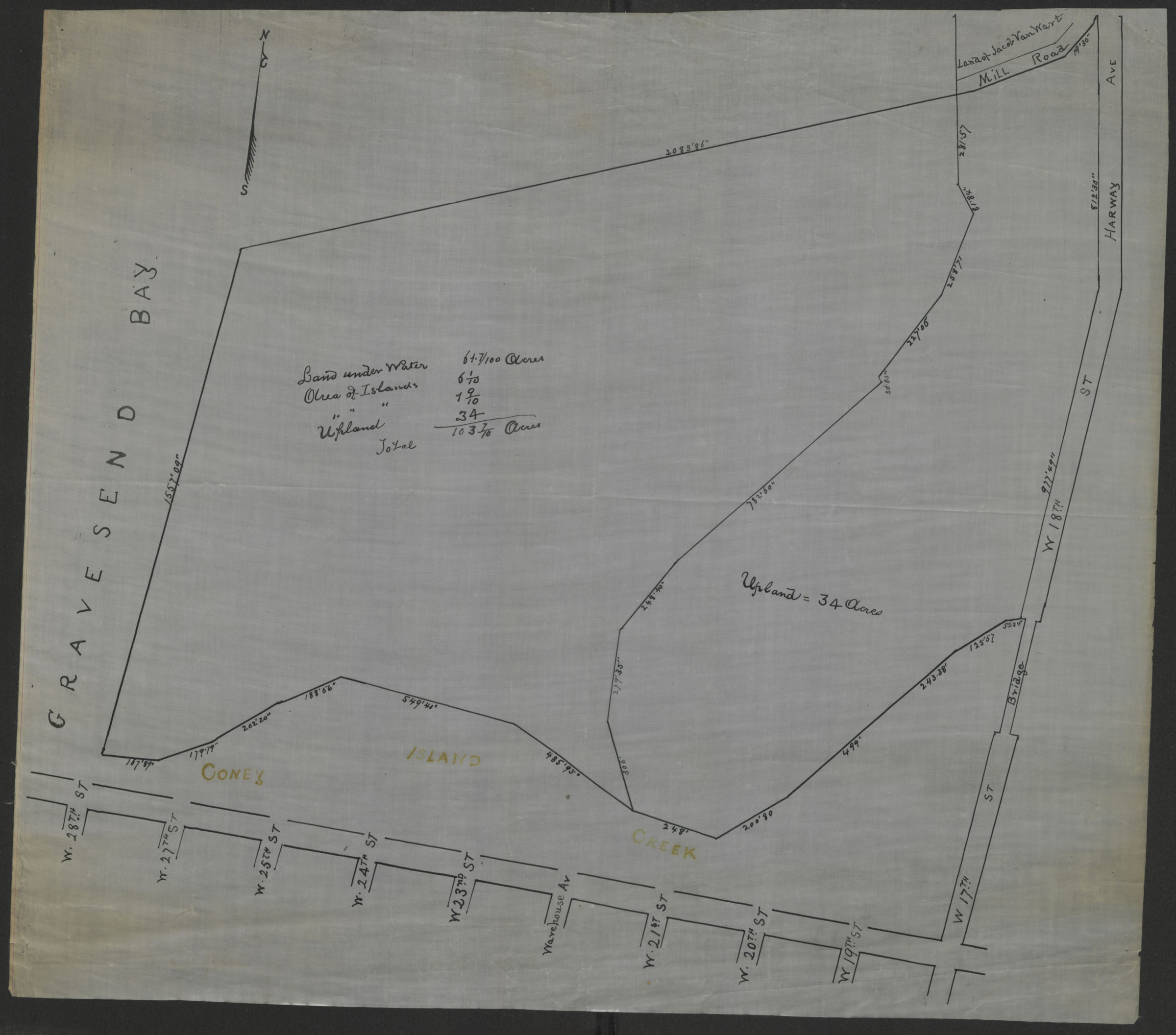

[Survey map of Coney Island and Gravesend] [18??]
Map No. B A-[18--?]d.Fl
Covers area east from W. 17th St. to W. 28th St. and north to Mill Rd. (modern-day Coney Island and Gravesend). Shows measurements of lands under water, islands, and “upland.” Title devised by cataloger.
Subjects
Places
Map area shown
Genre
Manuscript mapsRelation
Full catalog recordSize
48 × 54 cmDownload
Low Resolution Image
Creator
Publisher
Brooklyn Historical Society, Brooklyn Historical SocietyCitation
[Survey map of Coney Island and Gravesend]; [18??], Map Collection, B A-[18--?]d.Fl; Brooklyn Historical Society.Scale
Scale not givenLoading zoom image...