
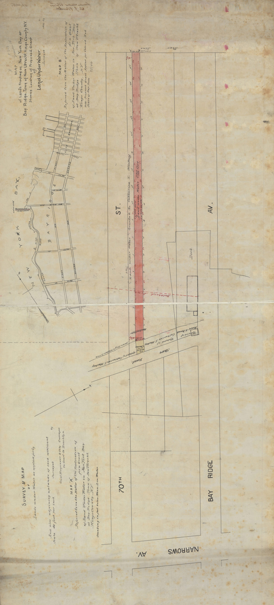
Survey & map of lands under water as applied for by [blank], and also adjoining uplands of said applicant 1892
Cadastral maps covering area in modern-day Bay Ridge. “Map A …” shows property, names of landowners, pierhead lines, bulkhead lines, high water lines, and “uplands.” “Map B …” is location map for “Map A …” Depths shown by soundings in feet on “Map A …” Orientations differ. Likely attributed to Samuel McElroy, based on handwriting on piece. Item incomplete name of applicant not filled in. “Map B …” also referred to as “Map of lands fronting on New York Bay at Bay Ridge, town of New Utrecht, Kings County, N.Y., showing location of proposed grant of land under water.” Map A, referred to in the matter of the application of [blank] for a grant of land under water in New York Bay at Bay Ridge, town of New Utrecht, Kings County, N.Y.. Map B, referred to in the matter of the application of [blank] for a grant of land under water in New York Bay at Bay Ridge, town of New Utrecht, Kings County, N.Y.”
Subjects
Places
Map area shown
Relation
Full catalog recordSize
52 × 113 cmDownload
Low Resolution Image
Creator
McElroy, Samuel, McElroy, Samuel,Publisher
Brooklyn Historical Society, Brooklyn Historical SocietyCitation
Survey & map of lands under water as applied for by [blank], and also adjoining uplands of said applicant; 1892, Map Collection, B P-1892.Fl; Brooklyn Historical Society.Scale
Scales differ