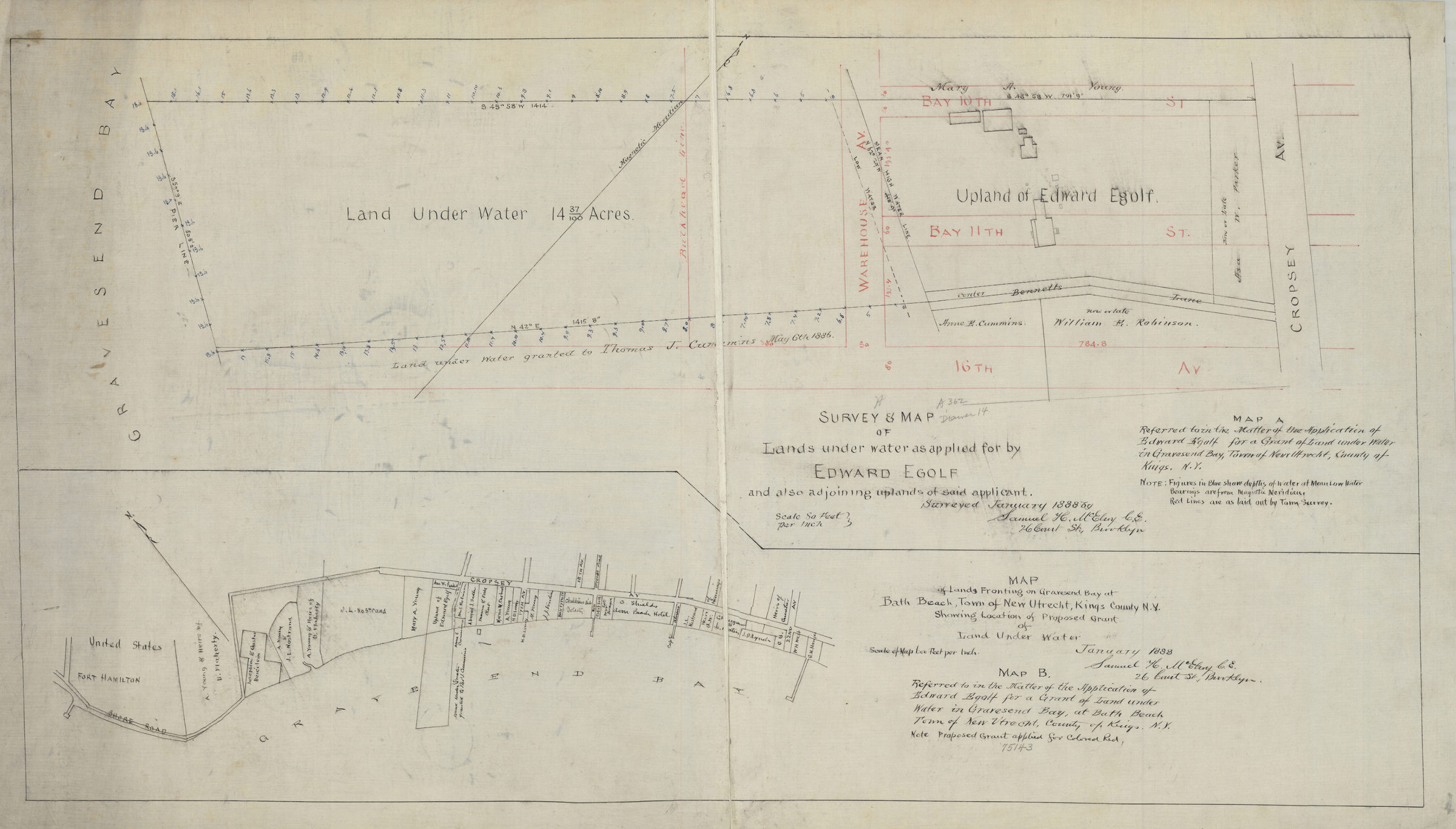

Survey & map of lands under water as applied for by Edward Egolf, and also adjoining uplands of said applicant: surveyed … by Samuel H. McElroy, C.E. January 1888
Cadastral maps covering areas in modern-day Gravesend and Bath Beach. Maps show property (including dimensions and buildings), and names of landowners. Depths shown by soundings on “Map A …” Orientations differ. Maps irregularly shaped. “Map B …” also referred to as “Map of lands fronting the Gravesend Bay at Bath Beach, town of New Utrecht, Kings County, N.Y., showing location of proposed grant of land under water.” Map A, referred to in the matter of the application of Edward Egolf for a grant of land under water in Gravesend Bay, town of New Utrecht, county of Kings, N.Y.. Map B, referred to in the matter of the application of Edward Egolf for a grant of land under water in Gravesend Bay, at Bath Beach, town of New Utrecht, county of Kings, N.Y.”
Subjects
Places
Map area shown
Relation
Full catalog recordSize
48 × 93 cmDownload
Low Resolution Image
Creator
McElroy, Samuel, McElroy, Samuel,Publisher
Brooklyn Historical Society, Brooklyn Historical SocietyCitation
Survey & map of lands under water as applied for by Edward Egolf, and also adjoining uplands of said applicant: surveyed … by Samuel H. McElroy, C.E.; January 1888, Map Collection, B P-1888a.Fl; Brooklyn Historical Society.Scale
Scales differ