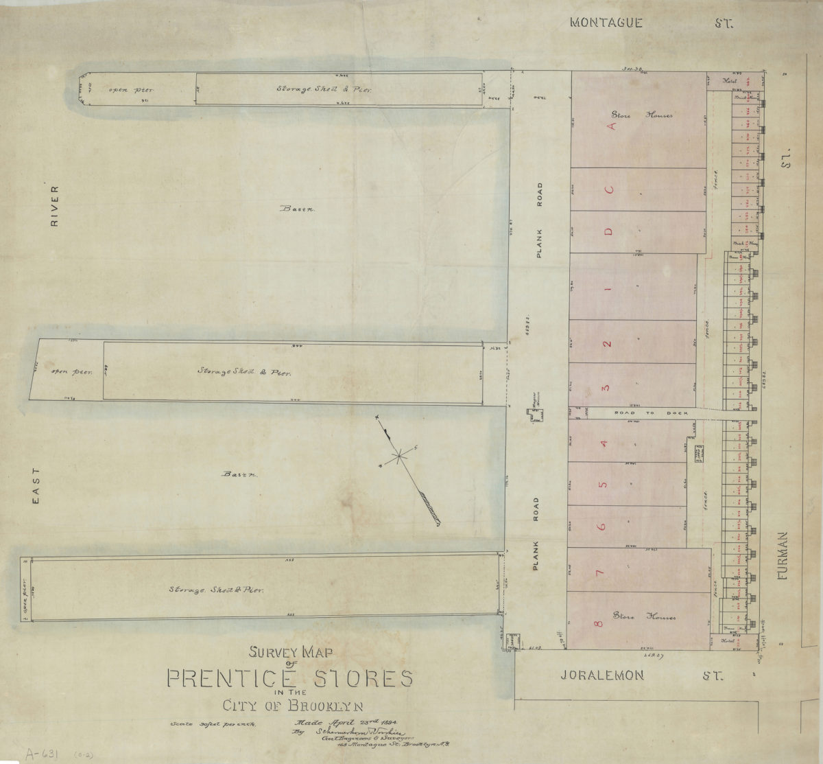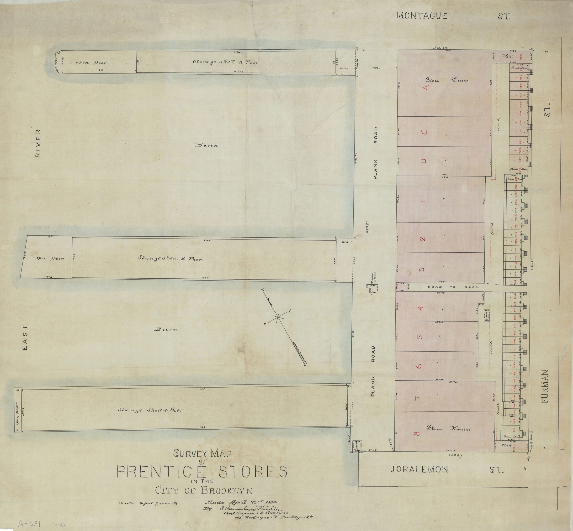
Survey map of Prentice Stores in the city of Brooklyn: by Schermerhorn [and] Voorhies, civil engineers & surveyors April 23, 1894
Map No. B P-1894b.Fl
Cadastral map covering area bounded by the East River, Joralemon St., Furman St., and Montague St. (modern-day Brooklyn Heights). Shows property (including lots, dimensions, and buildings), and piers. Oriented with north to the upper left.
Map area shown
Relation
Full catalog recordSize
77 × 83 cmDownload
Low Resolution Image
Creator
Schermerhorn, Richard,Publisher
Brooklyn Historical SocietyCitation
Survey map of Prentice Stores in the city of Brooklyn: by Schermerhorn [and] Voorhies, civil engineers & surveyors; April 23, 1894, Map Collection, B P-1894b.Fl; Brooklyn Historical Society.Scale
Scale [1:360] 1 in to 30Loading zoom image...