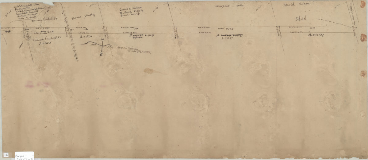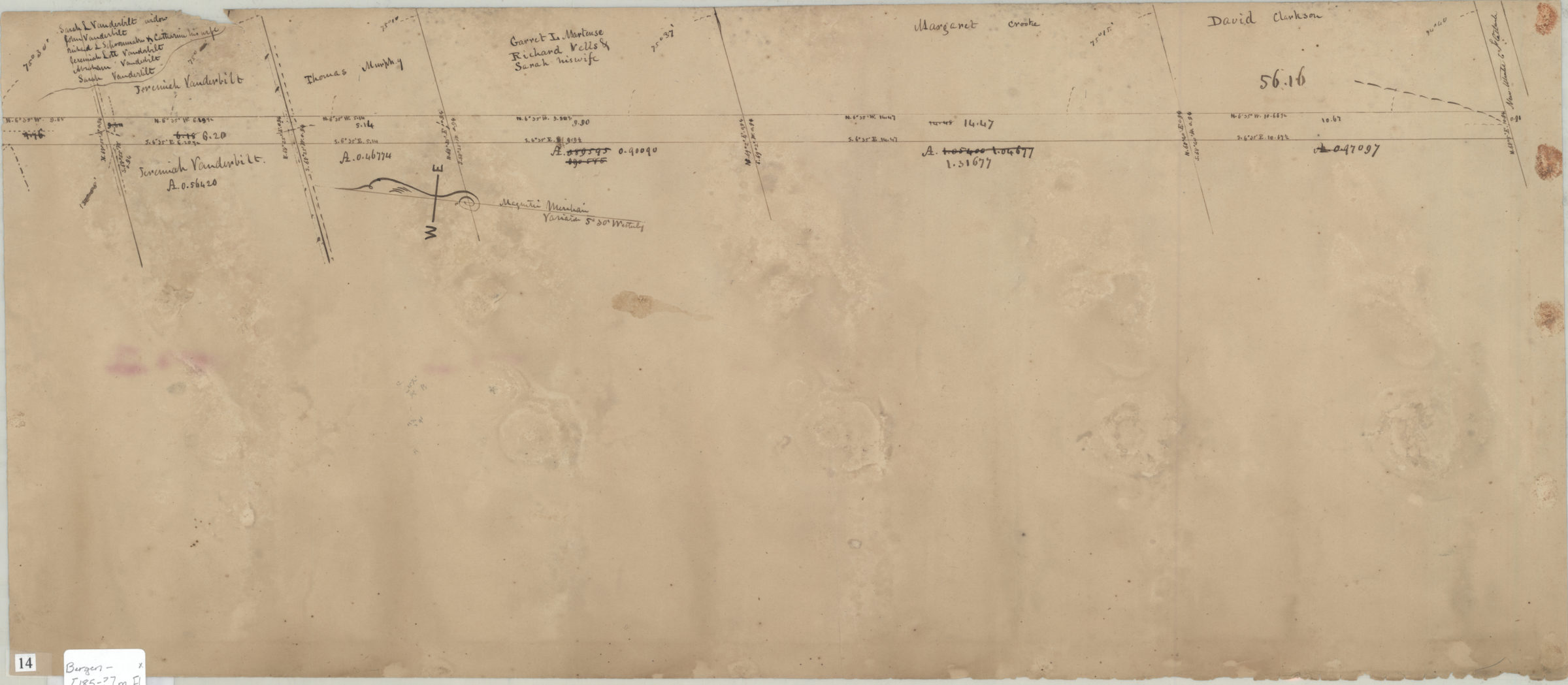
[Survey map of road in Brooklyn] [185?]
Map No. Bergen-[185-?]m.Fl
Survey map covering unknown area, likely Brooklyn. No street names given on map does show names of landowners, including the Martenses and Vanderbilts. Title devised by cataloger. Likely attributed to T.G. Bergen, based on handwriting on piece. Oriented with north to the left.
Map area shown
Genre
Manuscript mapsRelation
Full catalog recordSize
28 × 66 cmDownload
Low Resolution Image
Creator
Bergen, Teunis G.,Publisher
Brooklyn Historical SocietyCitation
[Survey map of road in Brooklyn]; [185?], Map Collection, Bergen-[185-?]m.Fl; Brooklyn Historical Society.Scale
Scale not givenLoading zoom image...