[Survey maps of Flatlands] [18??]
Map No. Bergen-[18--?]m.Fl
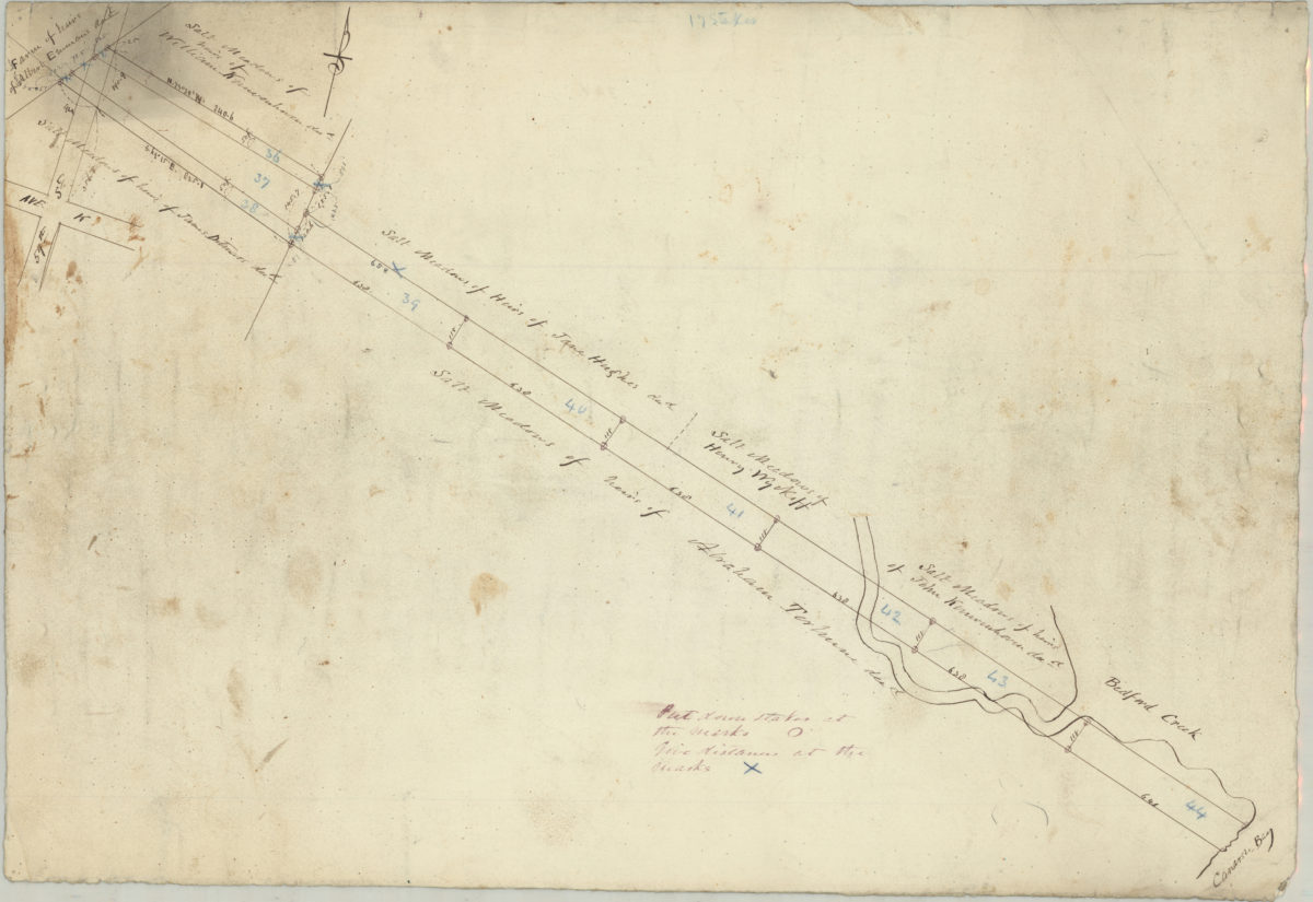
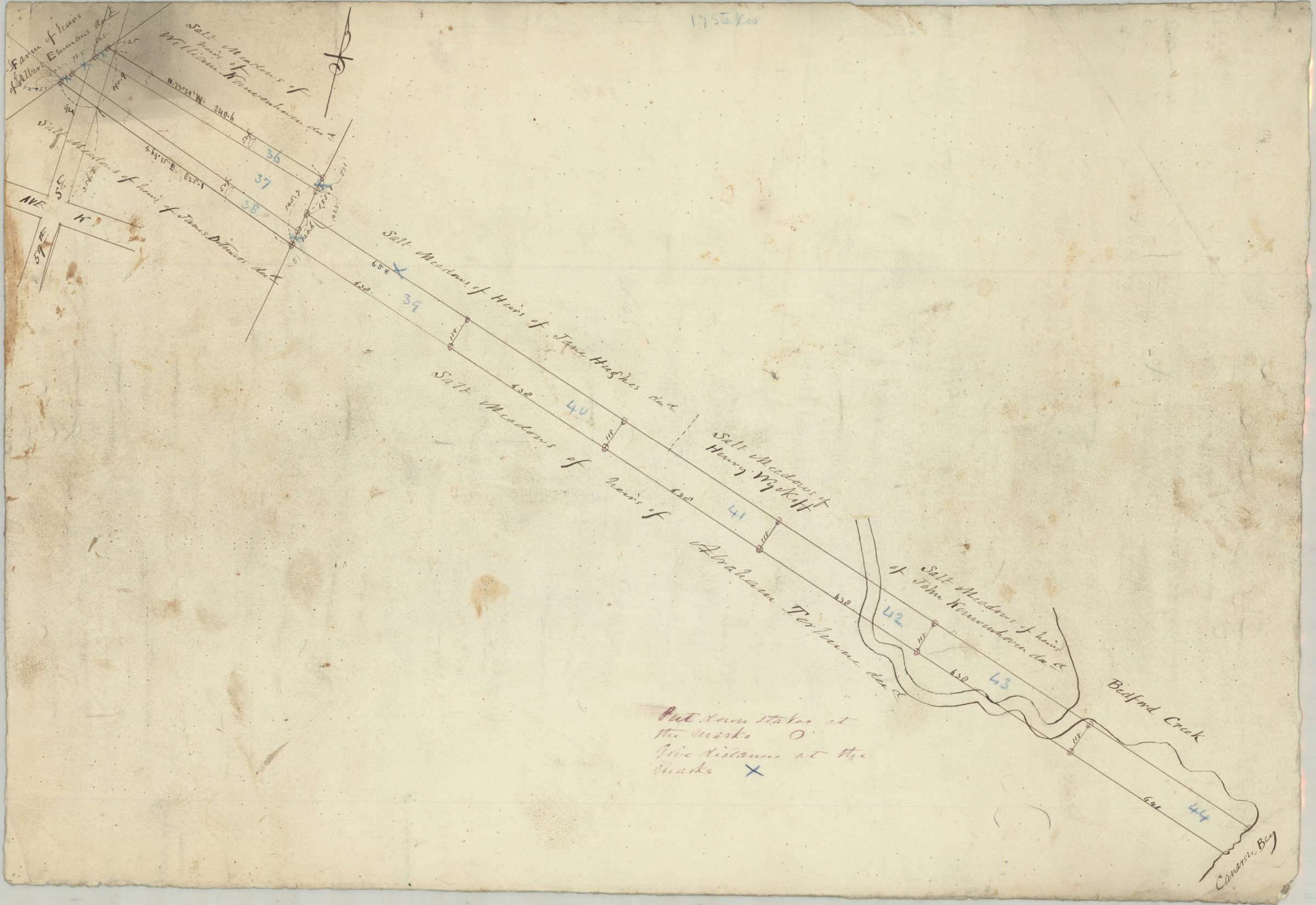
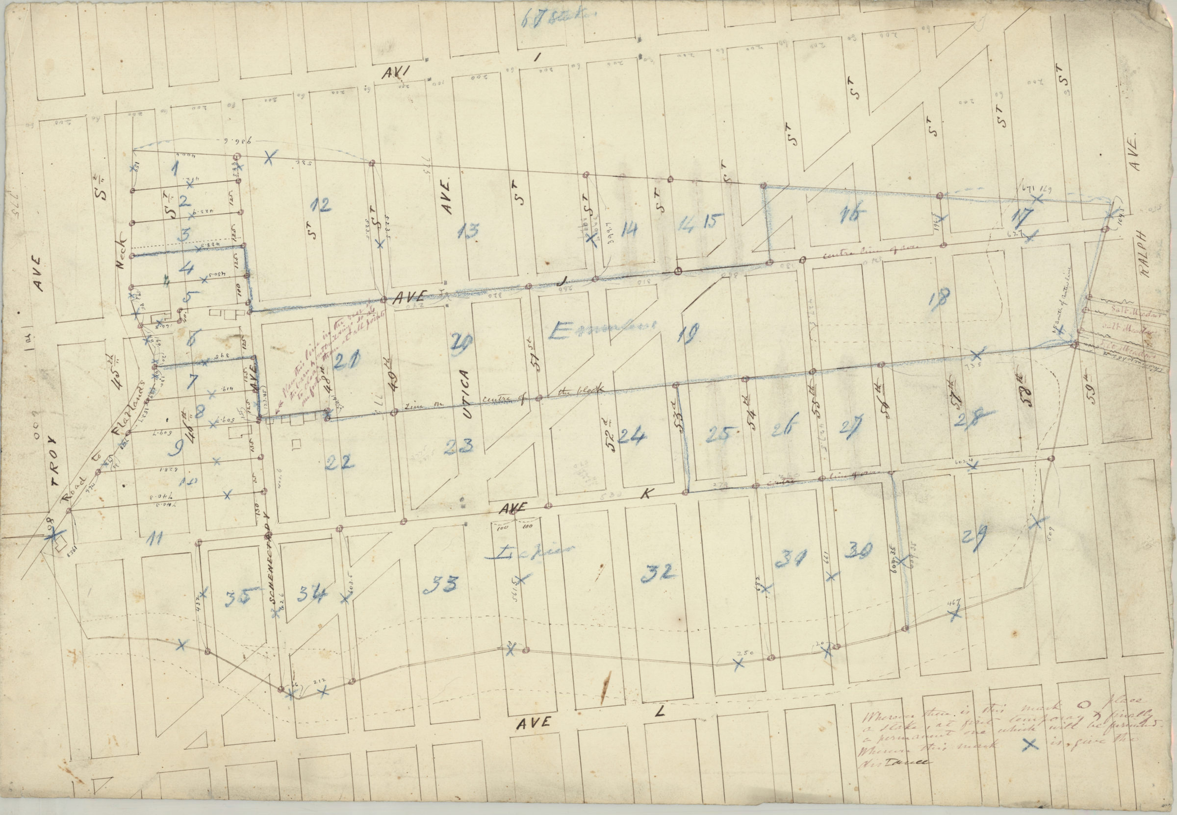
Cadastral survey maps covering area in modern-day Flatlands (including Futurama). Maps shows buildings, dimensions, and names of landowners. Title devised by cataloger. Likely attributed to T.G. Bergen, based on handwriting on piece. [Map of area bounded by Ave. L, Ralph Ave., Ave. I, and Troy Ave.]. [Map of salt meadows near 59th St. and Ave. K].
Subjects
Places
Map area shown
Relation
Full catalog recordSize
39 × 57 cmDownload
Low Resolution Image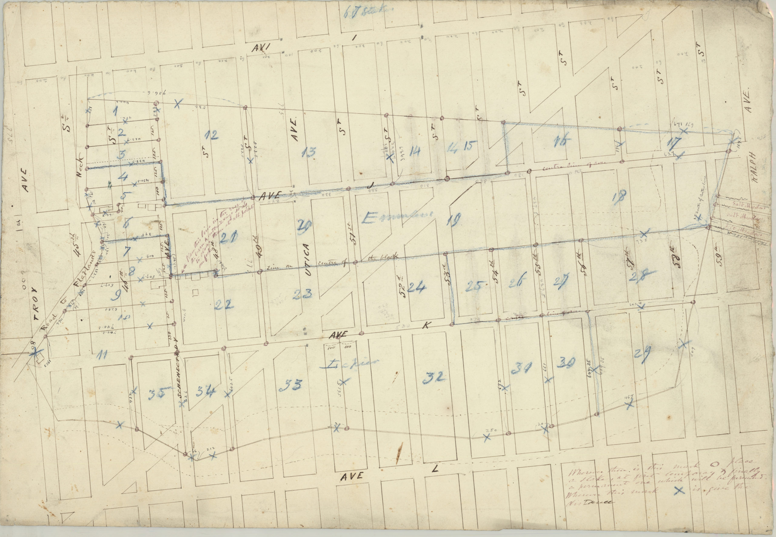
Creator
Bergen, Teunis G.,Publisher
Brooklyn Historical SocietyCitation
[Survey maps of Flatlands]; [18??], Map Collection, Bergen-[18--?]m.Fl; Brooklyn Historical Society.Scale
Scale not givenLoading zoom image...