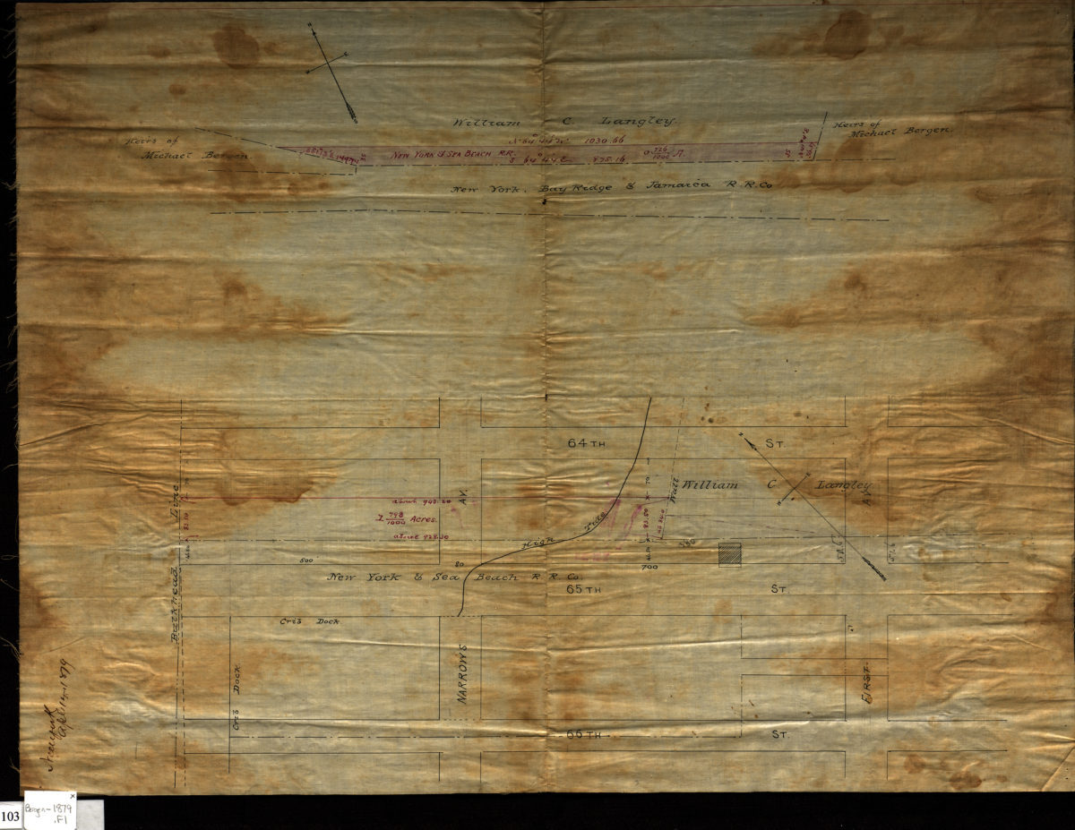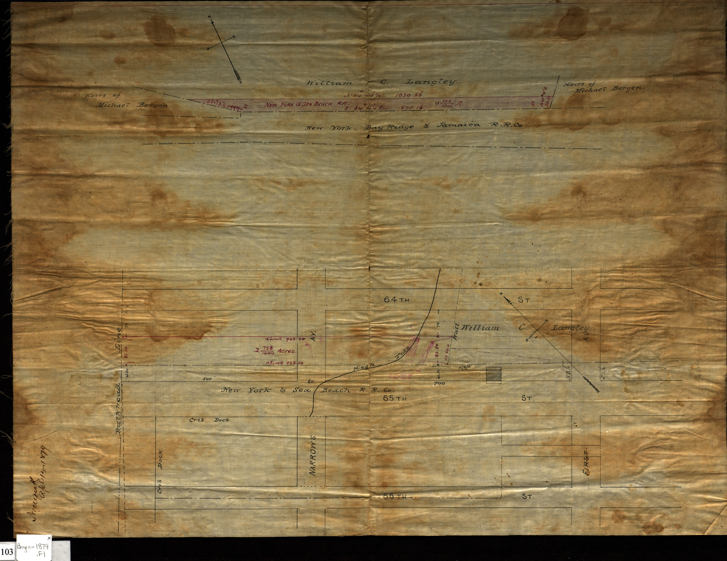
[Survey maps of New York & Sea Beach Railroad Company property in Bay Ridge] April 14, 1879
Map No. Bergen-1879.Fl
Cadastral maps cover areas in modern-day Bay Ridge. Shows streets, bulkhead line, names of landowners, and line of high tide. Title devised by cataloger. Attributed to Van Brunt Bergen, based on handwriting on piece. Oriented with north to the upper left. [Area bounded by 64th Street, First Avenue, 66th Street, and the bulkhead line]. [New York & Sea Beach Railroad property bounded by William C. Langley, heirs of Michael Bergen and the New York, Bay Ridge & Jamaica Railroad Company]
Map area shown
Relation
Full catalog recordSize
39 × 52 cmDownload
Low Resolution Image
Creator
Bergen, Van Brunt,Publisher
Brooklyn Historical SocietyCitation
[Survey maps of New York & Sea Beach Railroad Company property in Bay Ridge]; April 14, 1879, Map Collection, Bergen-1879.Fl; Brooklyn Historical Society.Scale
Scale not givenLoading zoom image...