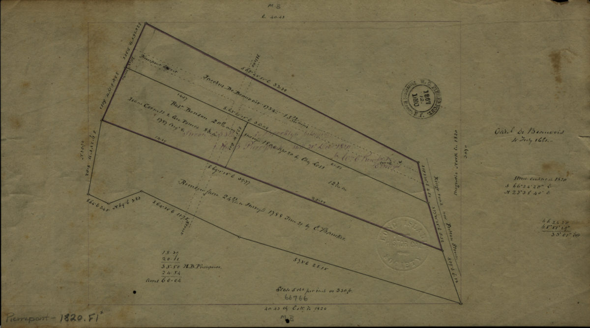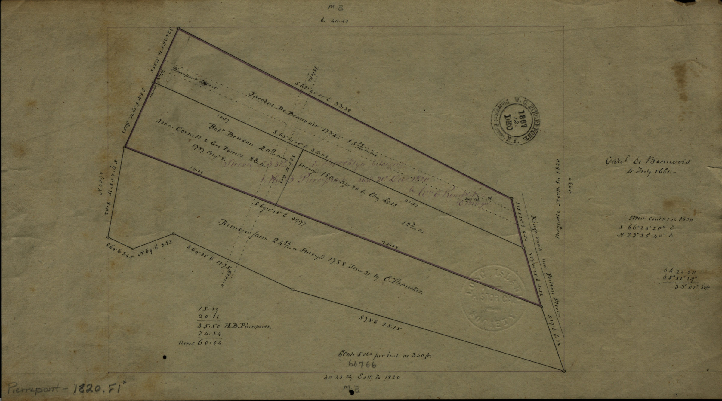
Survey of 35 50/100 … [text illegible] in Brooklyn belonging to Hez. B. Pierrepont: by Wm. C. Pierrepont & E. Bridges December 21, 1820
Map No. Pierrepont-1820.Fl
Cadastral map covering area near intersection of Pierrepont St. and Remsen St. (modern-day Brooklyn Heights). Shows names of former landowners. Includes notes and calculations. BHS copy stamped: W.C. Pierrepont, Pierrepont Manor, N.Y., 1867 Dec.
Map area shown
Relation
Full catalog recordSize
19 × 33 cmDownload
Low Resolution Image
Creator
Pierrepont, W. C., Pierrepont, W. C.,Publisher
Brooklyn Historical Society, Brooklyn Historical SocietyCitation
Survey of 35 50/100 … [text illegible] in Brooklyn belonging to Hez. B. Pierrepont: by Wm. C. Pierrepont & E. Bridges; December 21, 1820, Map Collection, Pierrepont-1820.Fl; Brooklyn Historical Society.Scale
Scale [1:3,960] 1 in to 5Loading zoom image...