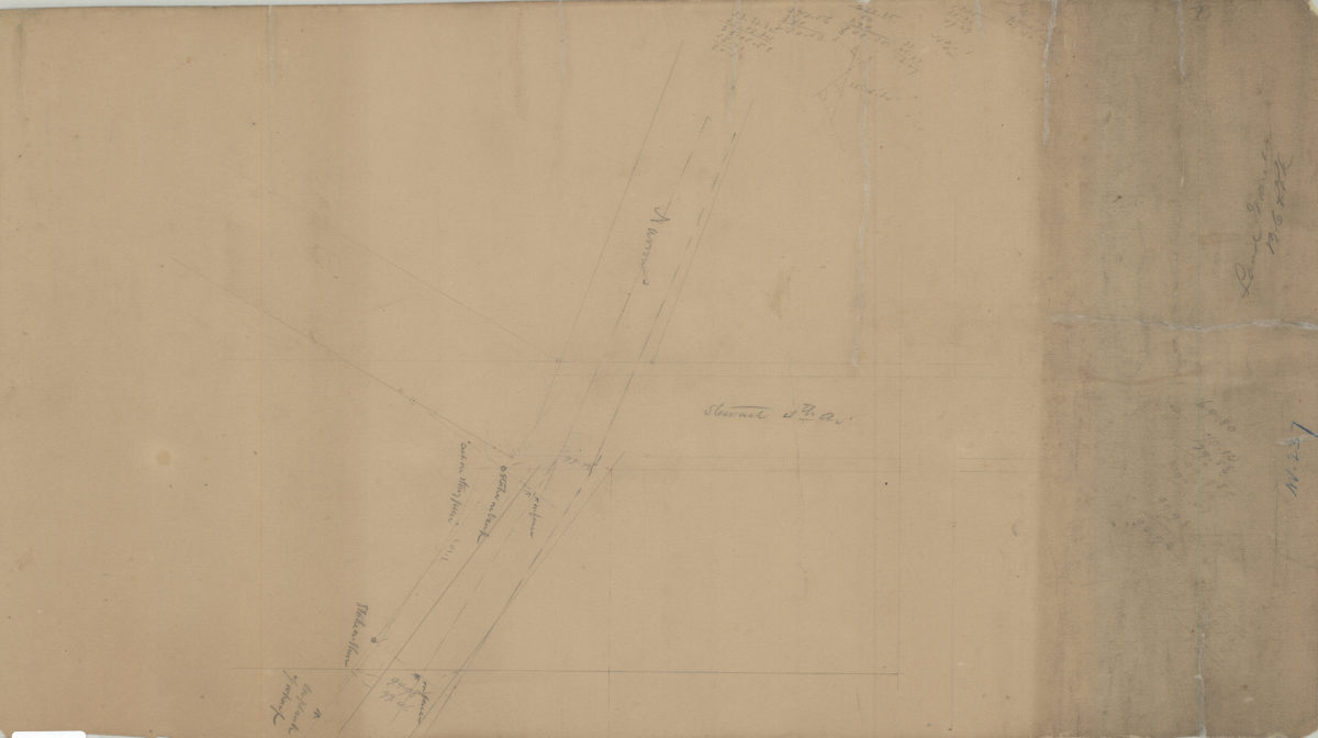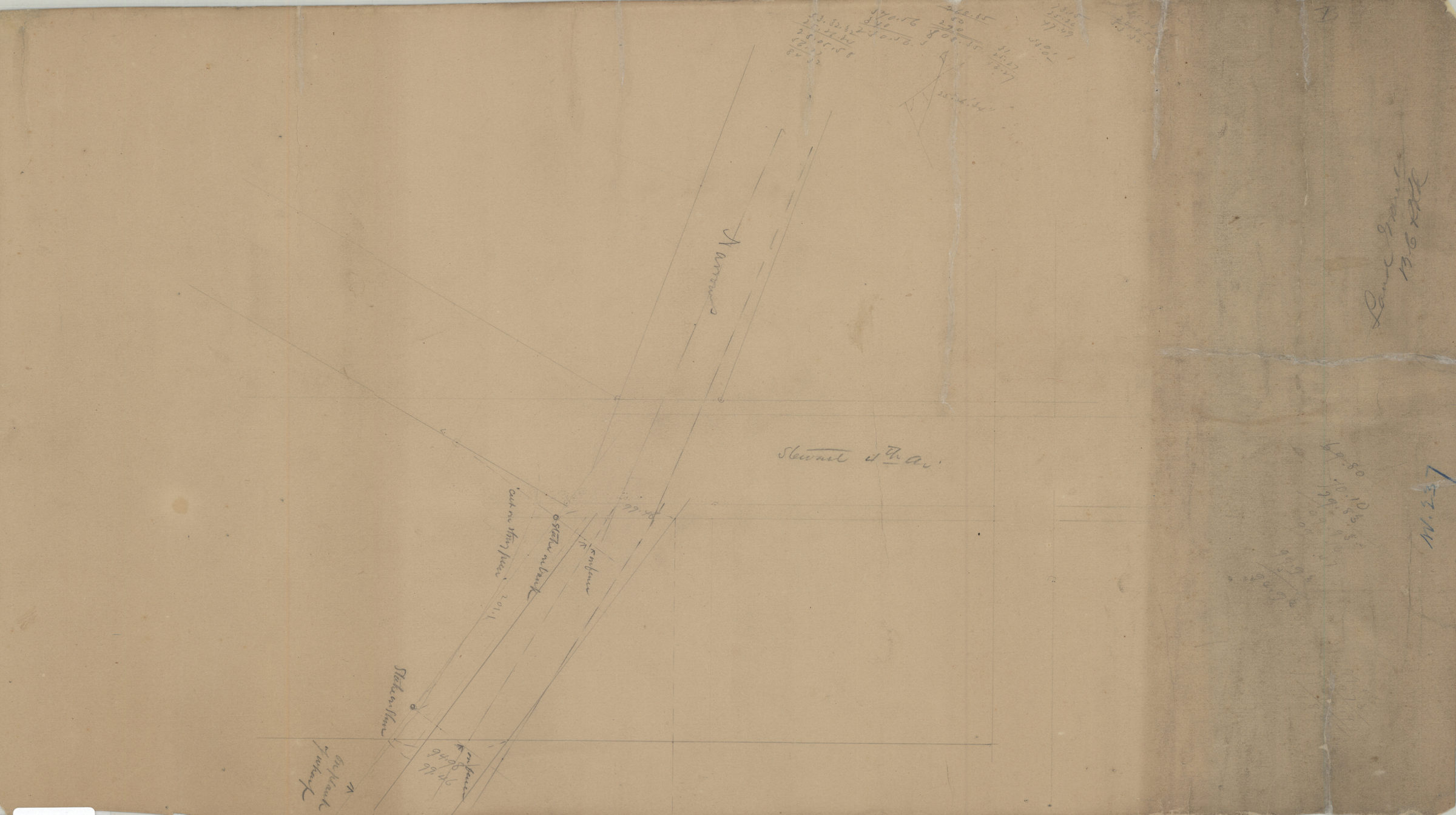
[Survey of Brooklyn City Rail Road Company land grant at the intersection of Narrows Shore Road and Stewart Avenue where it coincides with 4th Avenue] [1886]
Map No. Bergen-[1886].Fl
Survey map of area near the intersection of 4th Avenue, where it coincides with Stewart Avenue, and Narrows Shore Road in modern-day Fort Hamilton section of Bay Ridge. Title devised by cataloger. Likely attributed to Van Brunt Bergen, based on handwriting on piece. Includes notes and calculations. Date of creation conjectured based on similarity to: Map of property of the Brooklyn City Rail Road Co., Fort Hamilton, Kings Co., N.Y. / V.B. Bergen, C.E. (Bergen-1886a.Fl), also in the BHS collection.
Map area shown
Genre
Manuscript mapsRelation
Full catalog recordSize
36 × 63 cmDownload
Low Resolution Image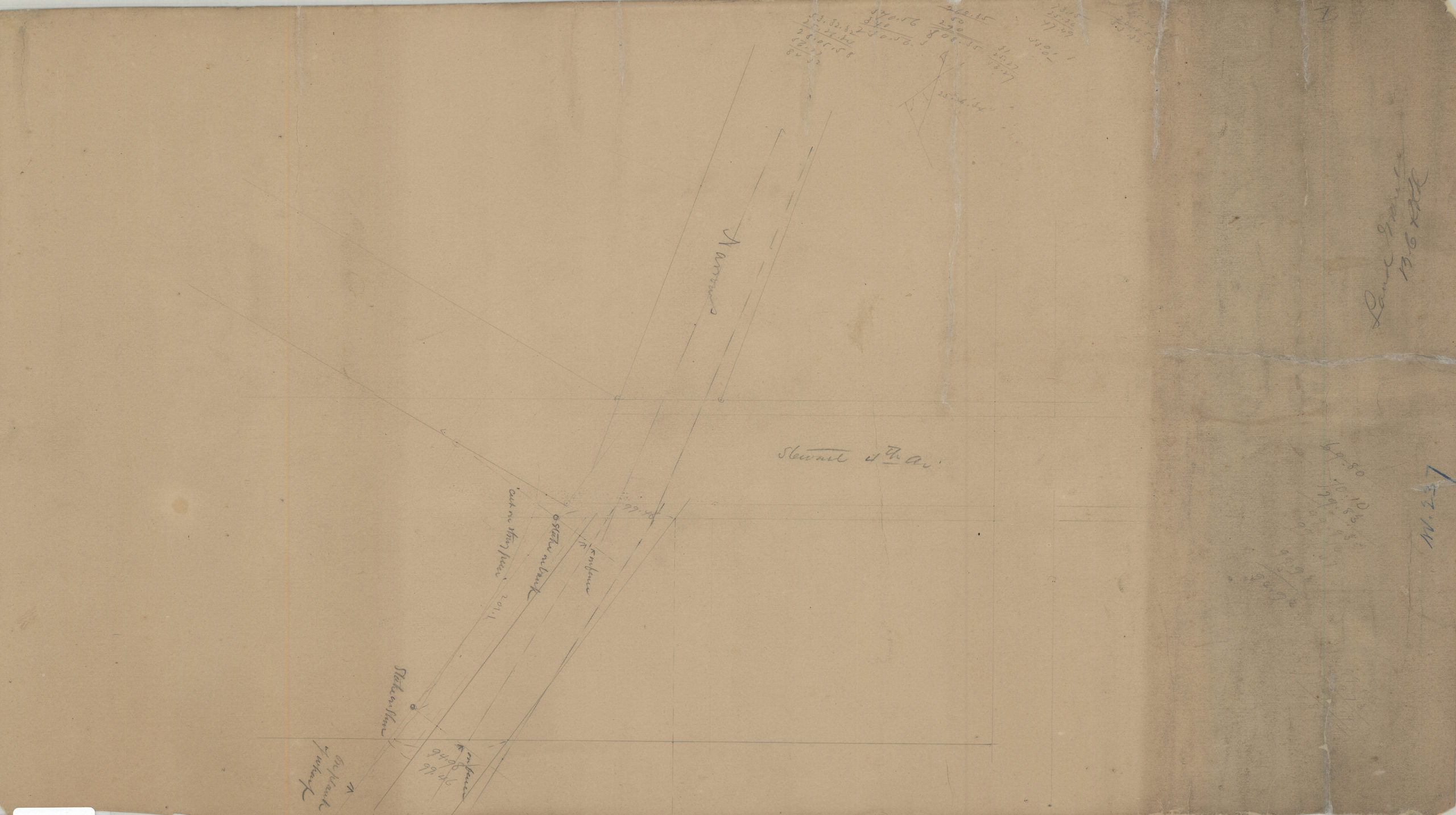
Creator
Bergen, Van Brunt,Publisher
Brooklyn Historical SocietyCitation
[Survey of Brooklyn City Rail Road Company land grant at the intersection of Narrows Shore Road and Stewart Avenue where it coincides with 4th Avenue]; [1886], Map Collection, Bergen-[1886].Fl; Brooklyn Historical Society.Scale
Scale not givenLoading zoom image...