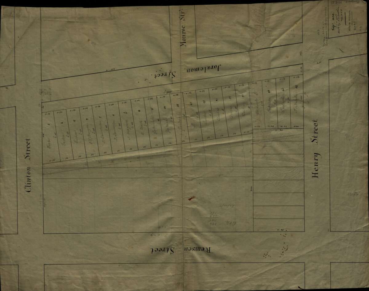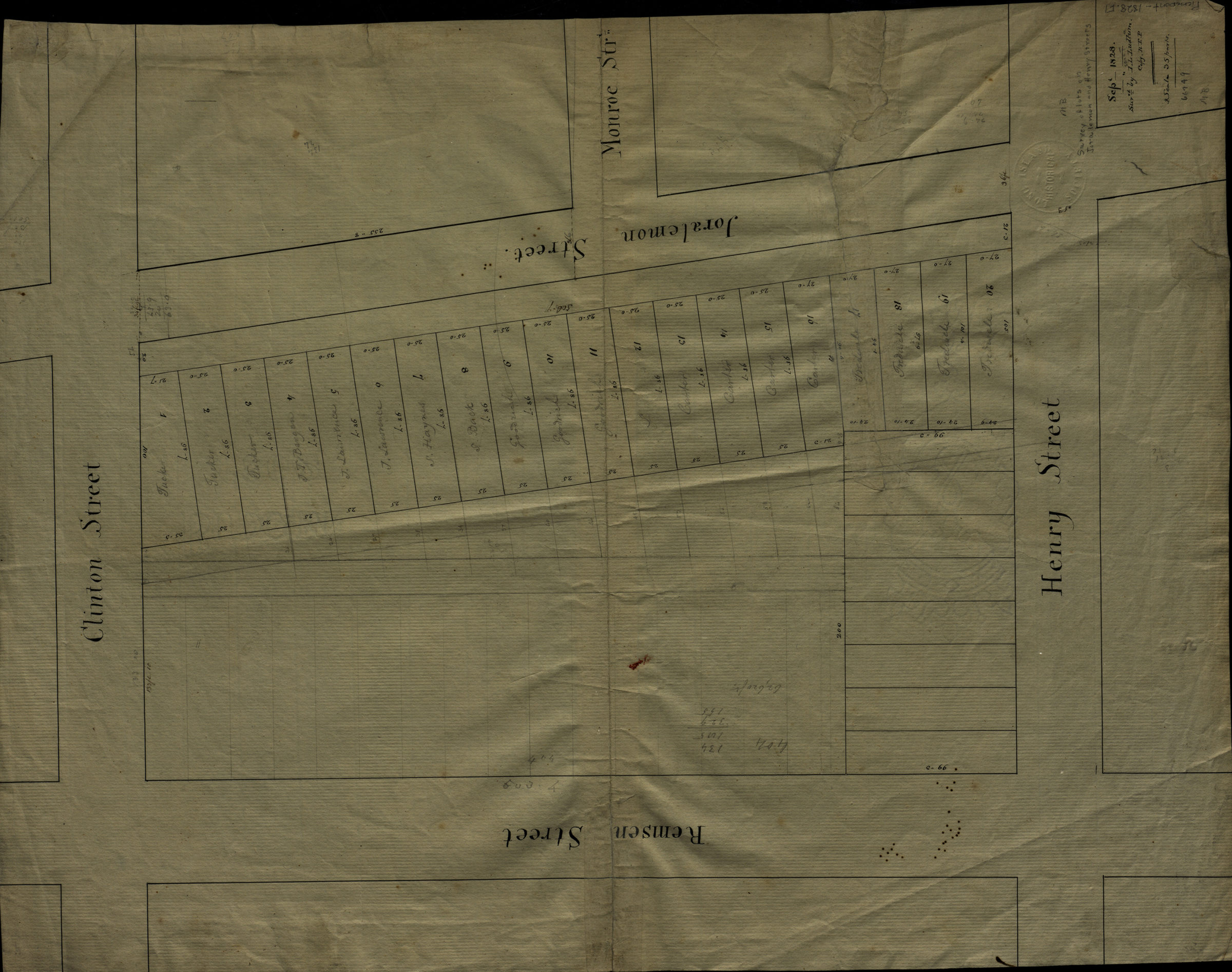
Survey of lots on Joralemon and Henry Streets 1828
Map No. Pierrepont-1828.Fl
Cadastral map. Shows property (including lot numbers and dimensions), and names of landowners. “Sept. 1828, surv’d by I. T. Ludlum, copy H.E.P.”
Map area shown
Relation
Full catalog recordSize
28 × 42 cmDownload
Low Resolution Image
Creator
Ludlum, Isaac T.,Publisher
Brooklyn Historical SocietyCitation
Survey of lots on Joralemon and Henry Streets; 1828, Map Collection, Pierrepont-1828.Fl; Brooklyn Historical Society.Scale
Scale not givenLoading zoom image...