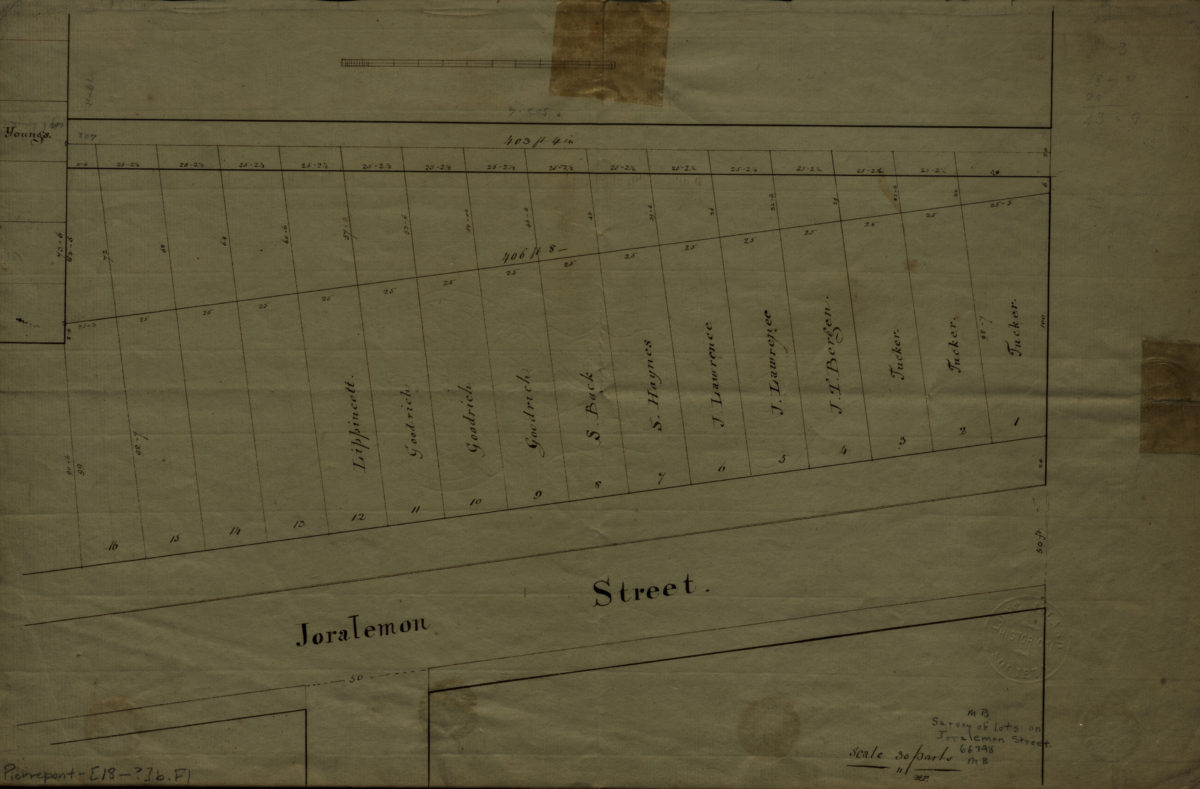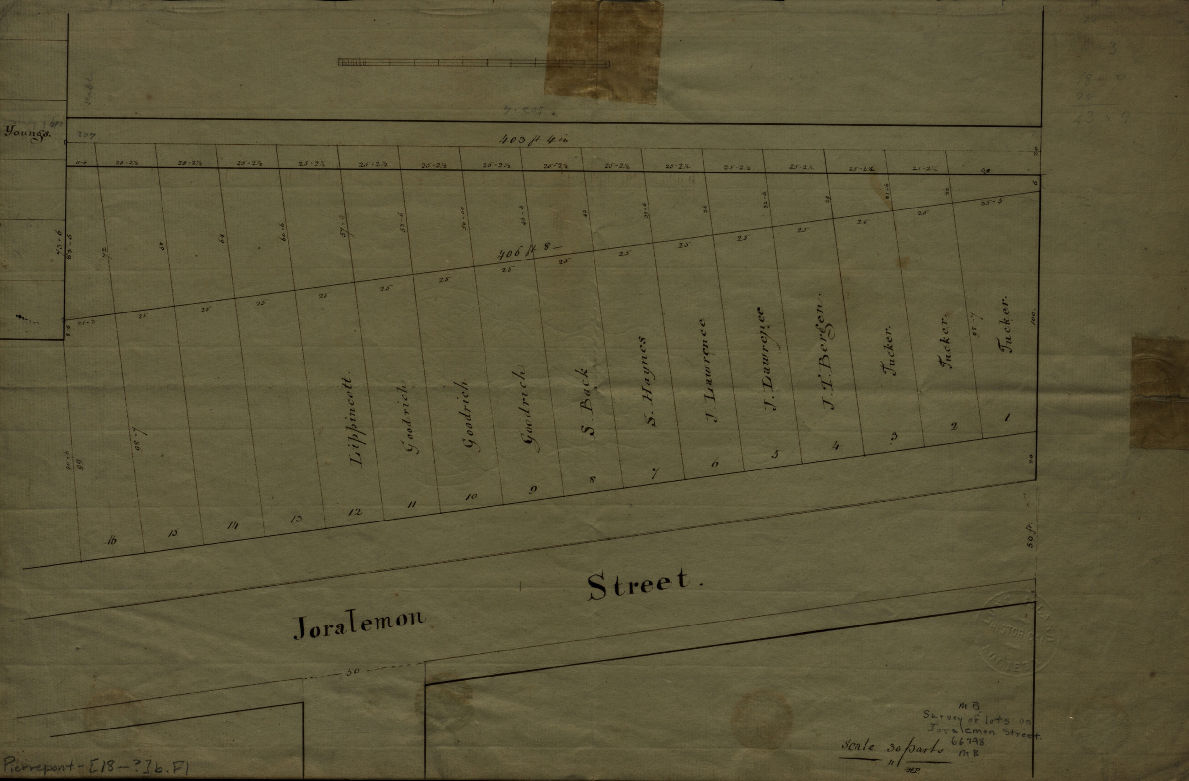
[Survey of lots on Joralemon St.]. [18??]
Map No. Pierrepont-[18--?]b.Fl
Cadastral map. Shows property (including lot numbers and dimensions), and names of landowners. Title devised by cataloger. Watermarked.
Map area shown
Relation
Full catalog recordSize
28 × 42 cmDownload
Low Resolution Image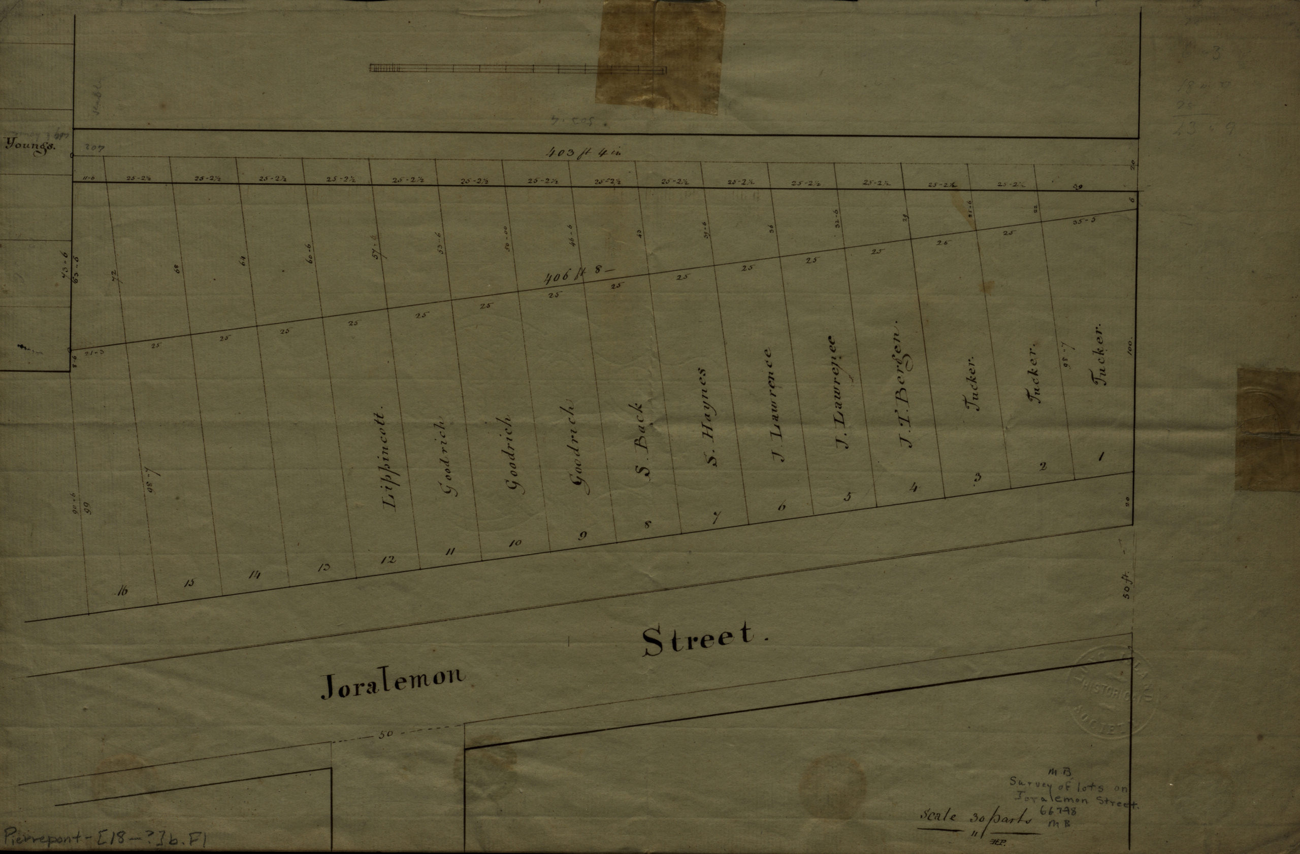
Creator
Publisher
Brooklyn Historical SocietyCitation
[Survey of lots on Joralemon St.].; [18??], Map Collection, Pierrepont-[18--?]b.Fl; Brooklyn Historical Society.Scale
Scale not givenLoading zoom image...