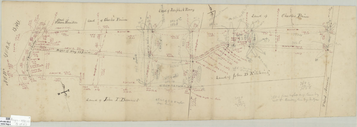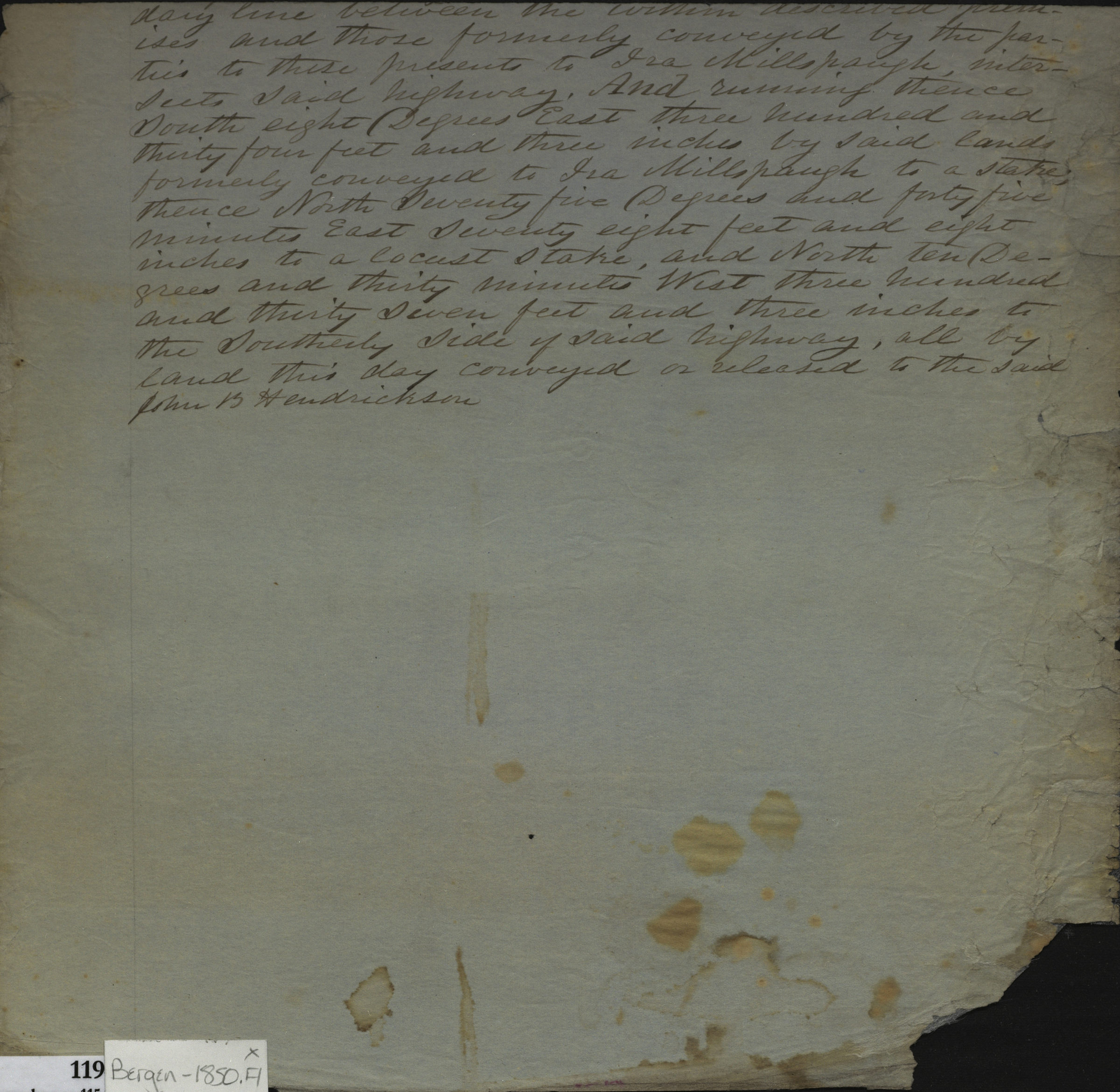
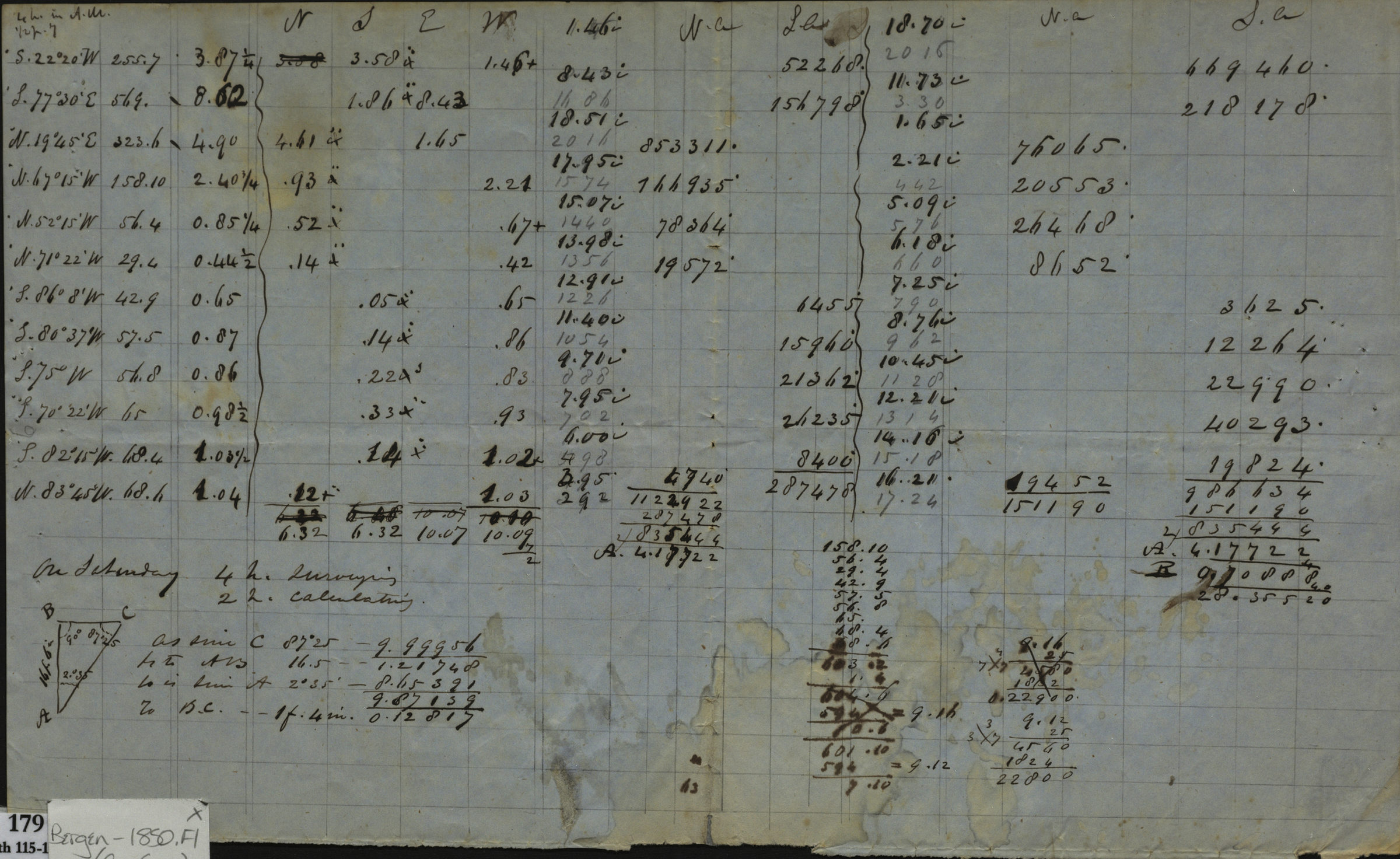

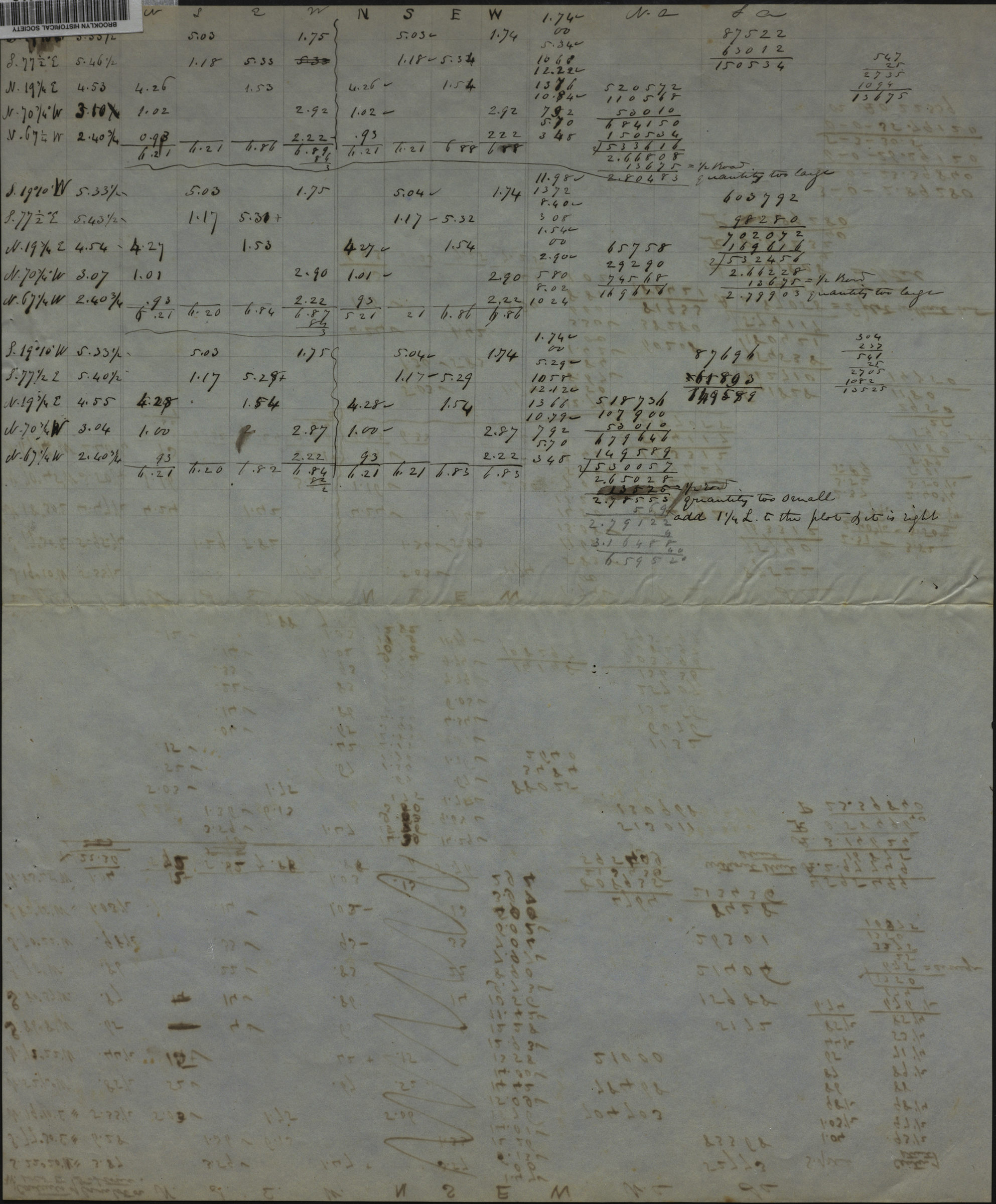
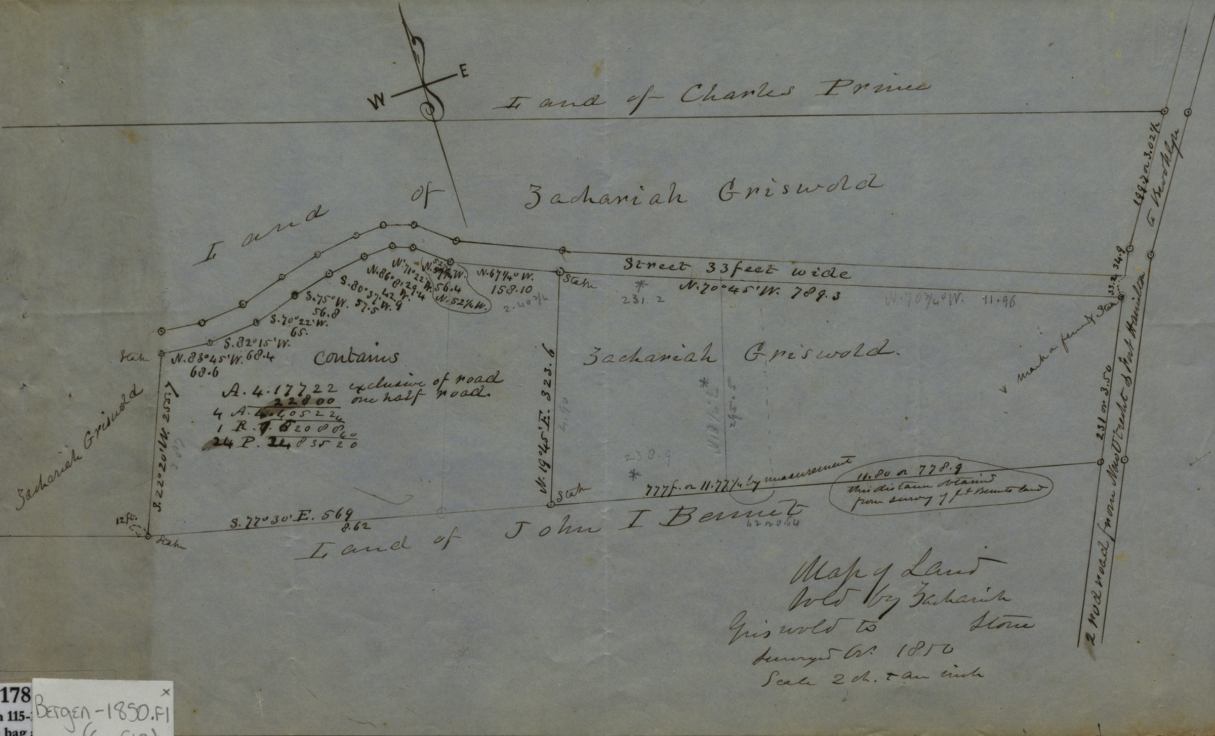
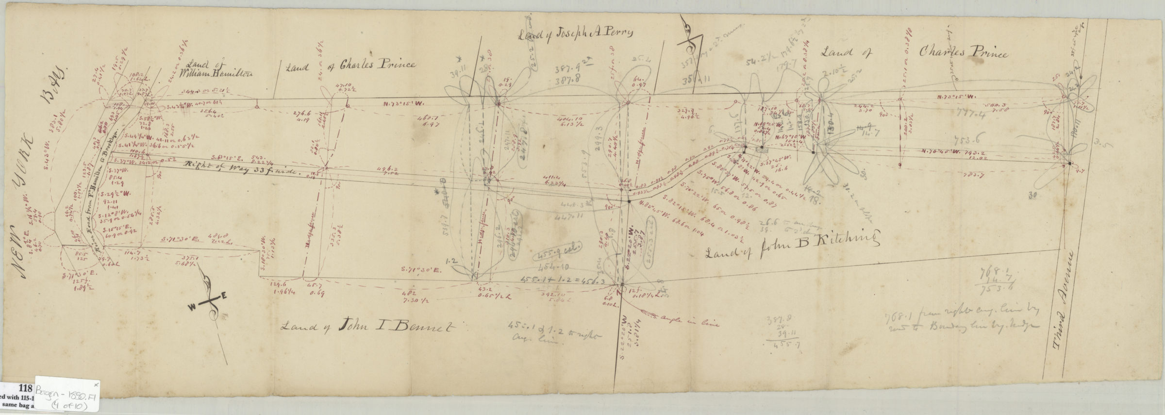
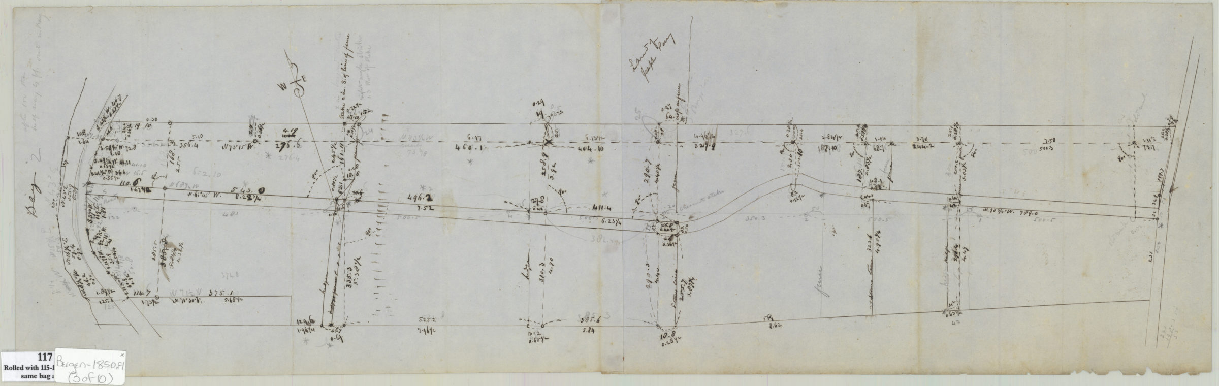
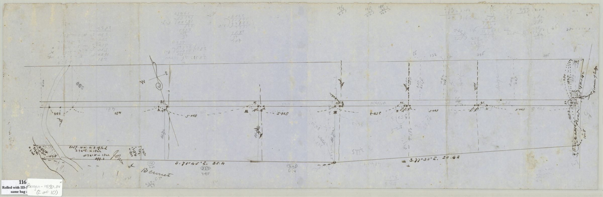

[Surveys and maps of Zachariah Griswold property in Bay Ridge] [ca. 1850]
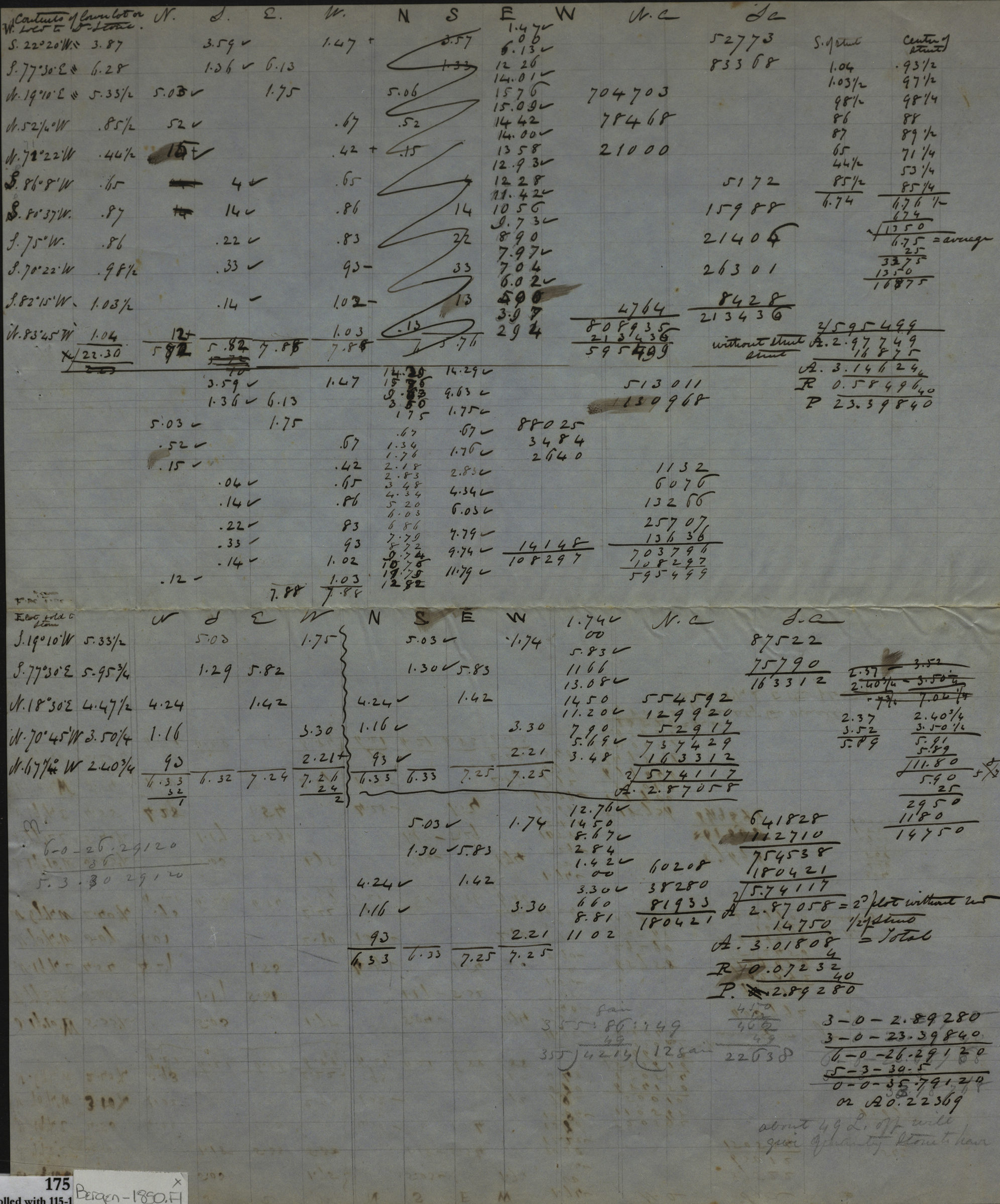
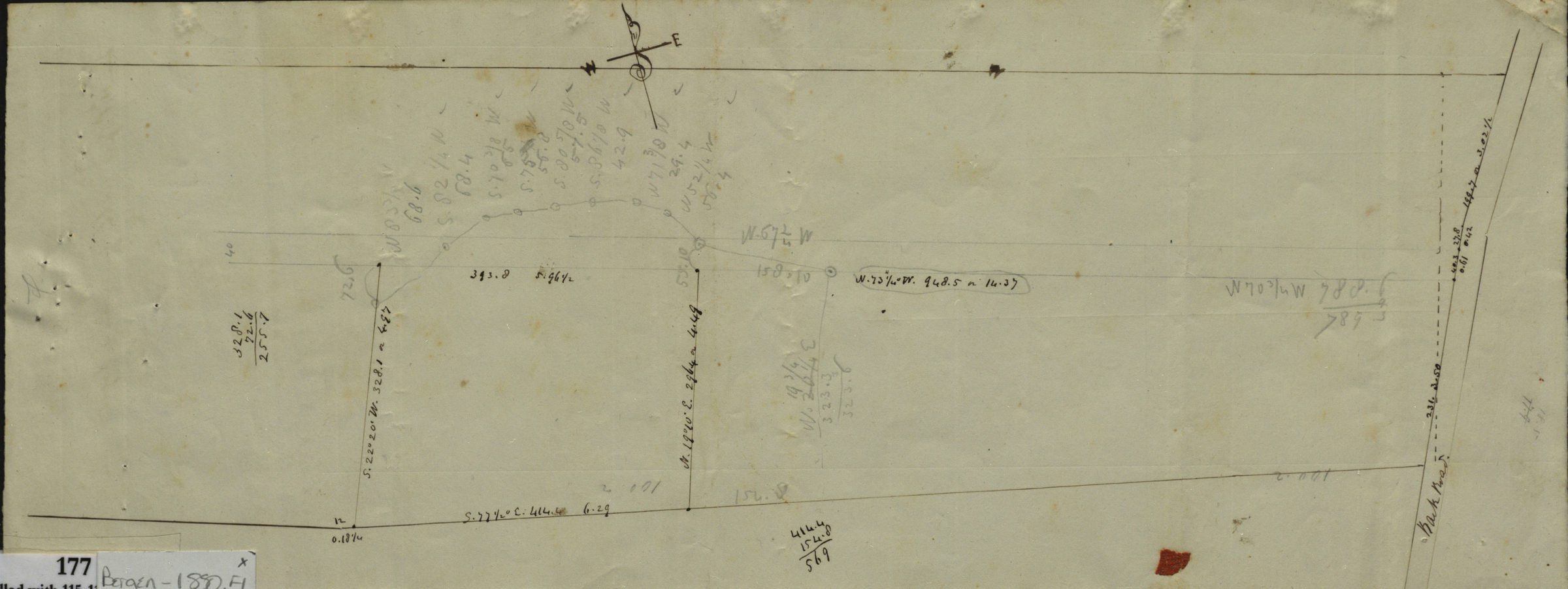
Cadastral maps covers area from 3rd Avenue to the River Road from Fort Hamilton to Brooklyn in modern-day Bay Ridge. Show property (including measurements and dimensions) and names of landowners. Title devised by cataloger. Attributed to Teunis G. Bergen, based on handwriting. Maps include notes and calculations. Accompanied by 3 sheets with calculations and 1 sheet with text. Maps found rolled together in BHS archives and cataloged as unit to preserve context. 1. Map of land as in the first place proposed to be sold by Z. Griswold to D. Stone but since abandoned. 2. [Map of same area showing measurements of perimeter]. 3. [Survey map of same area with internal and external measurements]. 4. Field book of land sold by heirs of Z. Griswold to Charles Cochrine. 5. Survey map of same area with measurements in ink and pencil]. 6. Map of land sold by Zacharias Griswold to Stone surveyed Oct. 1850.
Map area shown
Relation
Full catalog recordSize
23 × 67 cmDownload
Low Resolution Image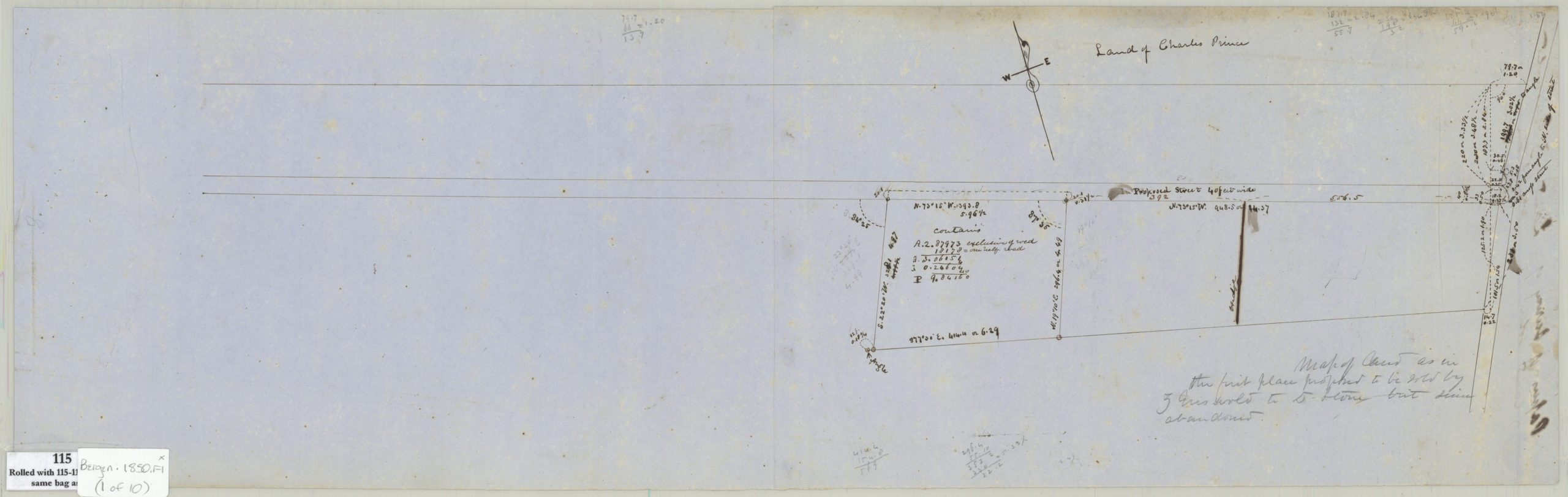
Creator
Bergen, Teunis G.,Publisher
Brooklyn Historical SocietyCitation
[Surveys and maps of Zachariah Griswold property in Bay Ridge]; [ca. 1850], Map Collection, Bergen-1850.Fl; Brooklyn Historical Society.Scale
Scales differ