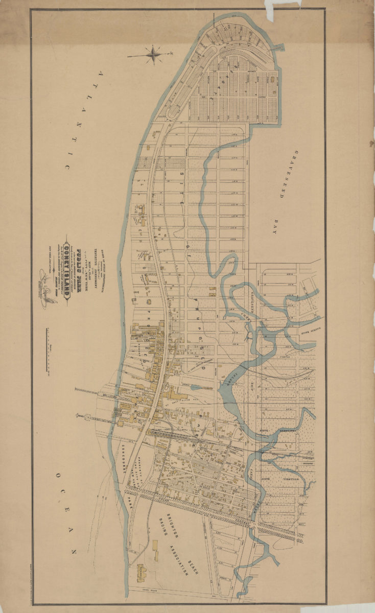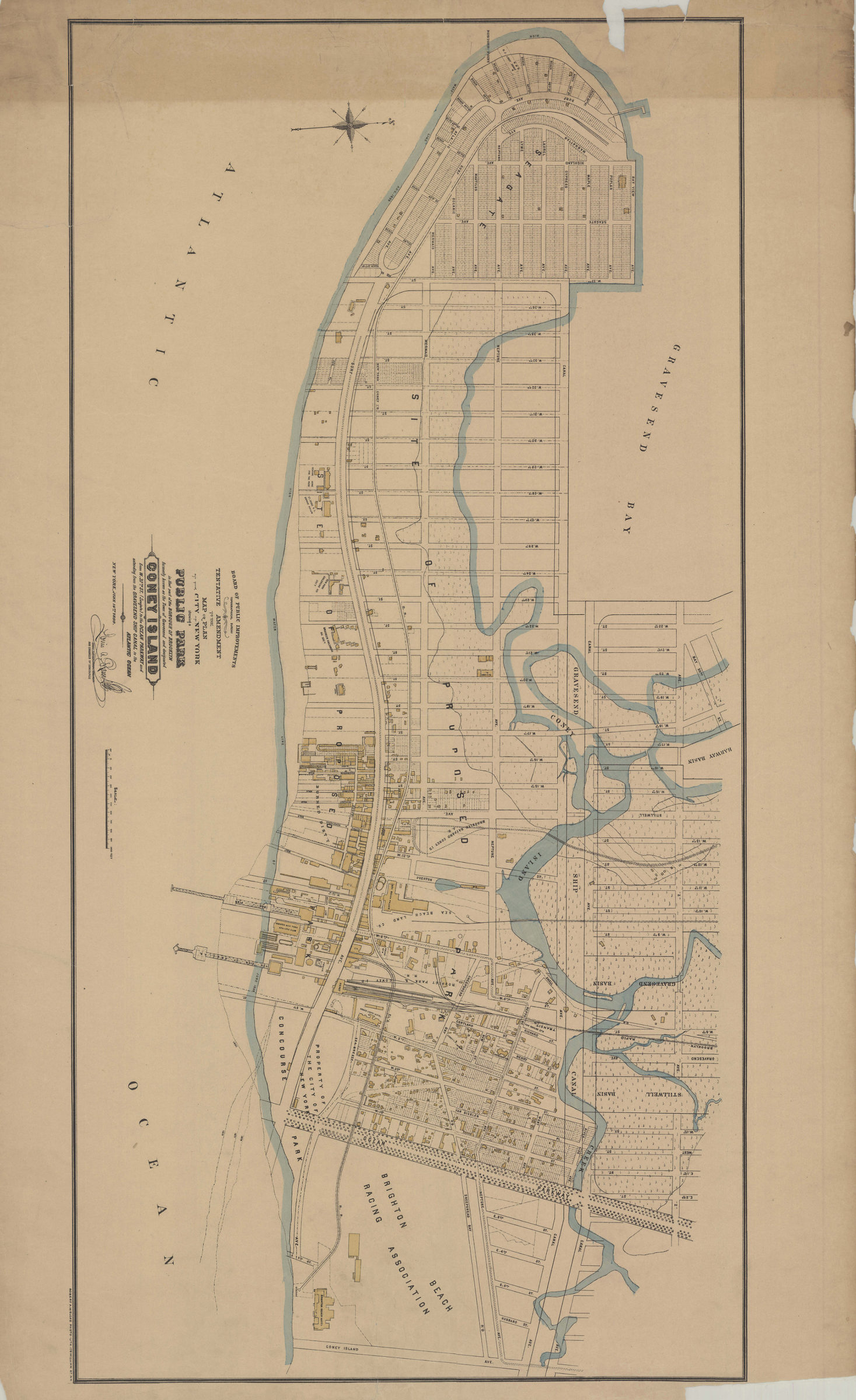

Tentative amendment to the Map or plan of the city of New York, showing a public park in that part of the borough of Brooklyn formerly known as the town of Gravesend and designated Coney Island, from W. 37th St. (Seagate) [1899]
Map No. B A-[1899].Fl
Also shows hotels, charitable organizations, and property of the Brighton Beach Racing Association. “New York, June 14th, 1899.” Signed by the “Chief Topographical Engineer and Engineer of Concourse.”
Map area shown
Genre
Topographic mapsRelation
Full catalog recordSize
47 × 94 cmDownload
Low Resolution Image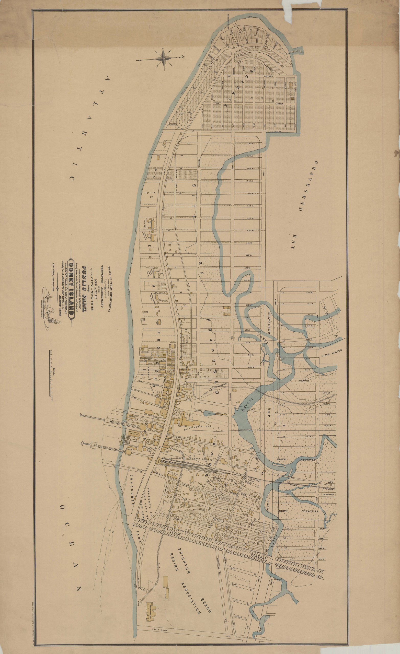
Creator
New York (N.Y.).; Board of Public Improvements.; Topographical Bureau,Publisher
Brooklyn Historical SocietyCitation
Tentative amendment to the Map or plan of the city of New York, showing a public park in that part of the borough of Brooklyn formerly known as the town of Gravesend and designated Coney Island, from W. 37th St. (Seagate); [1899], Map Collection, B A-[1899].Fl; Brooklyn Historical Society.Scale
Scale [ca. 1:4,900]Loading zoom image...