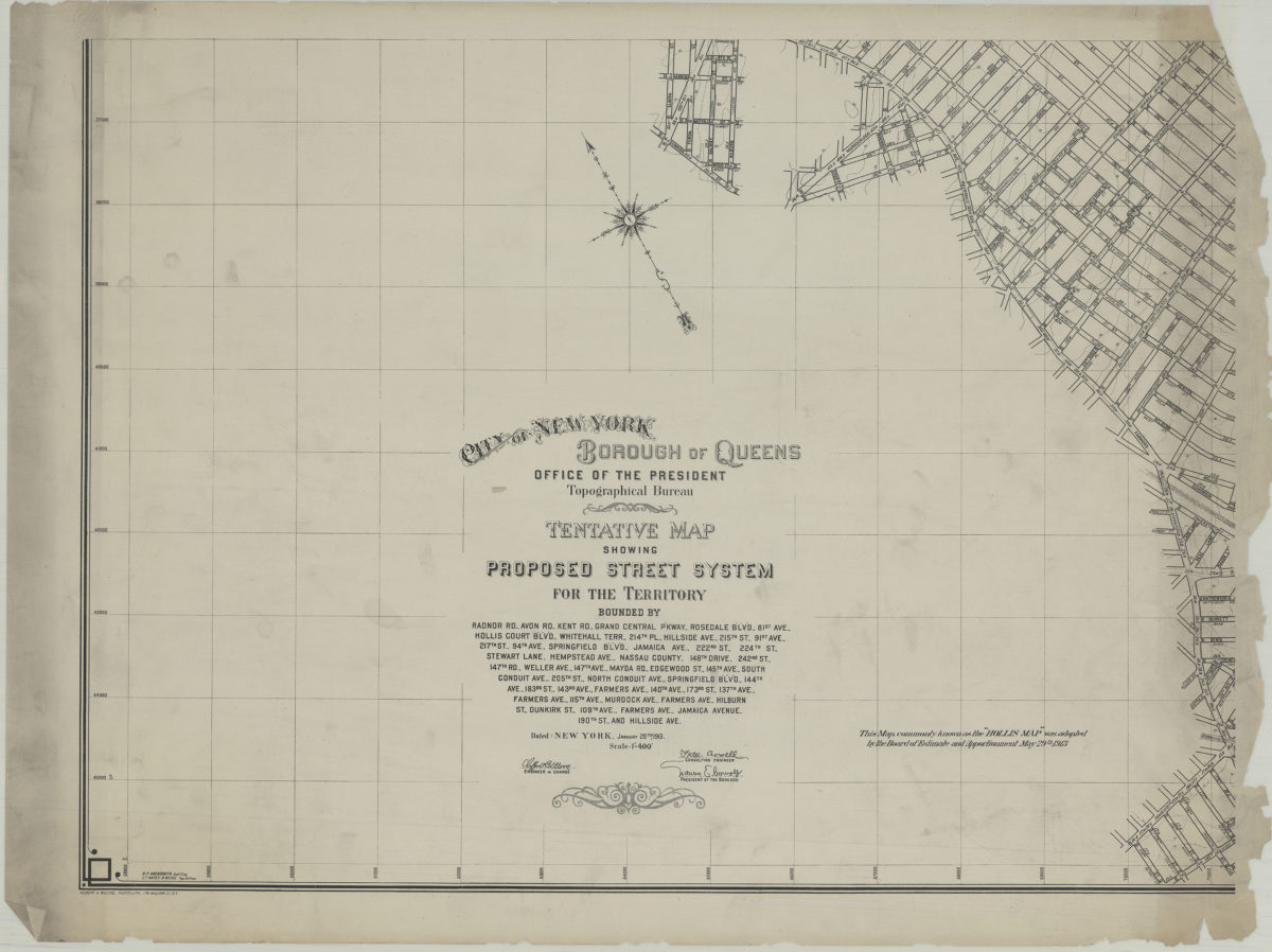
Tentative map showing proposed street system for the territory bounded by Radnor Rd., Avon Rd., Kent Rd. … Jamaica Avenue, 190th St. and Hillside Ave.: City of New York, Borough of Queens, Office of the President, Topographical Bureau 1913
Map No. Q-1913.Fl.Folio
Covers area in Queens in modern-day St. Albans. Relief shown by contours. “This map, commonly known as the ‘Hollis map,’ was adopted by the Board of Estimate and Apportionment, May 29th, 1913.” In lower left corner: R.P. Abendroth, C.T. Nafey, B. Weiss. Oriented with north toward upper left.
Map area shown
Genre
Topographic mapsRelation
Full catalog recordSize
60 × 88 cmDownload
Low Resolution Image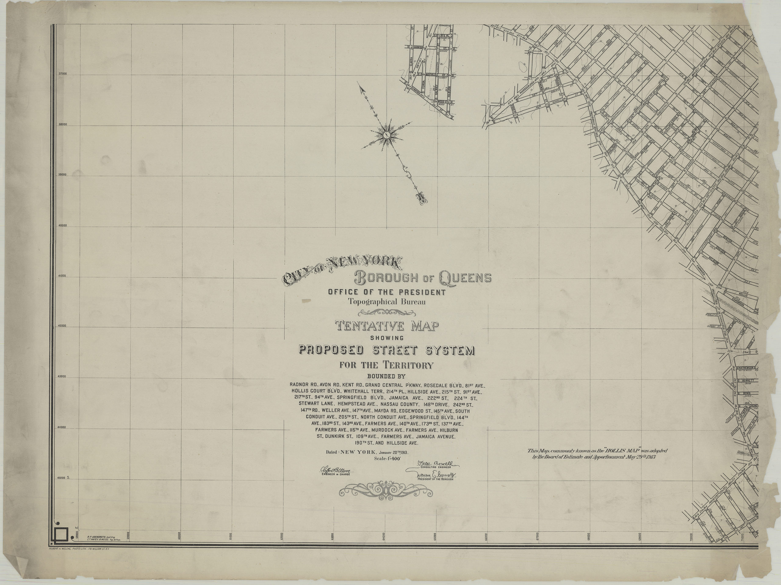
Creator
Queens (New York, N.Y.).; Office of Queens Borough President,Publisher
Brooklyn Historical SocietyCitation
Tentative map showing proposed street system for the territory bounded by Radnor Rd., Avon Rd., Kent Rd. … Jamaica Avenue, 190th St. and Hillside Ave.: City of New York, Borough of Queens, Office of the President, Topographical Bureau; 1913, Map Collection, Q-1913.Fl.Folio; Brooklyn Historical Society.Scale
Scale [1:4,800] 1 in to 4Loading zoom image...