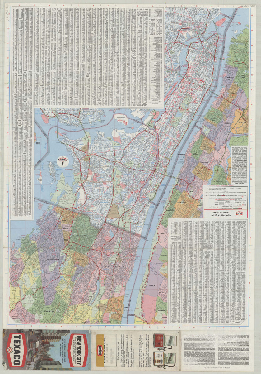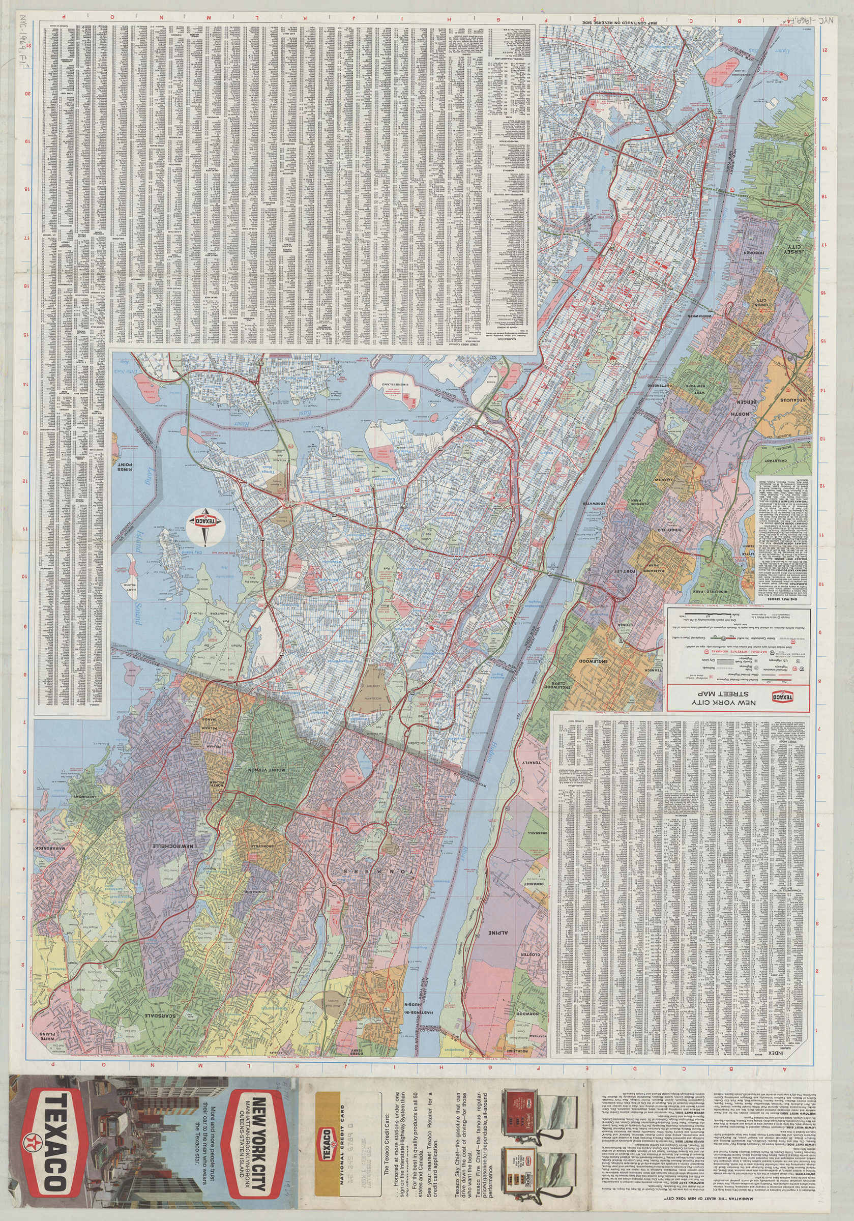

Texaco New York City street map [1969; 1969]
Map No. NYC-1969.Fl
Also covers portions of Nassau County and Westchester County. Shows county boundaries, neighborhoods, and some structures. Includes indexes, text, directories, Staten Island and metro-area insets, color illustrations, and advertisement. “696213-7.” “696212-6.”
Map area shown
Genre
Road mapsRelation
Full catalog recordSize
113 × 84 cmDownload
Low Resolution Image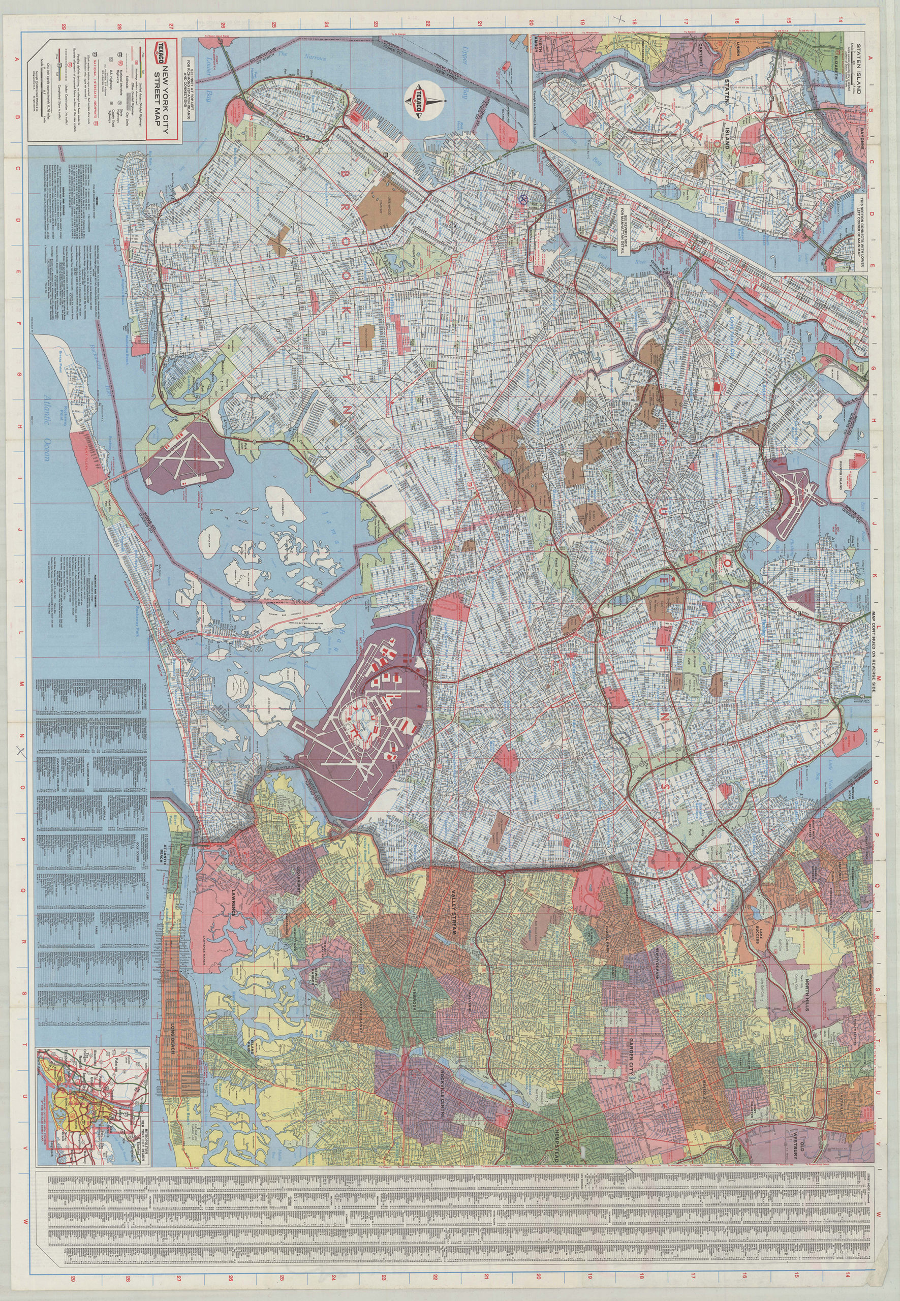
Creator
Rand McNally and Company,Publisher
Brooklyn Historical SocietyCitation
Texaco New York City street map; [1969; 1969], Map Collection, NYC-1969.Fl; Brooklyn Historical Society.Scale
Scale approximately 1:44,Loading zoom image...