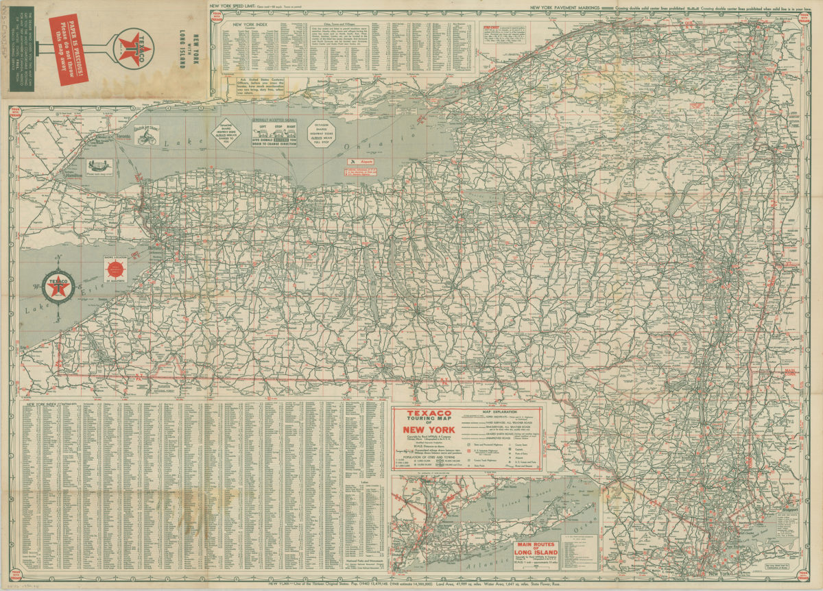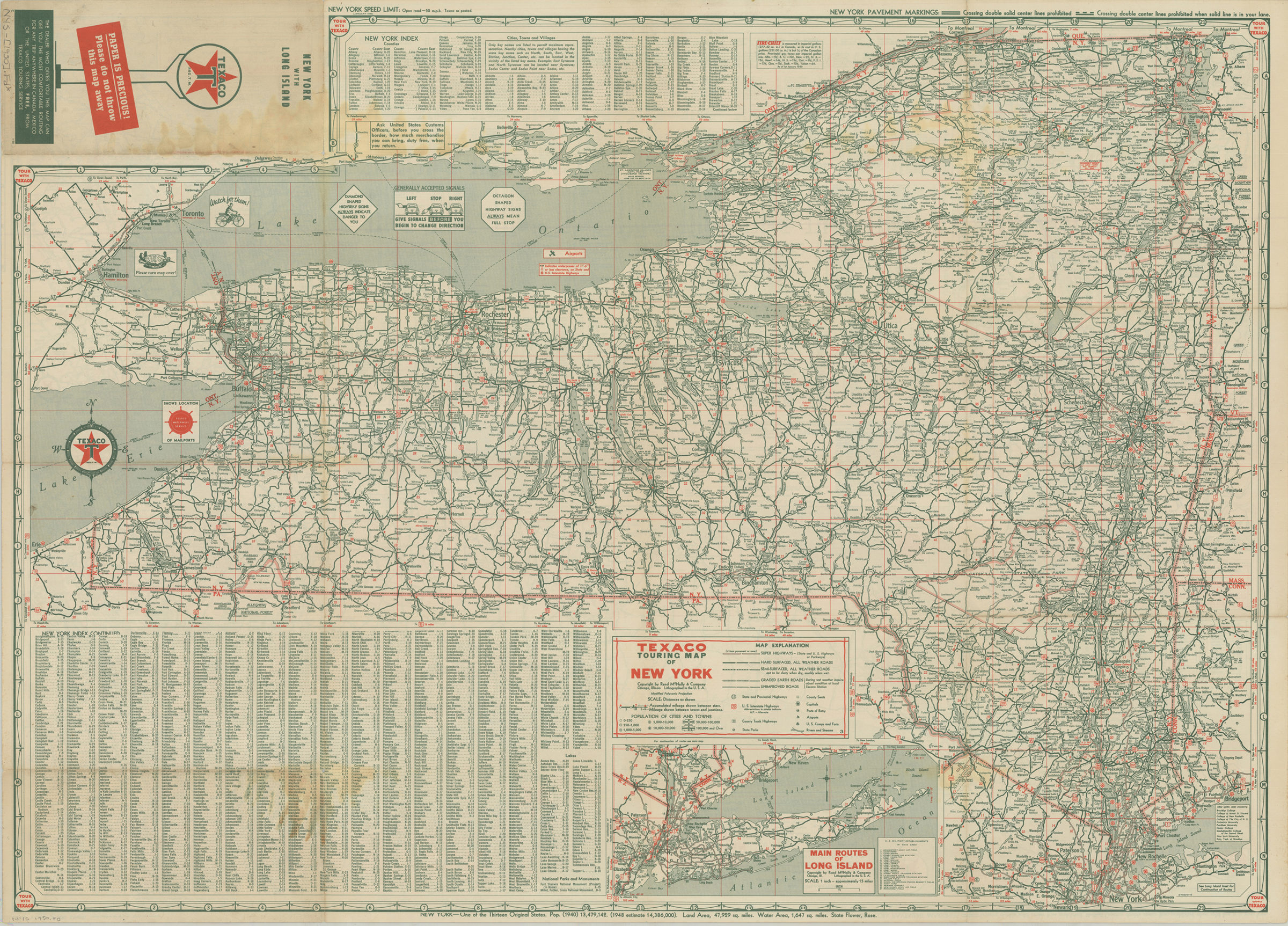
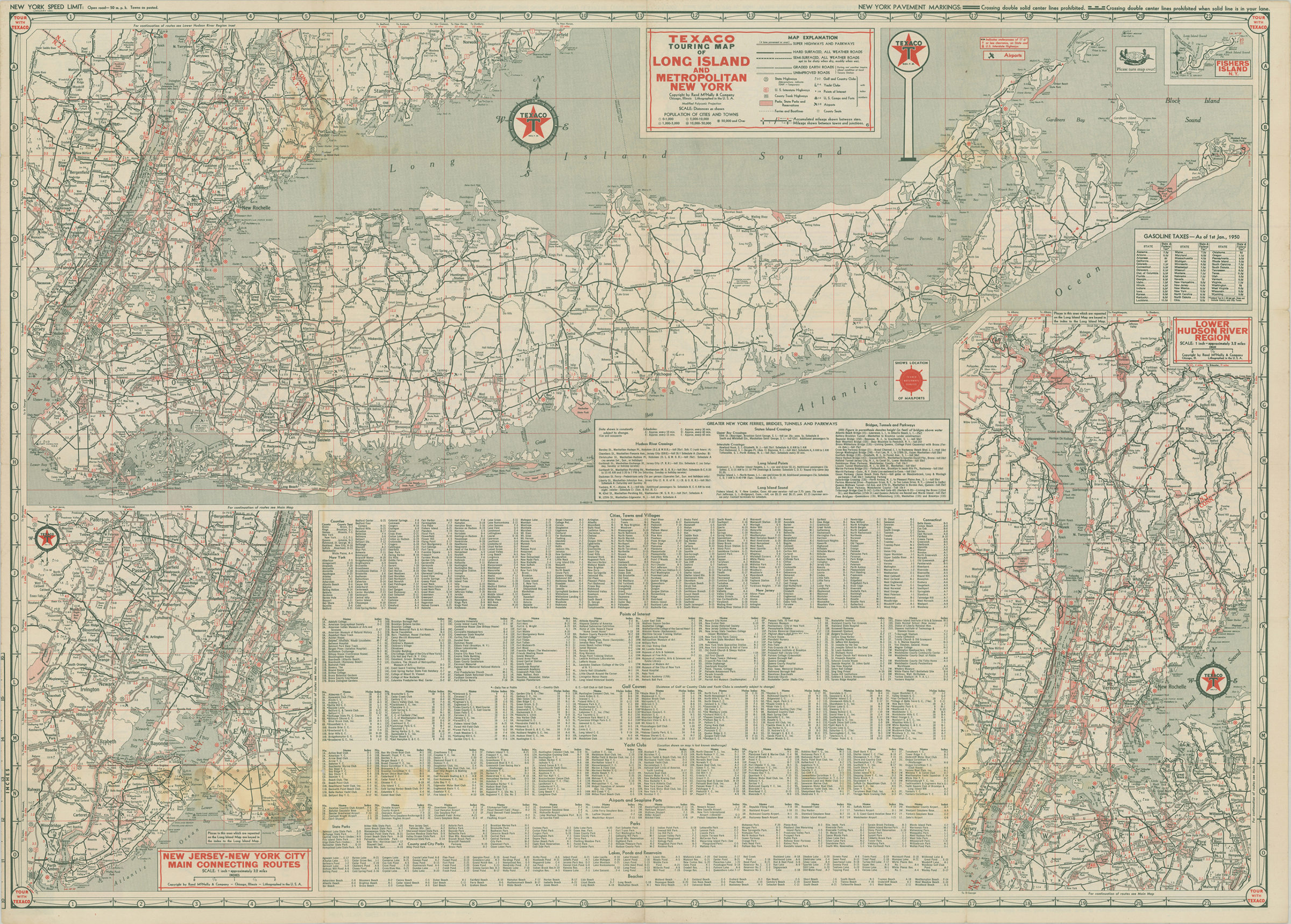
Texaco touring map of Long Island and Metropolitan New York [1950]
Map No. NYS-[1950].Fl
Inset: Lower Hudson River Region and New Jersey-New York city Main Connecting Routes. On verso: index and maps of “Texaco Touring Map of New York” and “Main routes of Long Island.” Includes index. Relief shown pictorially and by spot heights. State gasoline taxes as of 1st January, 1950. “0-4433-16.” “0-454216-16.”
Map area shown
Genre
Tourist mapsRelation
Full catalog recordSize
30 × 80 cmDownload
Low Resolution Image
Creator
Rand McNally and Company,Publisher
Brooklyn Historical SocietyCitation
Texaco touring map of Long Island and Metropolitan New York; [1950], Map Collection, NYS-[1950].Fl; Brooklyn Historical Society.Scale
Scale approximately 1:304Loading zoom image...