The Brooklyn of the future: Brooklyn Daily Eagle supplement, April 2, 1903 [1903; 1903]
Map No. B C-1903.Fl.Folio
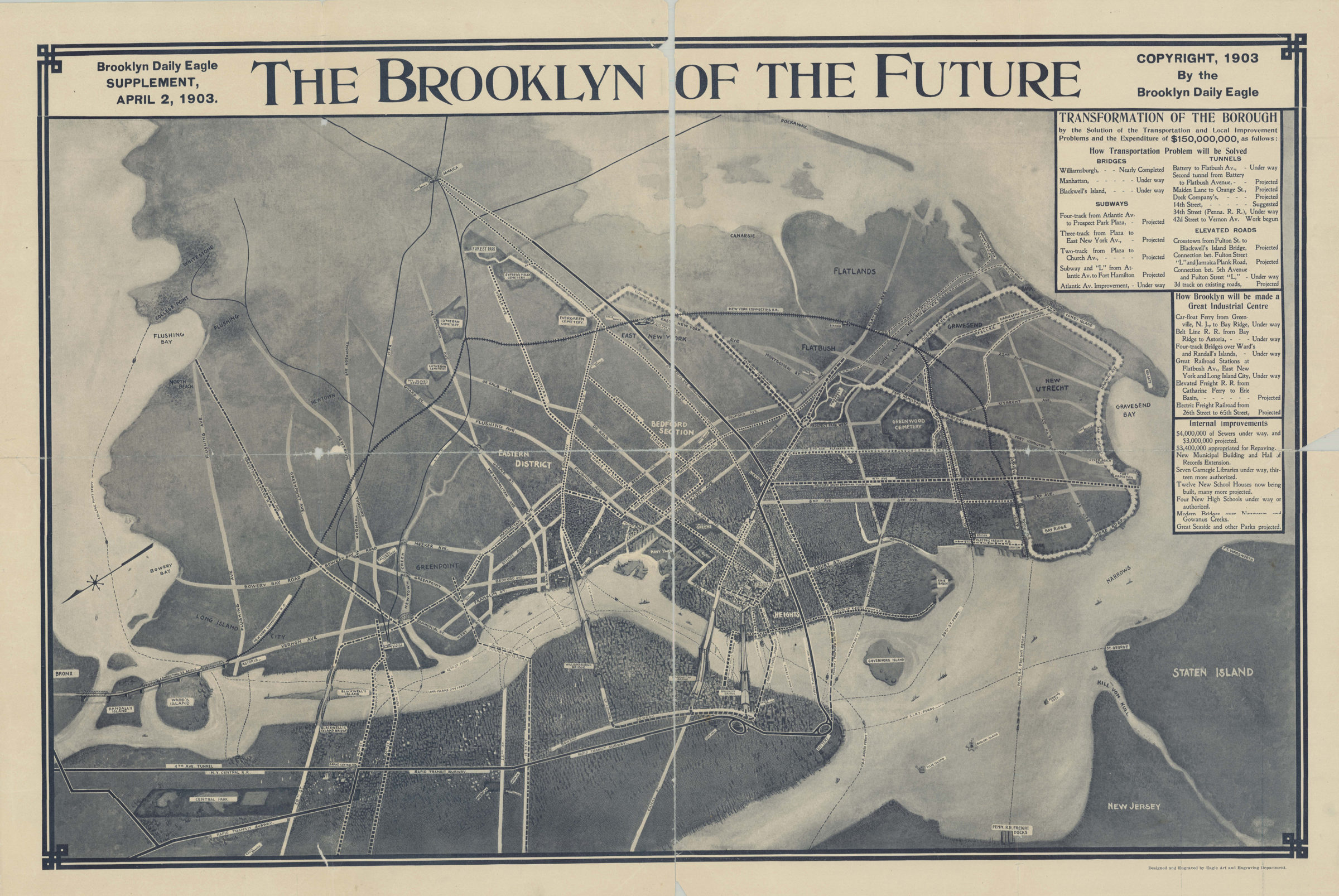
Aerial view of lower Manhattan and Brooklyn showing ferry lines and projected bridges, subways, tunnels and elevated roads. Designed and engraved by Eagle Art and Engraving Department. Includes text: Transformation of the Borough, How Brooklyn will be made a great industrial center, Internal improvements.
Subjects
Places
Map area shown
Relation
Full catalog recordSize
62 × 91 cmDownload
Low Resolution Image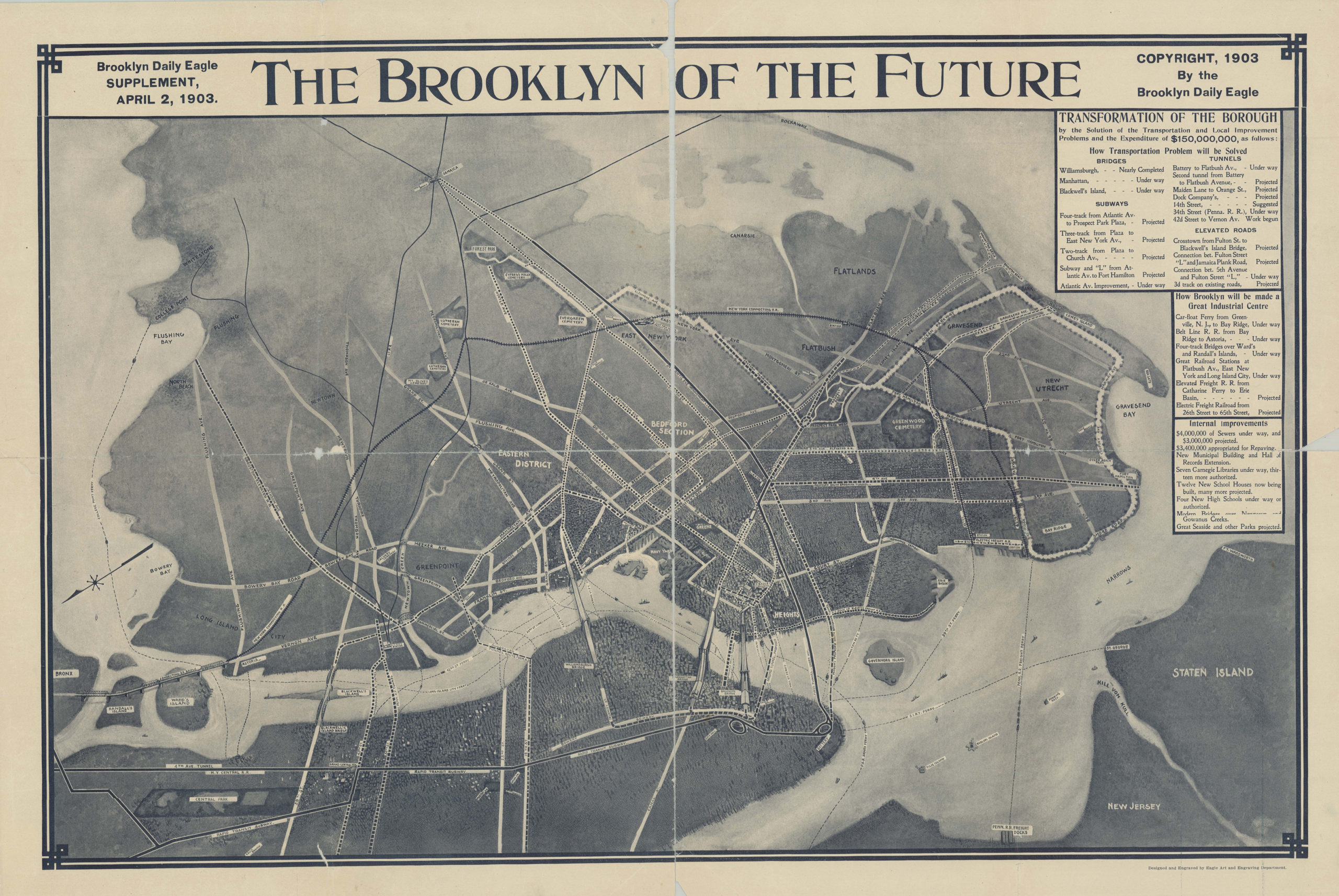
Creator
Brooklyn Daily Eagle (Firm),Publisher
Brooklyn Historical SocietyCitation
The Brooklyn of the future: Brooklyn Daily Eagle supplement, April 2, 1903; [1903; 1903], Map Collection, B C-1903.Fl.Folio; Brooklyn Historical Society.Scale
Not drawn to scaleLoading zoom image... 