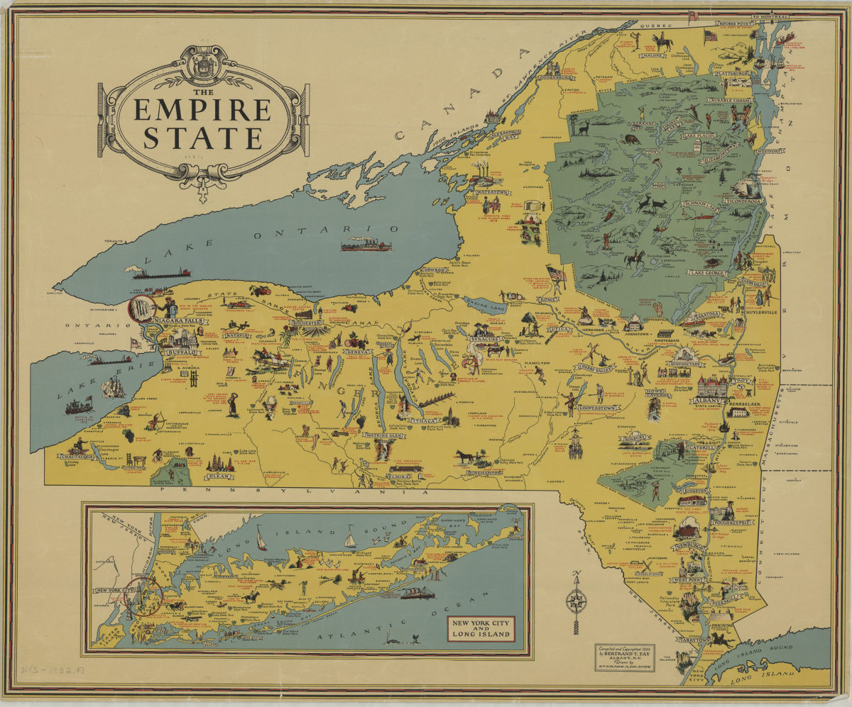
The Empire State: compiled and copyrighted 1932 by Bertrand T. Fay ; drawn by Everard A. McAvoy [1932;1932]
Map No. NYS-1932.Fl
Pictorial map showing state parks, recreation areas and points of interest throughout New York State. Insets: New York City and Long Island.
Map area shown
Relation
Full catalog recordSize
54 × 67 cmDownload
Low Resolution Image
Creator
Fay, Bertrand T.,Publisher
Brooklyn Historical SocietyCitation
The Empire State: compiled and copyrighted 1932 by Bertrand T. Fay ; drawn by Everard A. McAvoy; [1932;1932], Map Collection, NYS-1932.Fl; Brooklyn Historical Society.Scale
Scale not givenLoading zoom image...