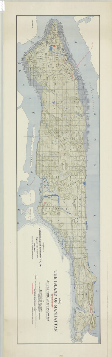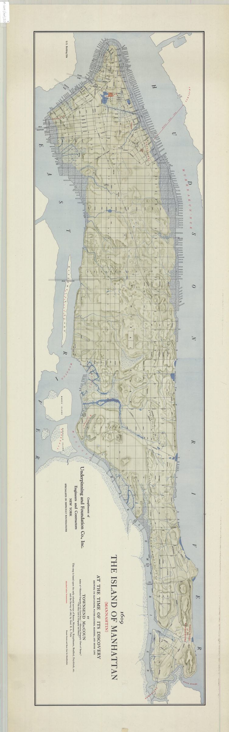
The island of Manhattan (Mannahtin) at the time of its discovery: showing its elevations, water-courses, marshes, and shore line: by Townsend MacCoun ; compliments of Underpinning and Foundation Co., Inc [ca. 1909]
Map No. M-1609 (1909).Fl.O
Physical map showing landscape details and shoreline ca. 1609 overlaid by street grid and shoreline ca. 1909. Also shows Native American geographic names. Relief shown by shading. Oriented with north to right. “This map is based upon the early colonial surveys of Ratzer, Montresor, Knypthausen, Bradford, Duyckinck, etc. and the Survey of 1867 by Genl. E.L. Viele.”
Map area shown
Relation
Full catalog recordSize
31 × 123 cmDownload
Low Resolution Image
Creator
MacCoun, Townsend,Publisher
Brooklyn Historical SocietyCitation
The island of Manhattan (Mannahtin) at the time of its discovery: showing its elevations, water-courses, marshes, and shore line: by Townsend MacCoun ; compliments of Underpinning and Foundation Co., Inc; [ca. 1909], Map Collection, M-1609 (1909).Fl.O; Brooklyn Historical Society.Scale
Scale not givenLoading zoom image...