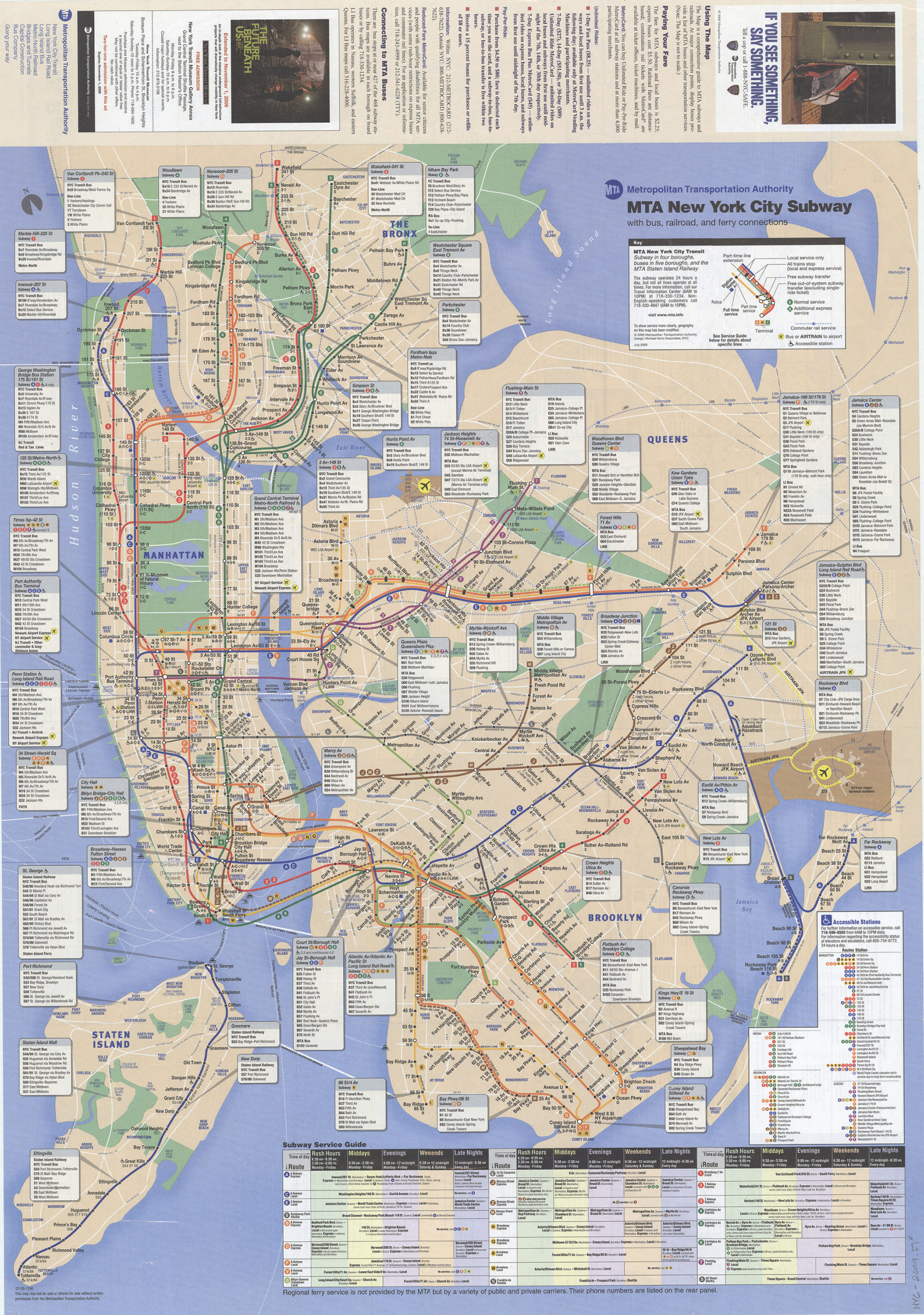
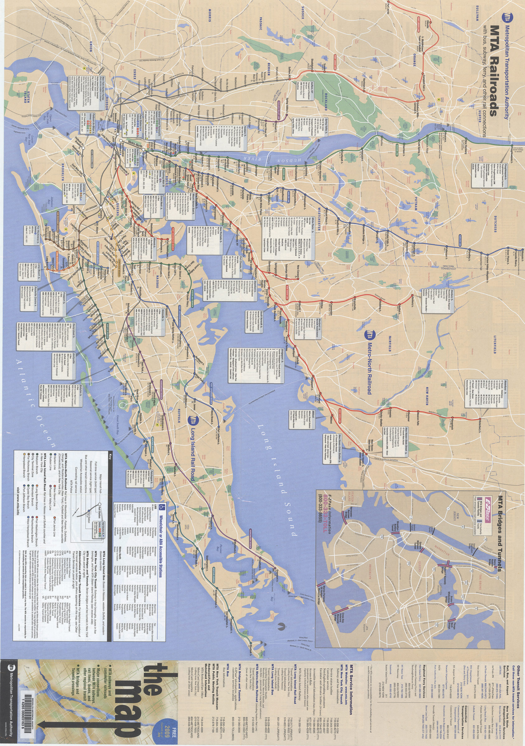
The map: MTA subways and commuter railroads, major connections between MTA subways, rail lines, buses, and other regional transit, MTA Bridges and Tunnels crossings: MTA Metropolitan Transportation Authority [ca. 2009]
Map No. NYC-2009.Fl
Schematic map showing subway lines in Manhattan, the Bronx, Queens, and Brooklyn and the Staten Island railway. Design: Michael Hertz Associates, NYC. Panel title. Includes text, directories, subway service guide, lists of wheelchair accessible stations, inset of “MTA bridges and tunnels” and advertisements. “22-30-1296.” MTA New York City subway with bus, railroad, and ferry connections. MTA railroads with bus, subway, ferry, and other rail connections.
Map area shown
Genre
Transportation mapsRelation
Full catalog recordSize
83 × 59 cmDownload
Low Resolution Image
Creator
New York (State); Metropolitan Transportation Authority,Publisher
Brooklyn Historical SocietyCitation
The map: MTA subways and commuter railroads, major connections between MTA subways, rail lines, buses, and other regional transit, MTA Bridges and Tunnels crossings: MTA Metropolitan Transportation Authority; [ca. 2009], Map Collection, NYC-2009.Fl; Brooklyn Historical Society.Scale
Not drawn to scaleLoading zoom image... 