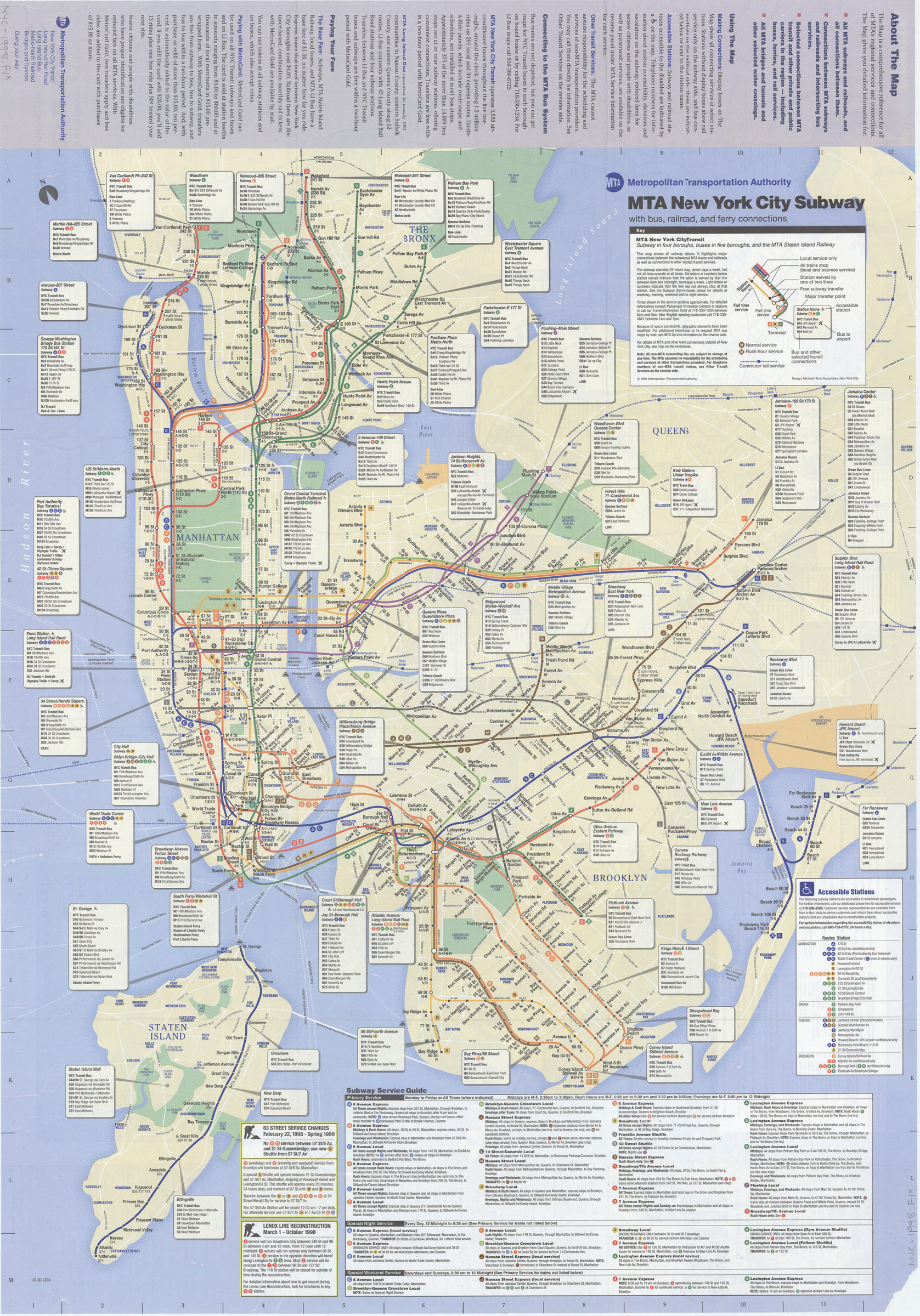
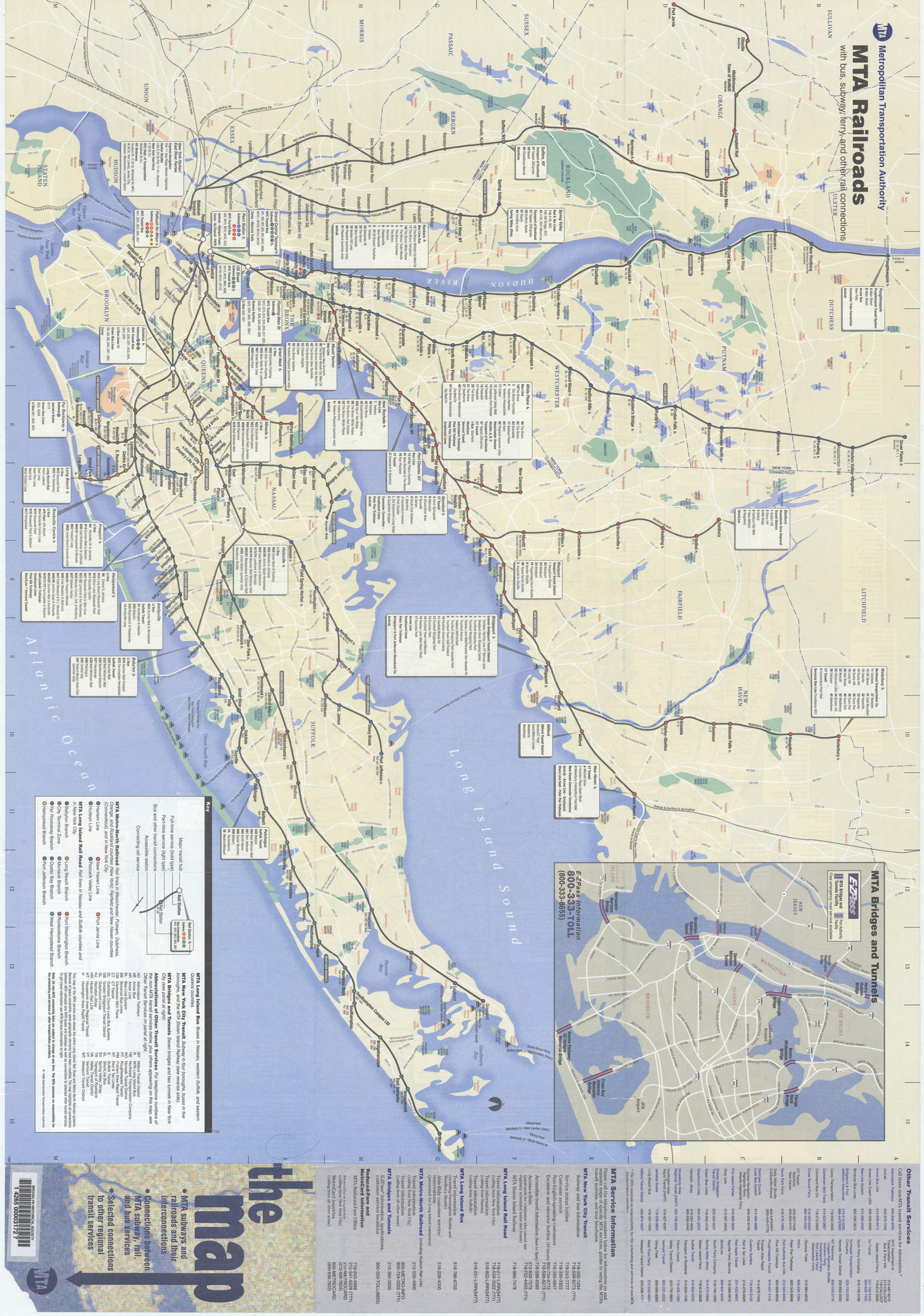
The map, MTA subways and railroads and their interconnections: connections between MTA subway, rail, and bus services, selected connections to other regional transit services: MTA Metropolitan Transportation Authority [ca. 1998]
Map No. NYC-1998.Fl
Schematic map showing subway lines in Manhattan, the Bronx, Queens, and Brooklyn and the Staten Island railway. Design: Michael Hertz Associates, NYC. Panel title. Includes text, directories, route/schedule tables, directory of handicapped-accessible stations, and inset of “MTA bridges and tunnels.” “22-30-1224.” MTA New York City subway with bus, railroad, and ferry connections. MTA railroads with bus, subway, ferry, and other rail connections [metropolitan area].
Map area shown
Genre
Transportation mapsRelation
Full catalog recordSize
83 × 58 cmDownload
Low Resolution Image
Creator
New York (State); Metropolitan Transportation Authority,Publisher
Brooklyn Historical SocietyCitation
The map, MTA subways and railroads and their interconnections: connections between MTA subway, rail, and bus services, selected connections to other regional transit services: MTA Metropolitan Transportation Authority; [ca. 1998], Map Collection, NYC-1998.Fl; Brooklyn Historical Society.Scale
Not drawn to scaleLoading zoom image... 