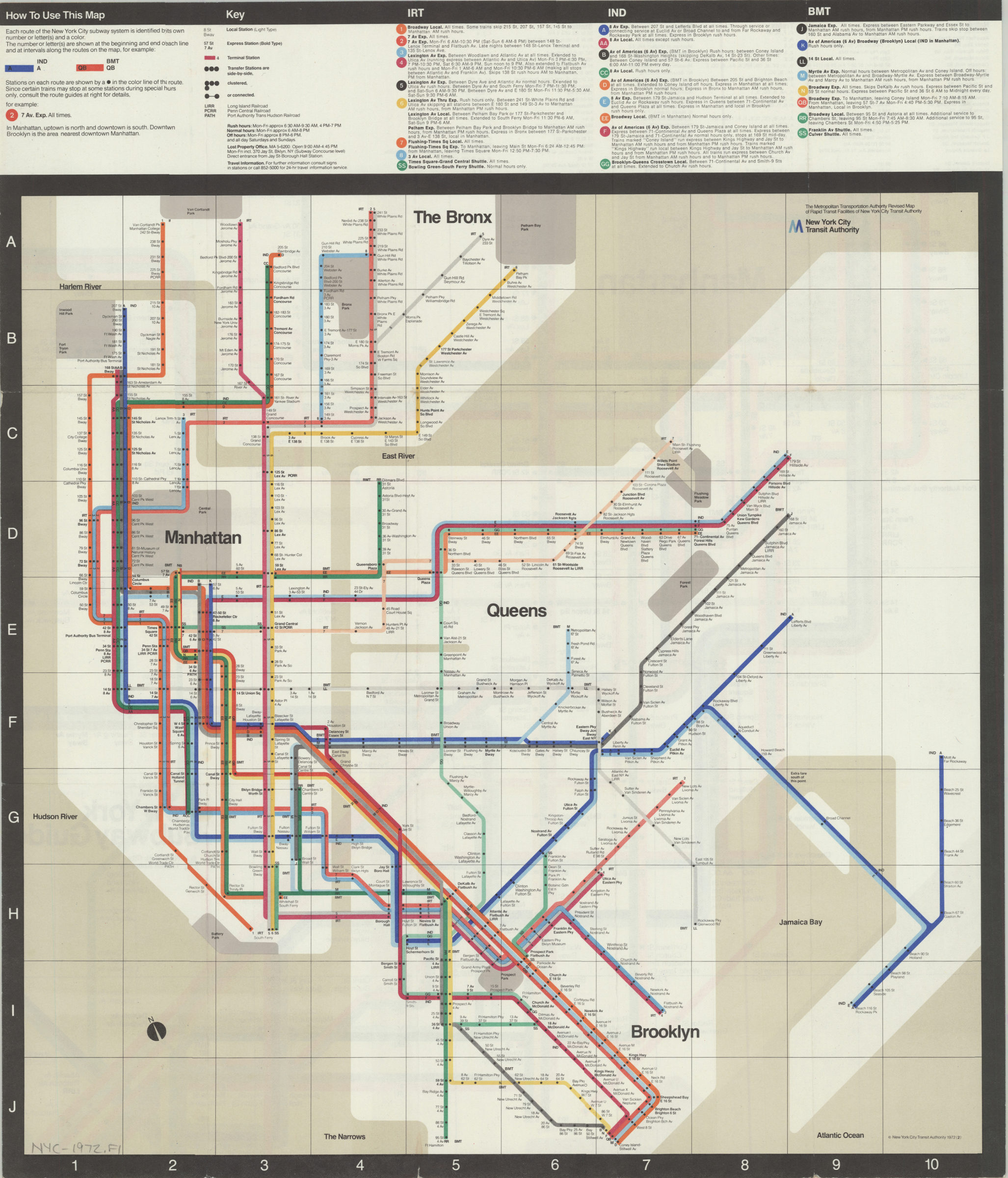
The Metropolitan Transportation Authority revised map of rapid transit facilities of New York City Transit Authority: New York City Transit Authority [ca. 1972]
Map No. NYC-1972.Fl
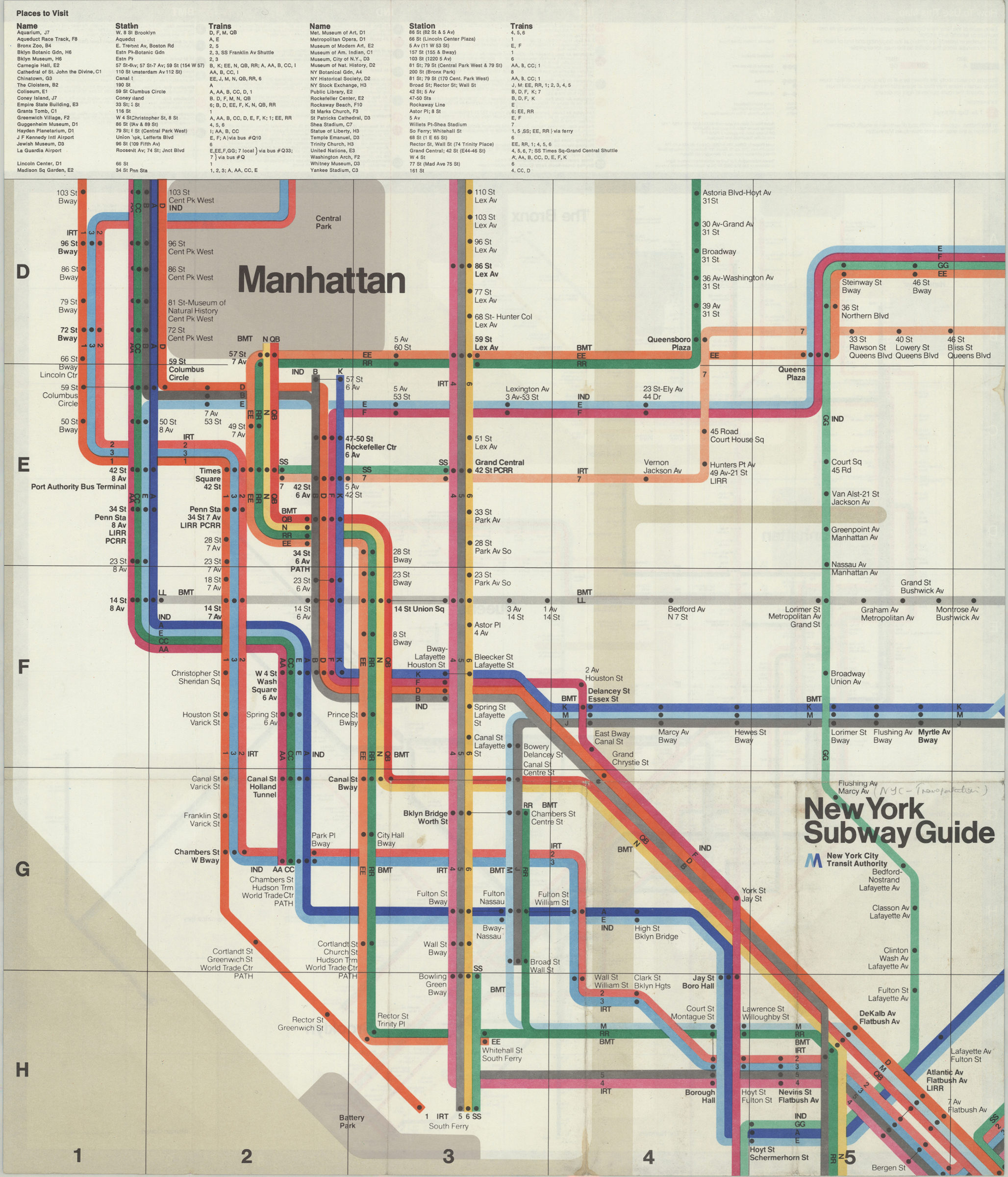
Schematic map showing subway lines in Manhattan, the Bronx, Queens, and Brooklyn. Oriented with north to the upper left. Includes key, route and schedule information. On verso: larger-scale version showing Manhattan below 110th Street, western Queens, and downtown Brooklyn. Includes index to points of interest. “1972 (2).”
Map area shown
Genre
Transportation mapsRelation
Full catalog recordSize
44 × 44 cmDownload
Low Resolution Image
Creator
New York City Transit Authority,Publisher
Brooklyn Historical SocietyCitation
The Metropolitan Transportation Authority revised map of rapid transit facilities of New York City Transit Authority: New York City Transit Authority; [ca. 1972], Map Collection, NYC-1972.Fl; Brooklyn Historical Society.Scale
Not drawn to scaleLoading zoom image... 