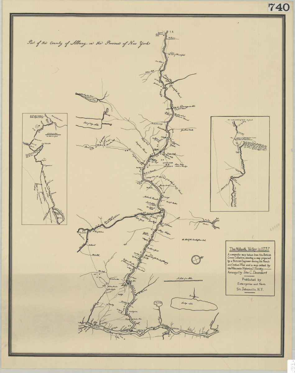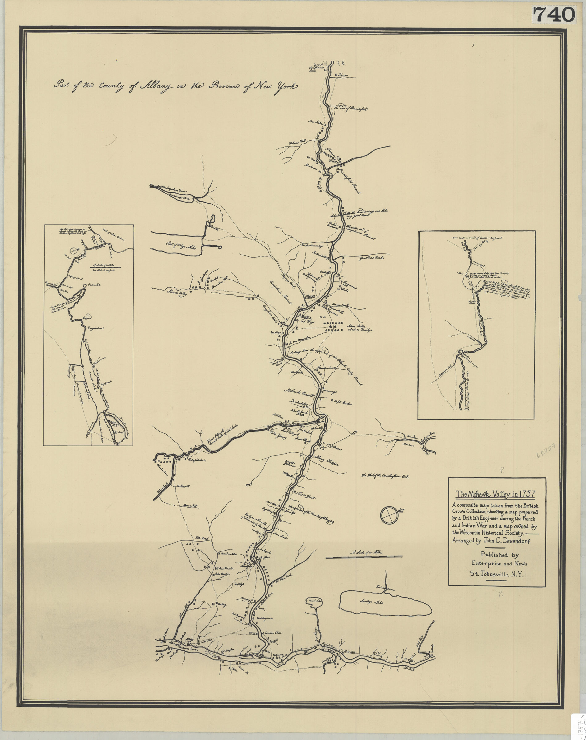
The Mohawk Valley in 1757: a composite map taken from the British Crown Collection, showing a map prepared by a British engineer during the French and Indian War and a map owned by the Wisconsin Historical Society: arranged by John C. Devendorf [19??]
Map No. NYS-1757 (19--?).Fl;NYS-1757 (19--?).Fl c.2
Also shows location of structures and names of landowners. Oriented with north to the upper right. Includes 2 inset detail maps. BHS has 2 copies.
Map area shown
Genre
Historical mapsRelation
Full catalog recordSize
58 × 47 cmDownload
Low Resolution Image
Creator
Devendorf, John C.,Publisher
Brooklyn Historical SocietyCitation
The Mohawk Valley in 1757: a composite map taken from the British Crown Collection, showing a map prepared by a British engineer during the French and Indian War and a map owned by the Wisconsin Historical Society: arranged by John C. Devendorf; [19??], Map Collection, NYS-1757 (19--?).Fl;NYS-1757 (19--?).Fl c.2; Brooklyn Historical Society.Scale
Scale [ca. 1:240,000]Loading zoom image...