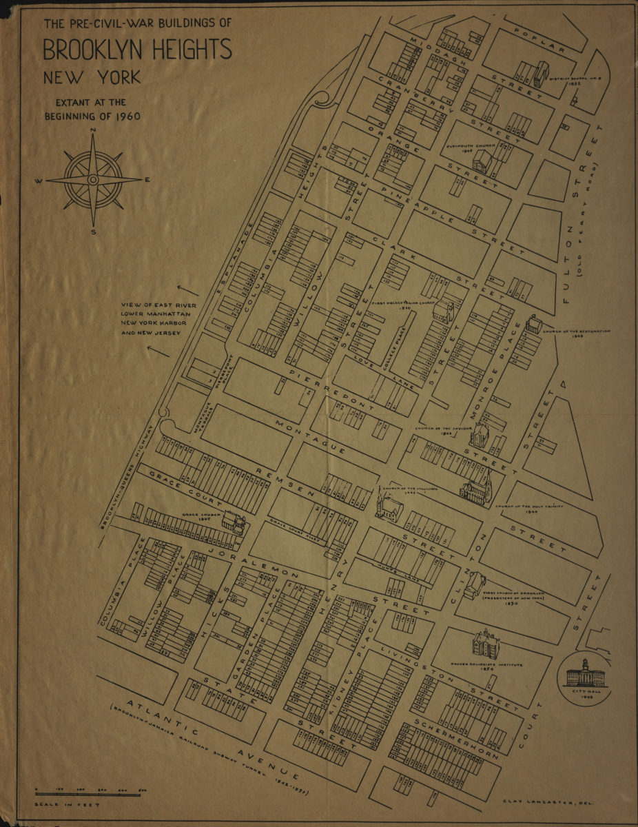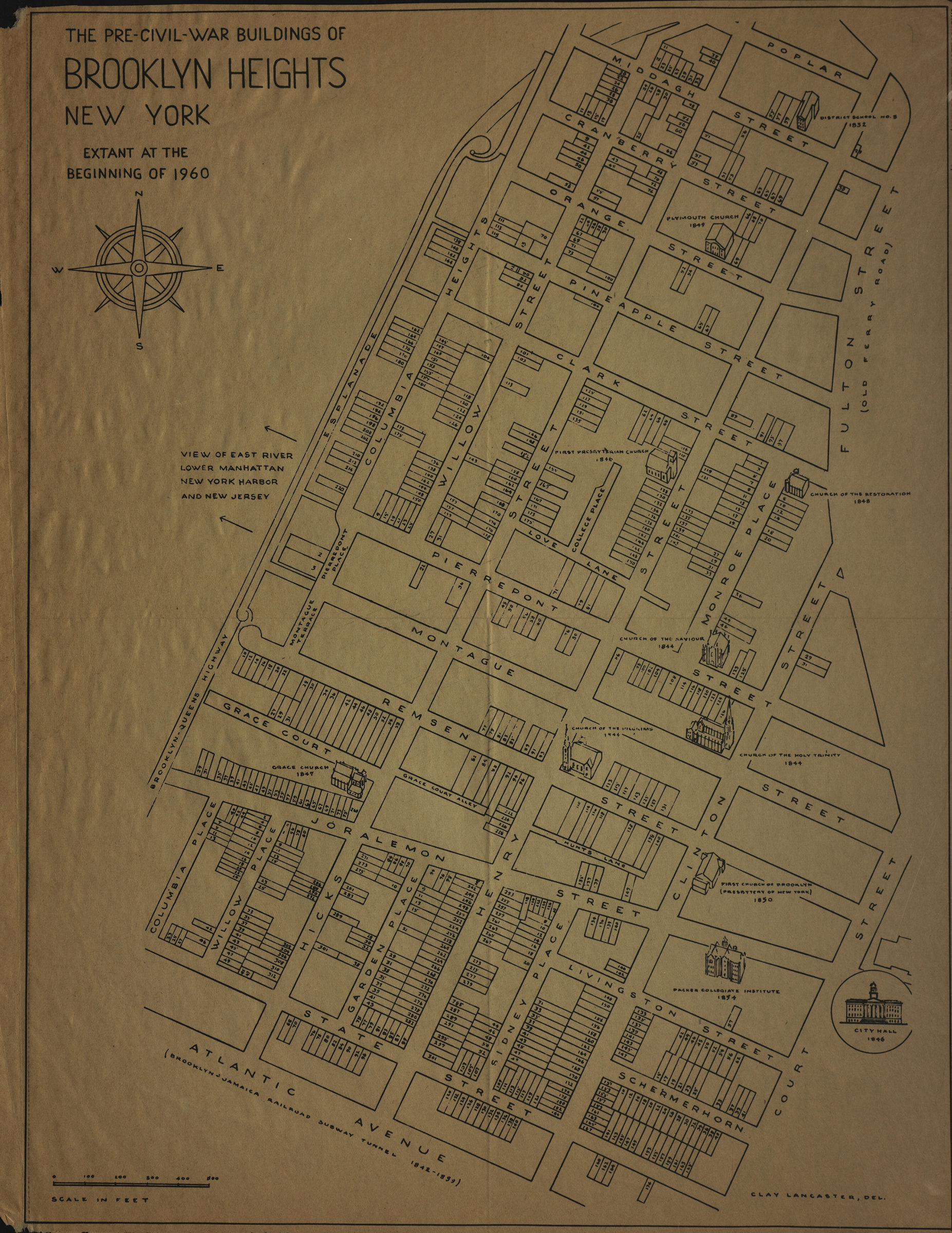

The pre-Civil-War buildings of Brooklyn Heights, New York, extant at the beginning of 1960: Clay Lancaster, del [1961]
Map No. B A-1961.Fl
Detached from: The Brooklyn Heights press, Oct. 5, 1961, p. 6-7.
Map area shown
Genre
MapRelation
Full catalog recordSize
57 × 42 cmDownload
Low Resolution Image
Creator
Lancaster, Clay,Publisher
Brooklyn Historical SocietyCitation
The pre-Civil-War buildings of Brooklyn Heights, New York, extant at the beginning of 1960: Clay Lancaster, del; [1961], Map Collection, B A-1961.Fl; Brooklyn Historical Society.Scale
Scale approximately 1:220Loading zoom image...