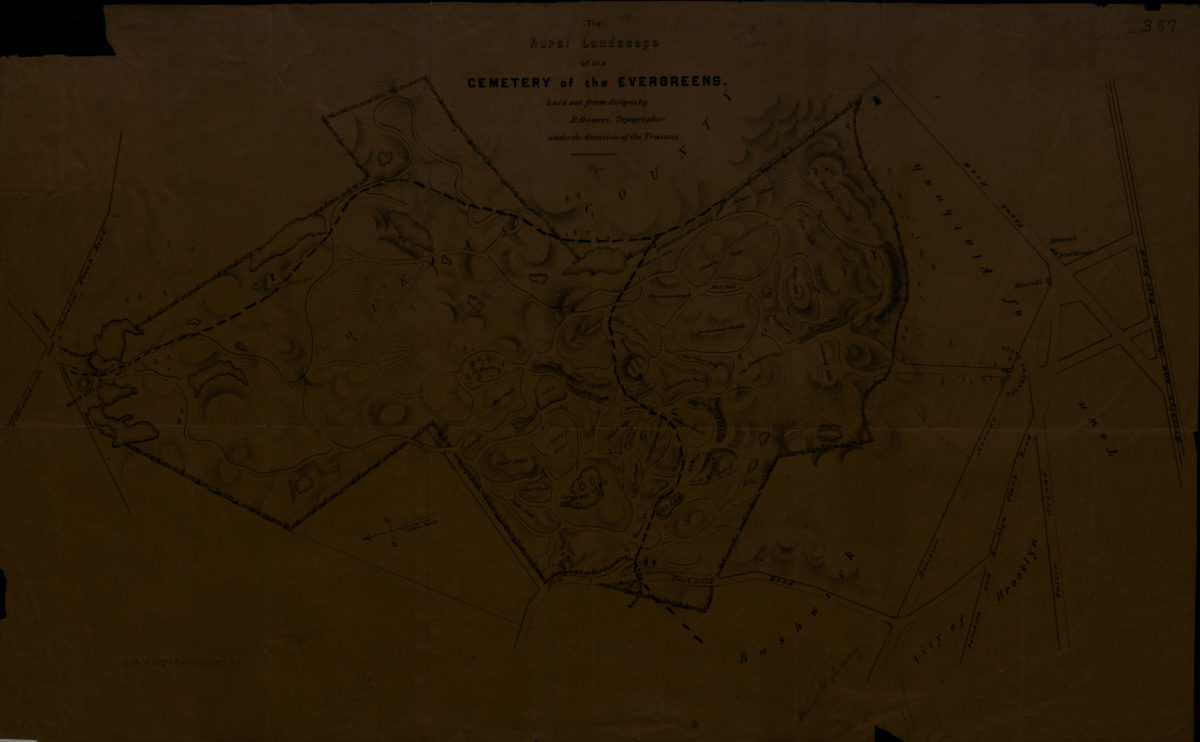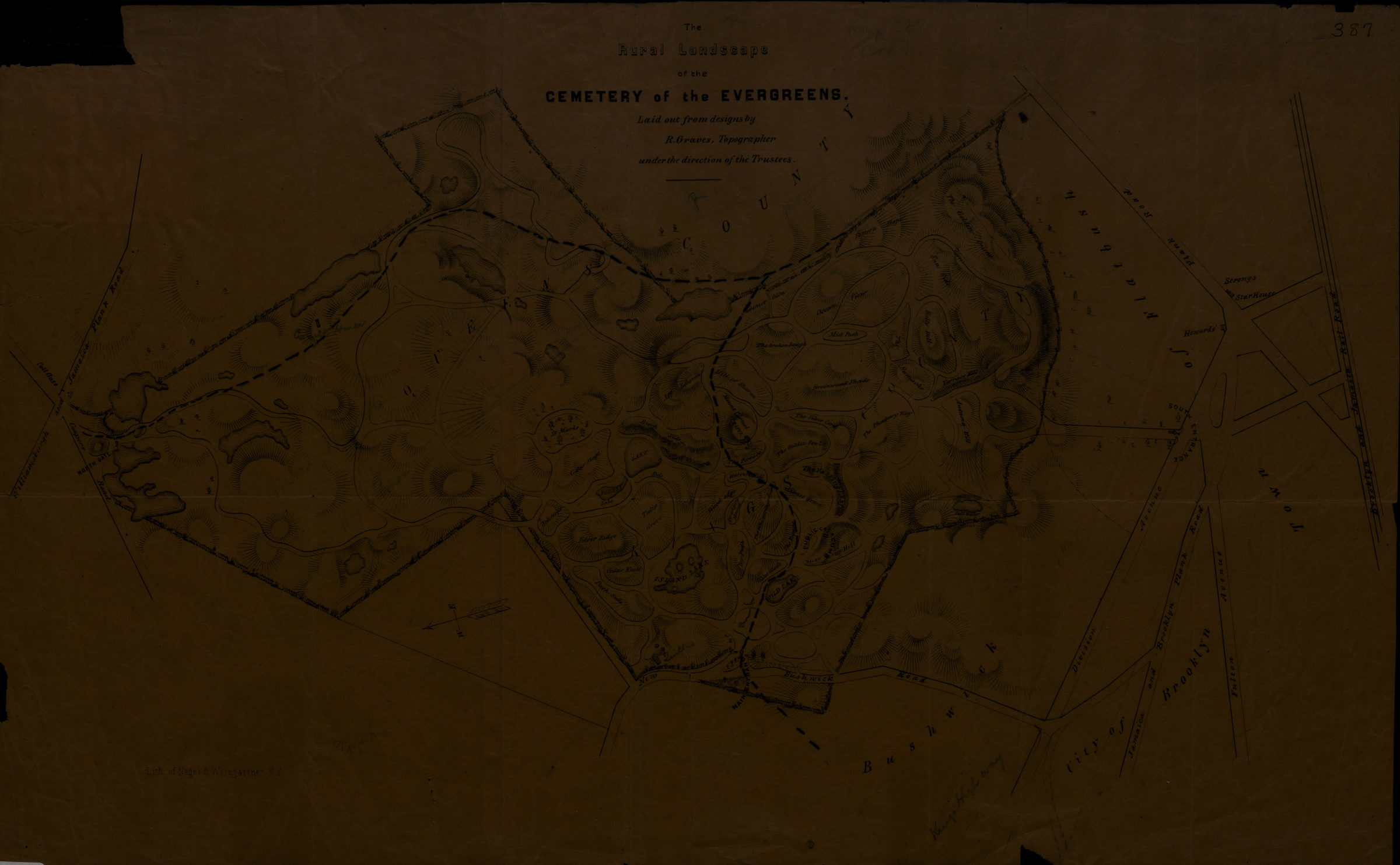
The rural landscape of the Cemetery of the Evergreens: laid out from designs by R. Graves, topographer, under the direction of the Trustees [185?]
Map No. B A-[185-?]a.Fl
Shows topography of the cemetery including lakes, hills, and dells. Also shows surrounding streets. Relief shown pictorially and by hachures. Oriented with north to the lower left. BHS copy annotated in pencil and black ink.
Map area shown
Genre
Thematic mapsRelation
Full catalog recordSize
46 × 29 cmDownload
Low Resolution Image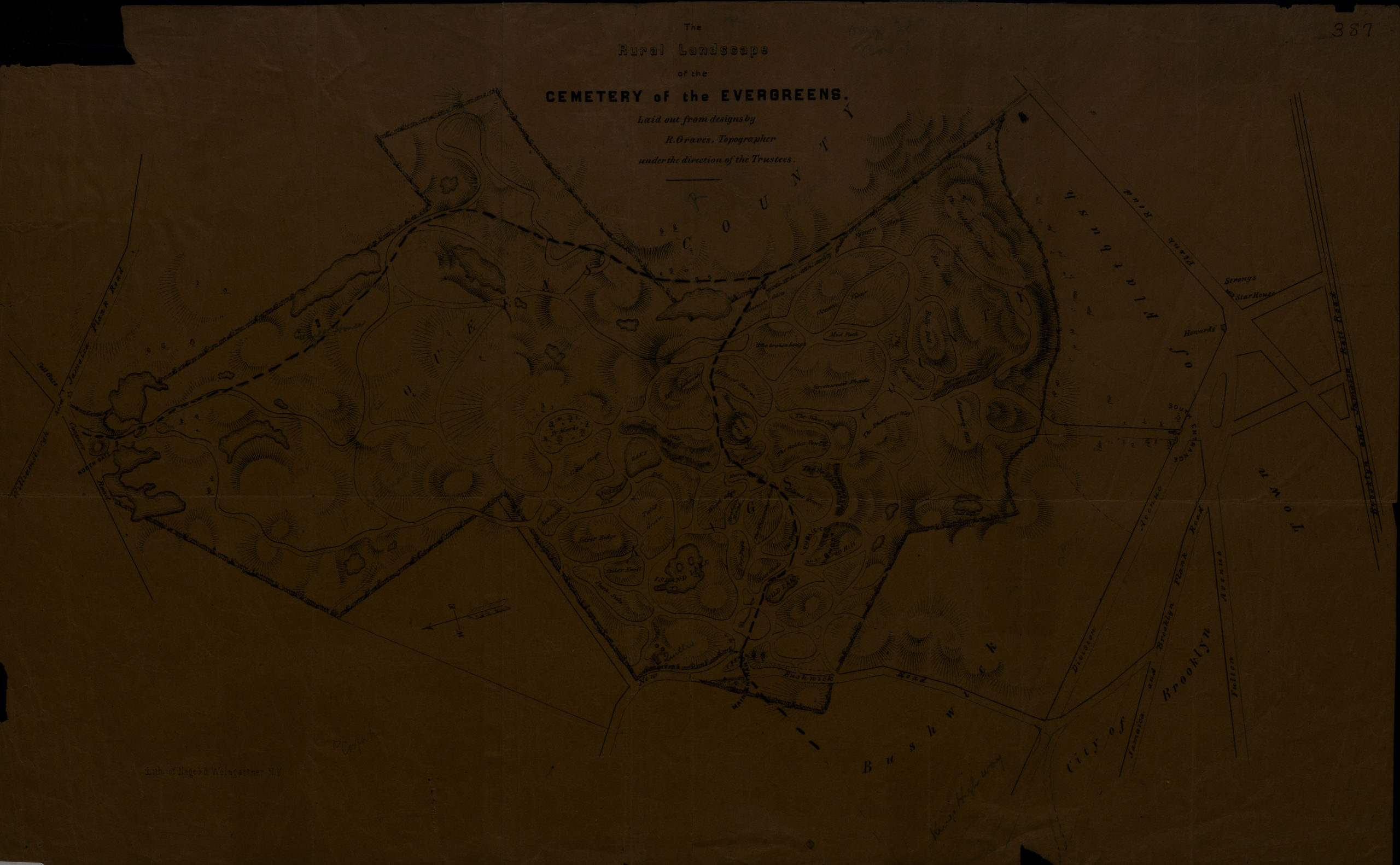
Creator
Graves, Roswell,Publisher
Brooklyn Historical SocietyCitation
The rural landscape of the Cemetery of the Evergreens: laid out from designs by R. Graves, topographer, under the direction of the Trustees; [185?], Map Collection, B A-[185-?]a.Fl; Brooklyn Historical Society.Scale
Scale not givenLoading zoom image...