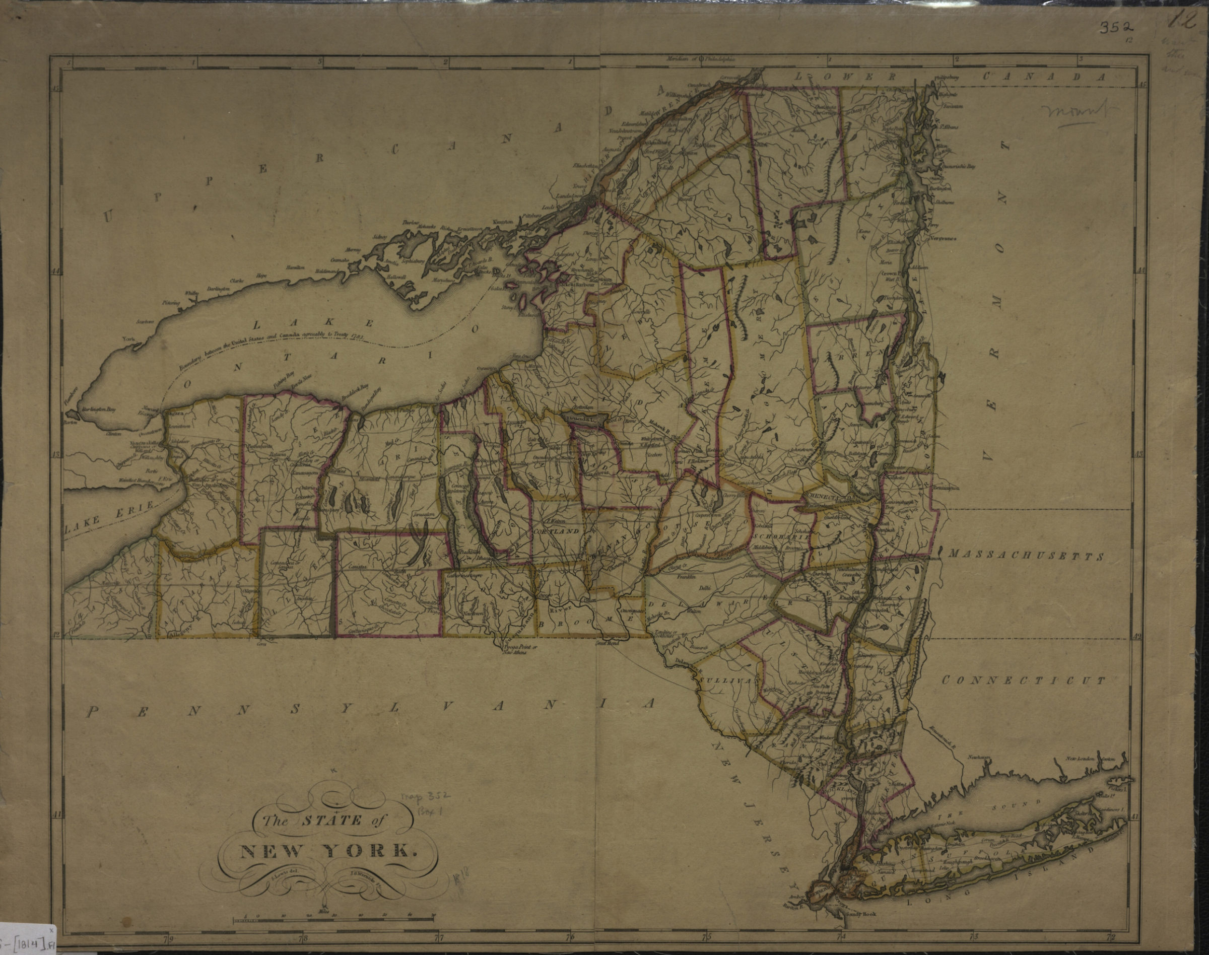
The state of New York: S. Lewis, del [1814]
Map No. NYS-[1814].Fl
Shows counties. Relief shown pictorially. Likely extracted from: Carey’s general atlas, improved and enlarged. 1814. Prime meridian: Philadelphia. “12”–upper right margin. BHS copy mounted on linen.
Places
Map area shown
Genre
MapRelation
Full catalog recordSize
40 × 50 cmDownload
Low Resolution Image
Creator
Lewis, Samuel,Publisher
Brooklyn Historical SocietyCitation
The state of New York: S. Lewis, del; [1814], Map Collection, NYS-[1814].Fl; Brooklyn Historical Society.Scale
Scale [ca. 1:1,364,677]Loading zoom image... 