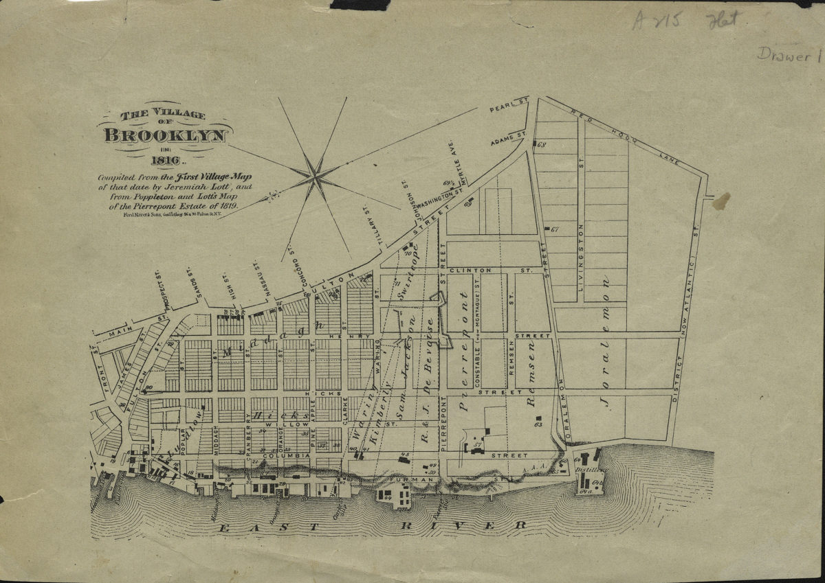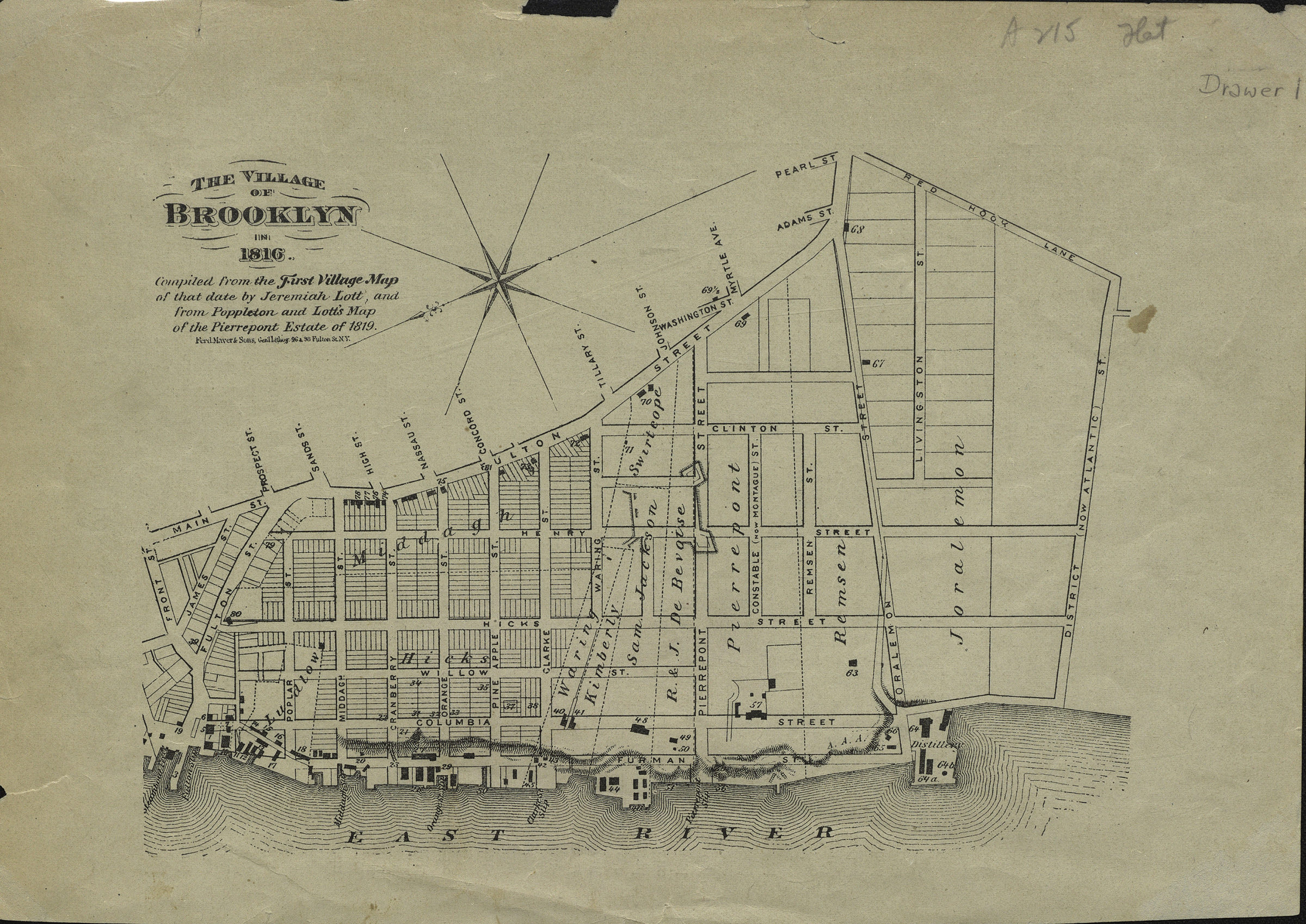
The village of Brooklyn in 1816: compiled from the First village map of that date by Jeremiah Lott and from Poppleton and Lott’s map of the Pierrepont Estate of 1819 [18??]
Map No. B P-1816 (18--?).Fl
Cadastral map covering area north from Atlantic Ave. to Front St. and east from the East River to Red Hook Lane (modern-day Brooklyn Heights and Downtown Brooklyn). Shows property (including lots and buildings), names of landowners, and slips. Relief show by hachures. Extracted from: History of Long Island. Author/publication information unknown. Oriented with north to the lower left. On verso: Text. “422”–Upper right corner of verso.
Subjects
Places
Map area shown
Genre
Cadastral mapsRelation
Full catalog recordSize
19 × 27 cmDownload
Low Resolution Image
Creator
Lott, Jeremiah; Poppleton, Thomas H.; Ferd. Mayer & Sons,Publisher
Brooklyn Historical SocietyCitation
The village of Brooklyn in 1816: compiled from the First village map of that date by Jeremiah Lott and from Poppleton and Lott’s map of the Pierrepont Estate of 1819; [18??], Map Collection, B P-1816 (18--?).Fl; Brooklyn Historical Society.Scale
Scale not givenLoading zoom image...