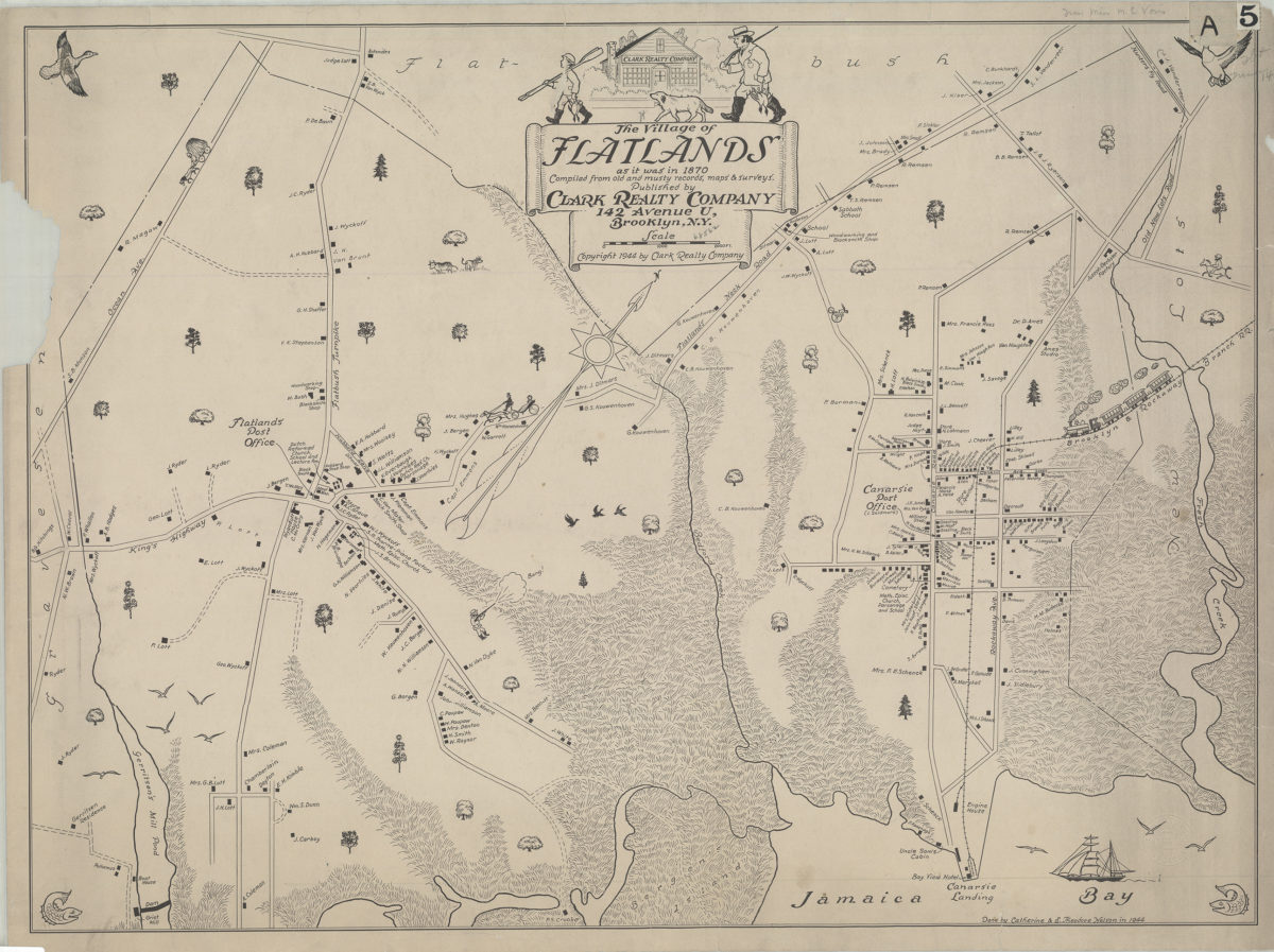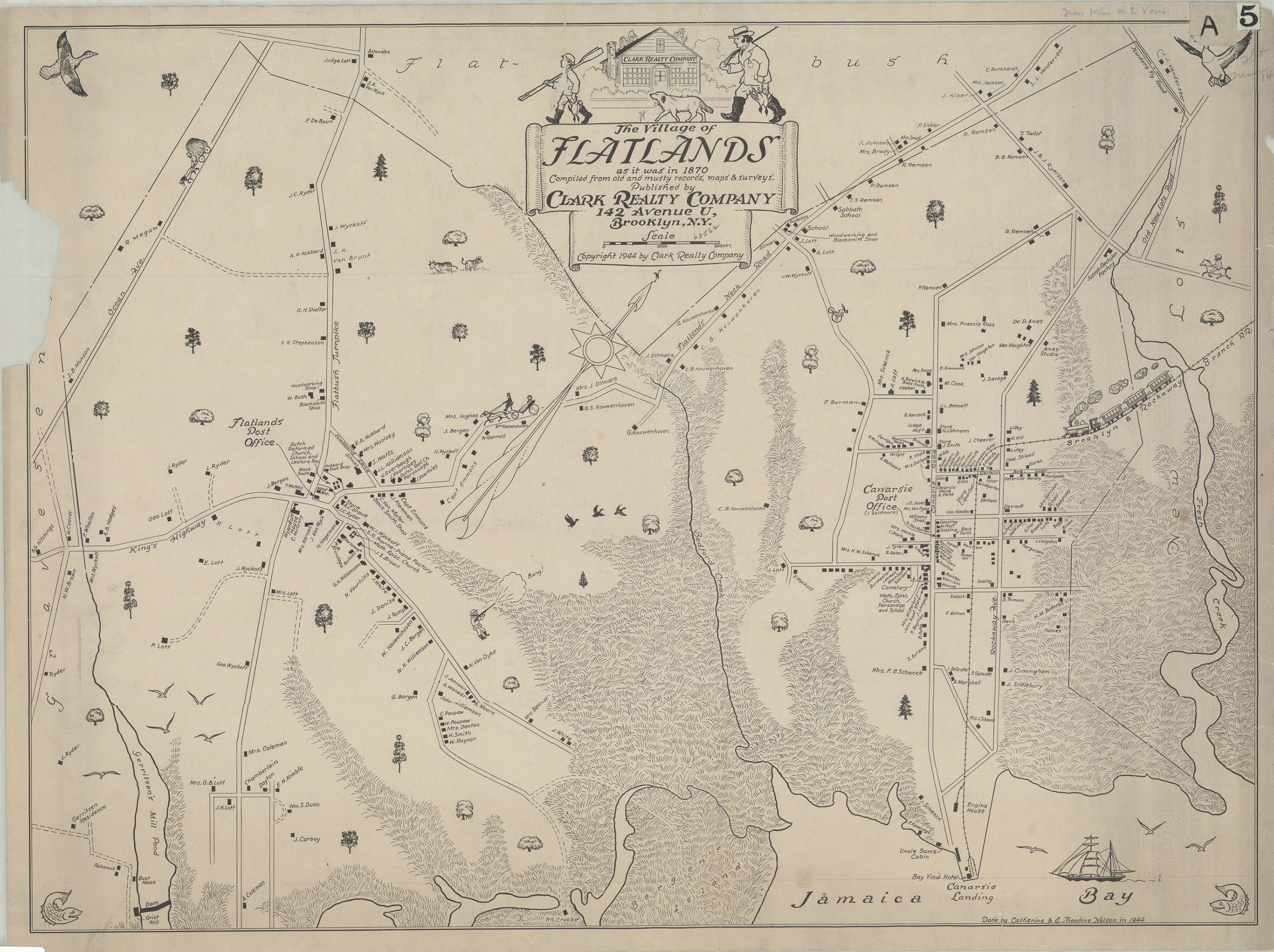
The village of Flatlands as it was in 1870: compiled from old and musty records, maps, & surveys: done by Catherine and E. Theodore Nelson [ca. 1944]
Map No. B P-1870 (1944).Fl
Pictorial map covering modern-day Canarsie east from Ocean Ave. to Fresh Creek, and north from Jamaica Bay to Hunters Fly Road. Shows names of property owners, schools, shops, public buildings, cemeteries, churches, and the Brooklyn and Rockaway Branch R.R. Oriented with north to the upper right. Includes decorative cartouche and ill. BHS copy imperfect missing portion of left margin.
Subjects
Places
Map area shown
Genre
Pictorial mapsRelation
Full catalog recordSize
53 × 73 cmDownload
Low Resolution Image
Creator
Nelson, Catherine,Publisher
Brooklyn Historical SocietyCitation
The village of Flatlands as it was in 1870: compiled from old and musty records, maps, & surveys: done by Catherine and E. Theodore Nelson; [ca. 1944], Map Collection, B P-1870 (1944).Fl; Brooklyn Historical Society.Scale
Scale [ca. 1:8,930]Loading zoom image...