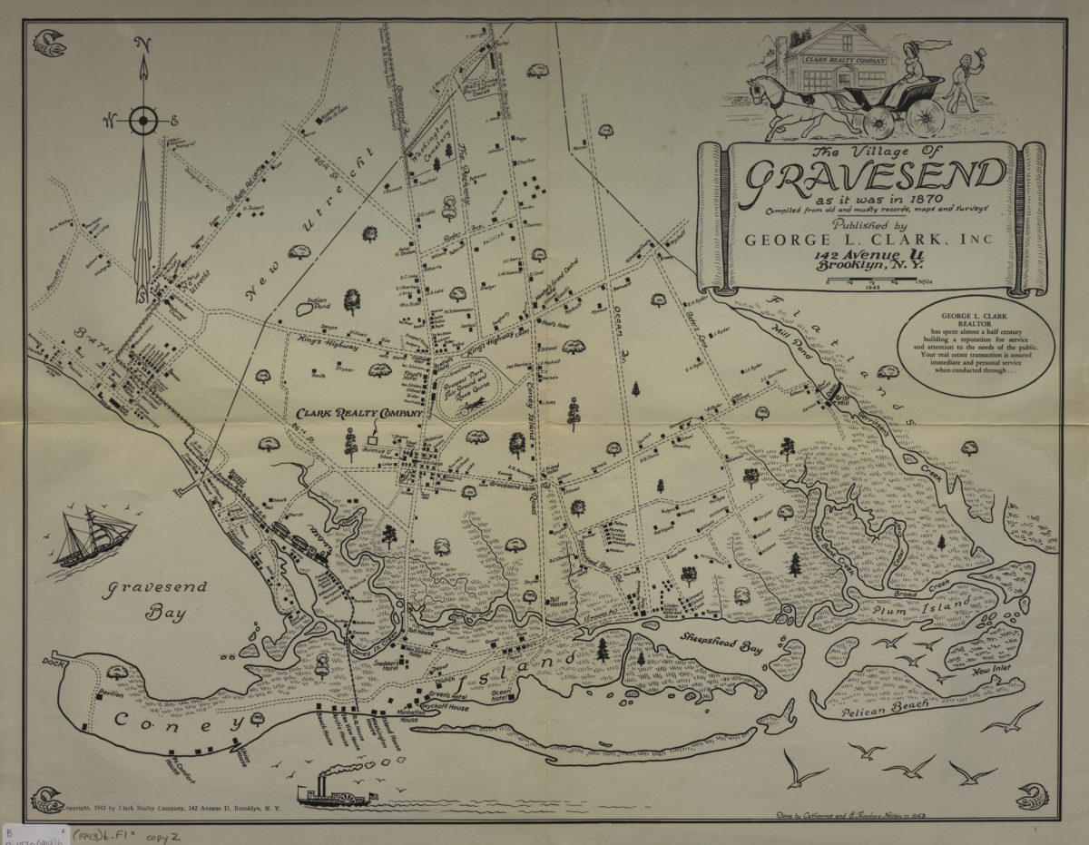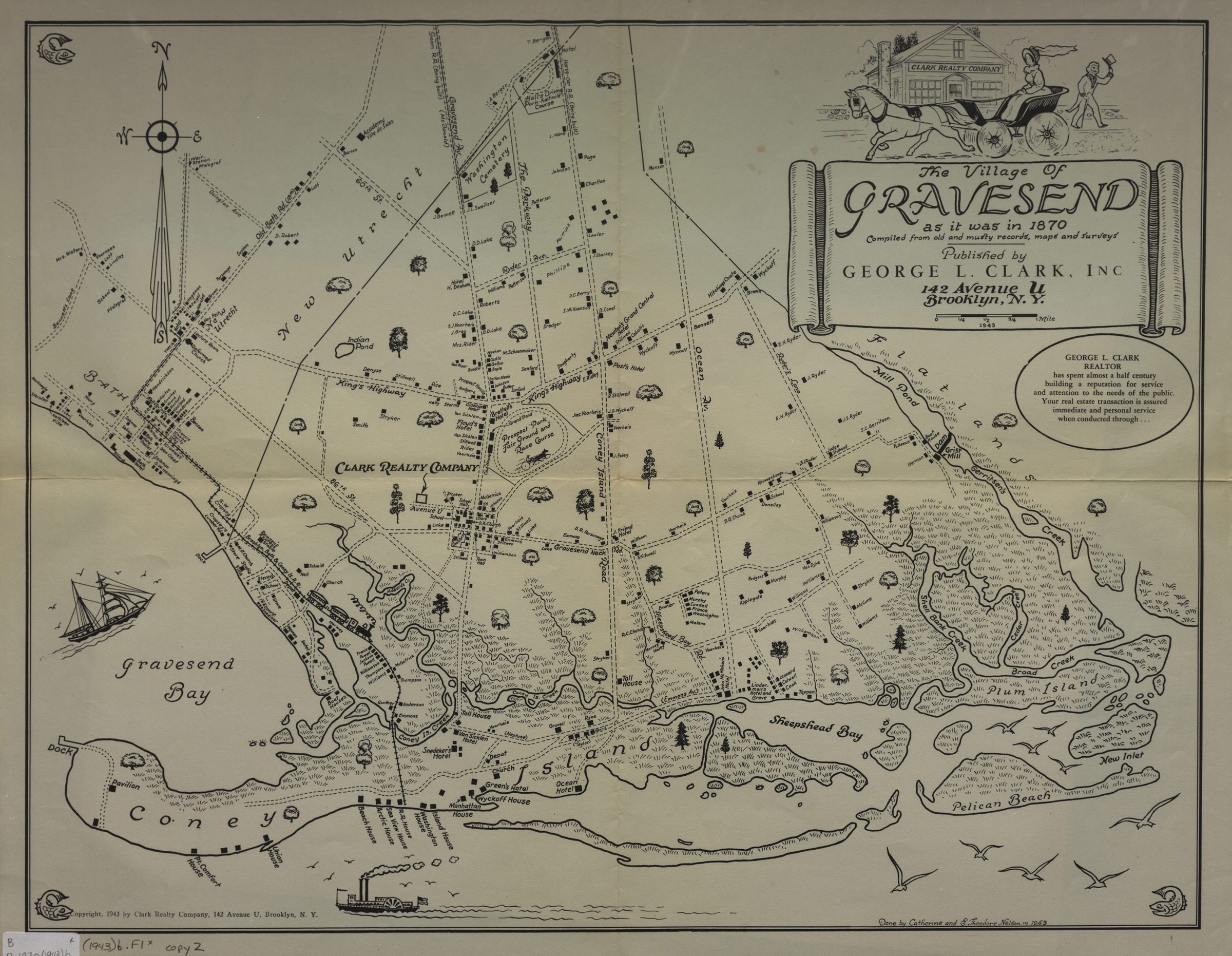
The village of Gravesend as it was in 1870: compiled from old and musty records, maps and surveys: done by Catherine and E. Theodore Nelson in 1943 [ca. 1943]
Map No. B P-1870 (1943)b.Fl c.2;B P-1870 (1943)b.Fl
Pictorial map covering present-day Brooklyn south of 65th St. Shows property owners, public structures, and streets. Title in cartouche. Includes ill. BHS copy 2 originally part of the collection of Everett and Evelyn Ortner papers and photographs (ARC.306). Includes original cover.
Subjects
Places
Map area shown
Genre
Pictorial mapsRelation
Full catalog recordSize
41 × 53 cmDownload
Low Resolution Image
Creator
Nelson, Catherine,Publisher
Brooklyn Historical SocietyCitation
The village of Gravesend as it was in 1870: compiled from old and musty records, maps and surveys: done by Catherine and E. Theodore Nelson in 1943; [ca. 1943], Map Collection, B P-1870 (1943)b.Fl c.2;B P-1870 (1943)b.Fl; Brooklyn Historical Society.Scale
Scale [ca. 1:36,000]Loading zoom image...