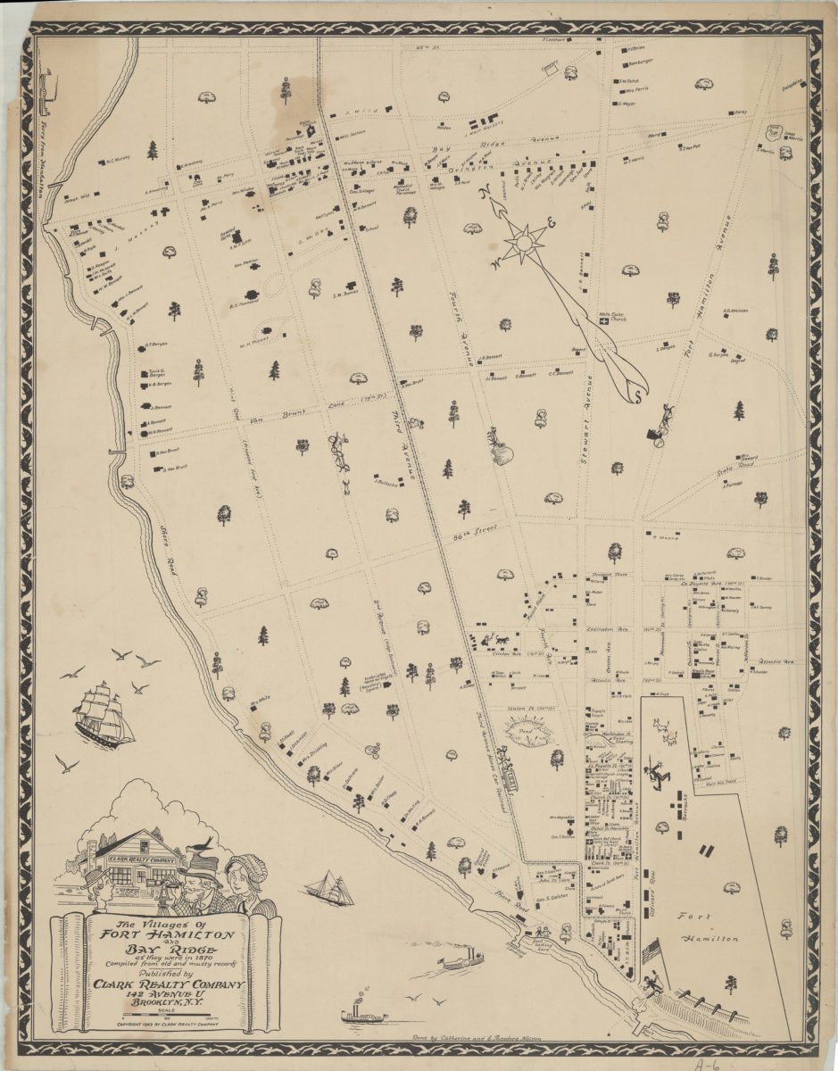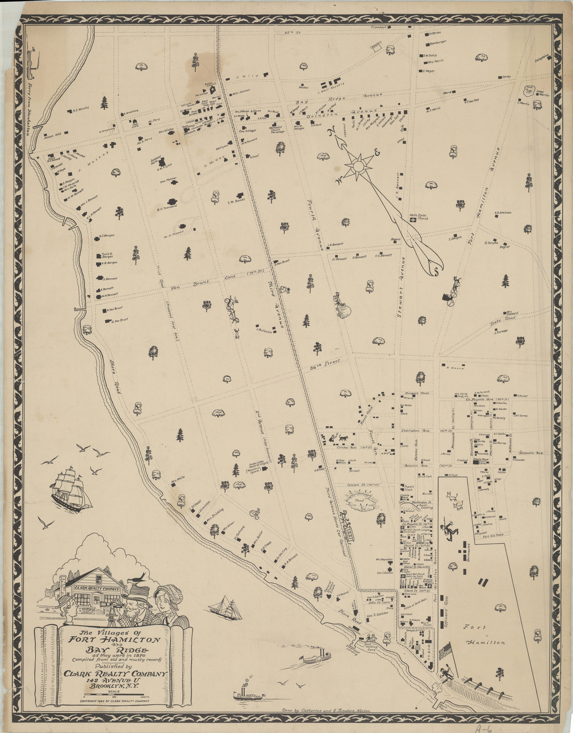
The villages of Fort Hamilton and Bay Ridge as they were in 1870: compiled from old and musty records: done by Catherine and E. Theodore Nelson [ca. 1942]
Map No. P-1870 (1942).Fl c.2;P-1870 (1942).Fl;P-1870 (1942).Fl c.3
Pictorial map covering Fort Hamilton and Bay Ridge south from 65th St. to the waterfront and east to Fort Hamilton Ave. Shows property, names of property owners, churches, public buildings, piers, hotels, ferry lines, and the Third Avenue Car Railroad. Relief shown pictorially. Oriented with north to the upper left. Includes decorative border, cartouche, and ill. BHS has 3 copies.
Subjects
Places
Map area shown
Genre
Pictorial mapsRelation
Full catalog recordSize
67 × 52 cmDownload
Low Resolution Image
Creator
Nelson, Catherine,Publisher
Brooklyn Historical SocietyCitation
The villages of Fort Hamilton and Bay Ridge as they were in 1870: compiled from old and musty records: done by Catherine and E. Theodore Nelson; [ca. 1942], Map Collection, P-1870 (1942).Fl c.2;P-1870 (1942).Fl;P-1870 (1942).Fl c.3; Brooklyn Historical Society.Scale
Scale [ca. 1:5,189]Loading zoom image...