Thomas Adams [text illegible], late Leah Morris, west of 3rd Ave., 8[th] ward, 1855 1855
Map No. Bergen-1855c.Fl
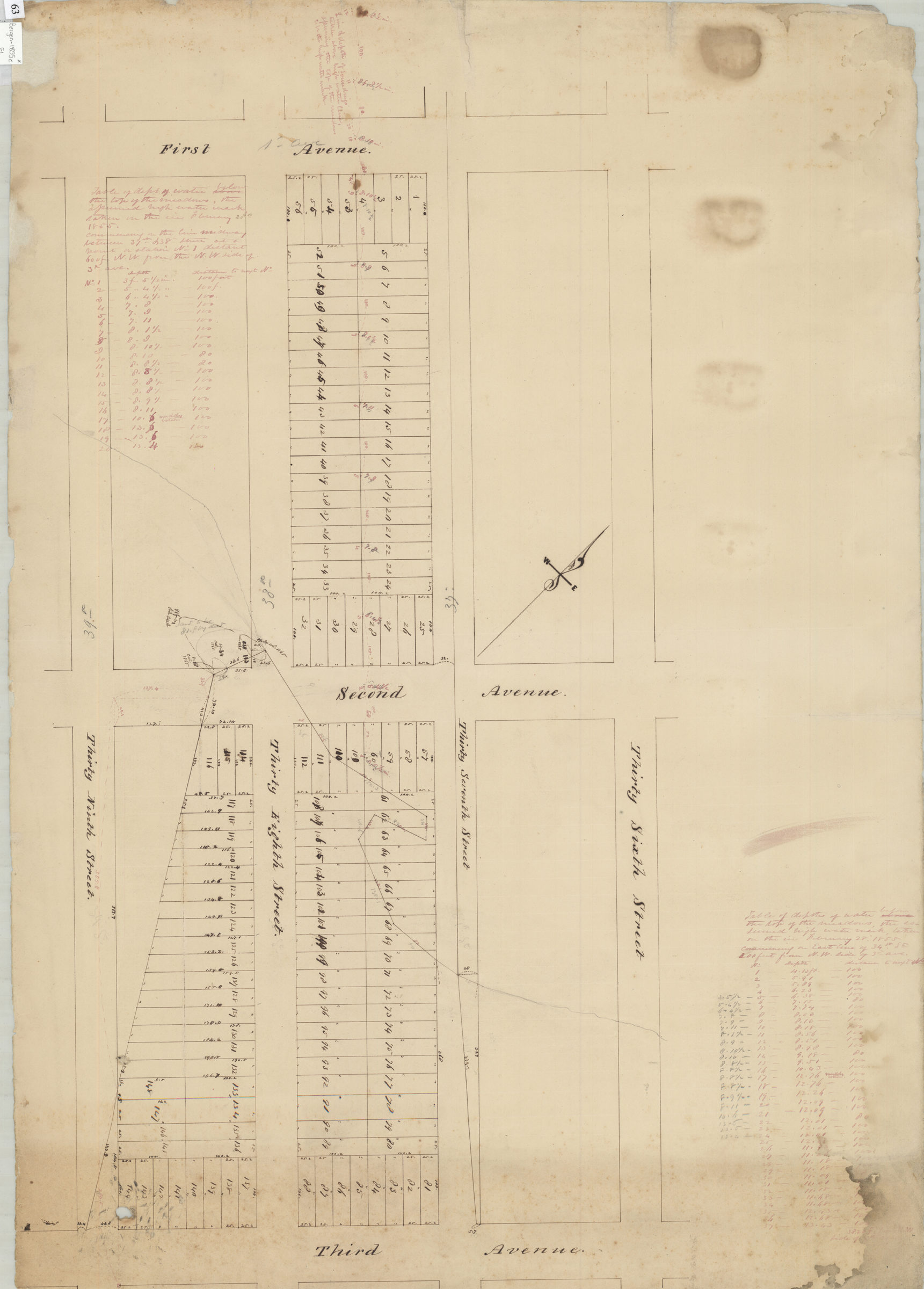
Cadastral map covering land between First Ave. and Third Ave., and 27th St. to 39th St. in modern-day Sunset Park. Shows streets and lots (including dimensions). Verso title. Attributed to Teunis G. Bergen, based on handwriting on piece. Includes “tables of depths of water below the top of the meadows, the assumed high water mark based on ice, February 28, 1855.” Oriented with north to the upper left.
Subjects
Places
Map area shown
Relation
Full catalog recordSize
55 × 77 cmDownload
Low Resolution Image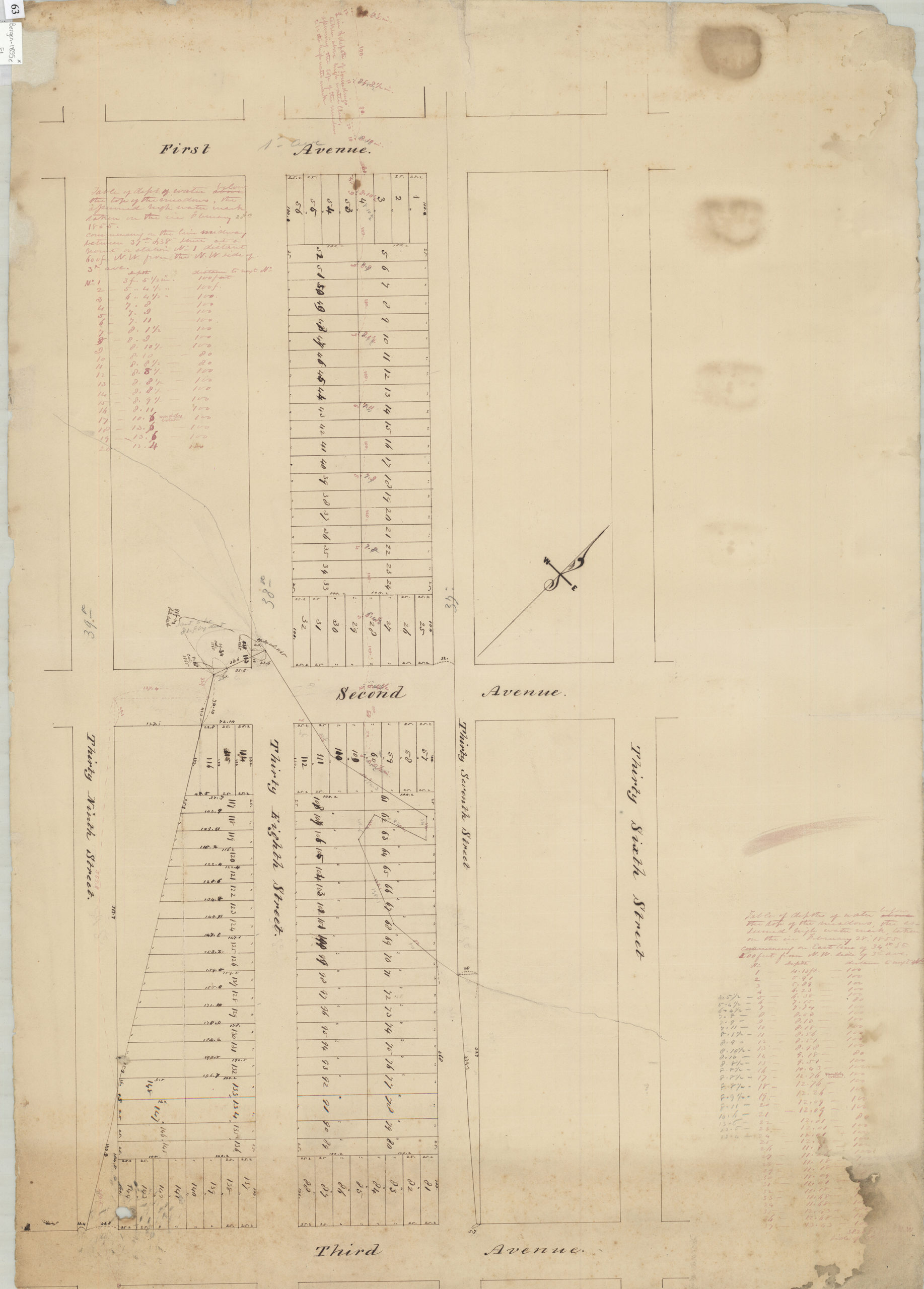
Creator
Bergen, Teunis G.,Publisher
Brooklyn Historical SocietyCitation
Thomas Adams [text illegible], late Leah Morris, west of 3rd Ave., 8[th] ward, 1855; 1855, Map Collection, Bergen-1855c.Fl; Brooklyn Historical Society.Scale
Scale not givenLoading zoom image... 