
Topographical map of New York City, County and vicinity showing the original high water lines, permanent pier lines, and the present wharves & piers: compiled from authentic surveys 1855
Map No. NYC-1855a.Fl
Map area shown
Download
Low Resolution Image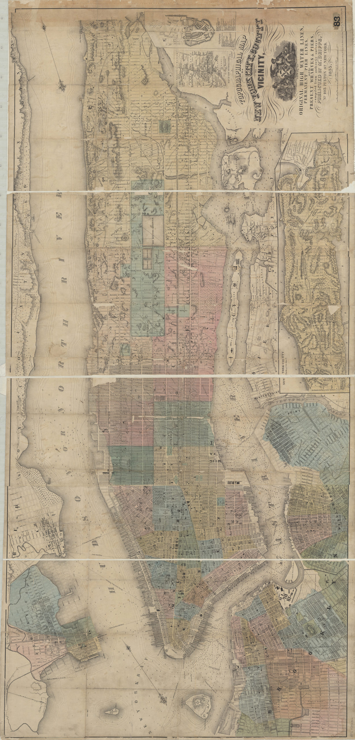
Citation
Topographical map of New York City, County and vicinity showing the original high water lines, permanent pier lines, and the present wharves & piers: compiled from authentic surveys; , , ; Brooklyn Historical Society.Loading zoom image... 