
Topographical map of New York City, County and vicinity showing the original high water lines, permanent pier lines, and the present wharves & piers: compiled from authentic surveys 1855
Map No. NYC-1855a.Fl
Shows property holdings, wards, street and ferry lines. Relief shown by hachures depths shown by soundings and isolines. “Entered according to Act of Congress in the year 1853 by M. Dripps, in the Clercks [sic] office of the District Ct. of the Southern Dist. of N.Y.” Oriented with north to the right. On cover: Bulkhead & pier lines. Brooklyn & New York. Includes inset continuation map, 2 insets, and ill. Insets: New York County north of 155th St. — Map of New Netherlands, 1656. BHS copy missing cover, mounted on linen, 4 segments assembled on one sheet.
Map area shown
Relation
Full catalog recordSize
80 × 164 cmDownload
Low Resolution Image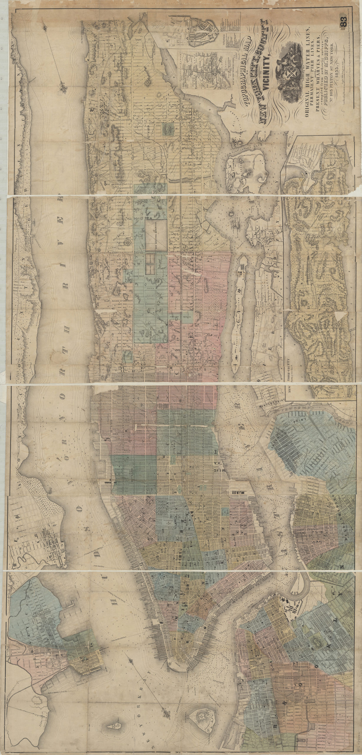
Creator
Dripps, M.,Publisher
Brooklyn Historical SocietyCitation
Topographical map of New York City, County and vicinity showing the original high water lines, permanent pier lines, and the present wharves & piers: compiled from authentic surveys; 1855, Map Collection, NYC-1855a.Fl; Brooklyn Historical Society.Scale
Scale [1:10,800] 1 in toLoading zoom image... 