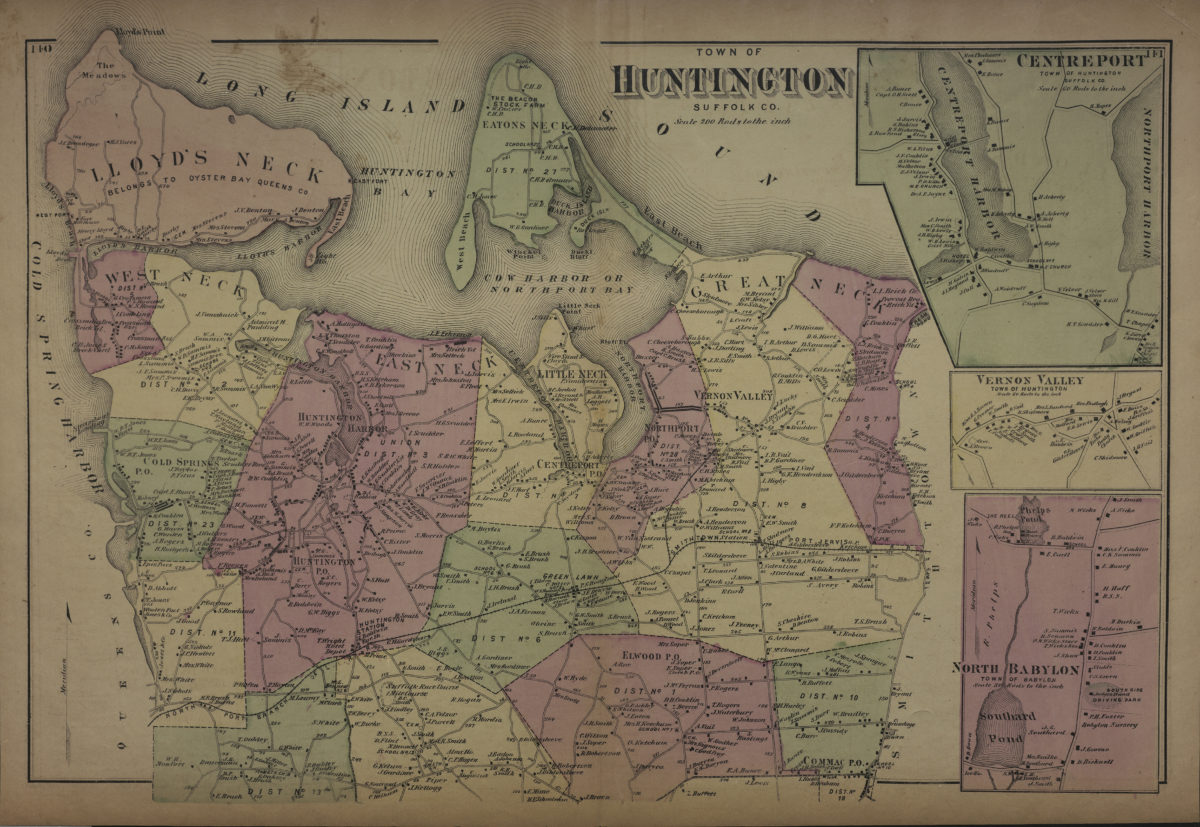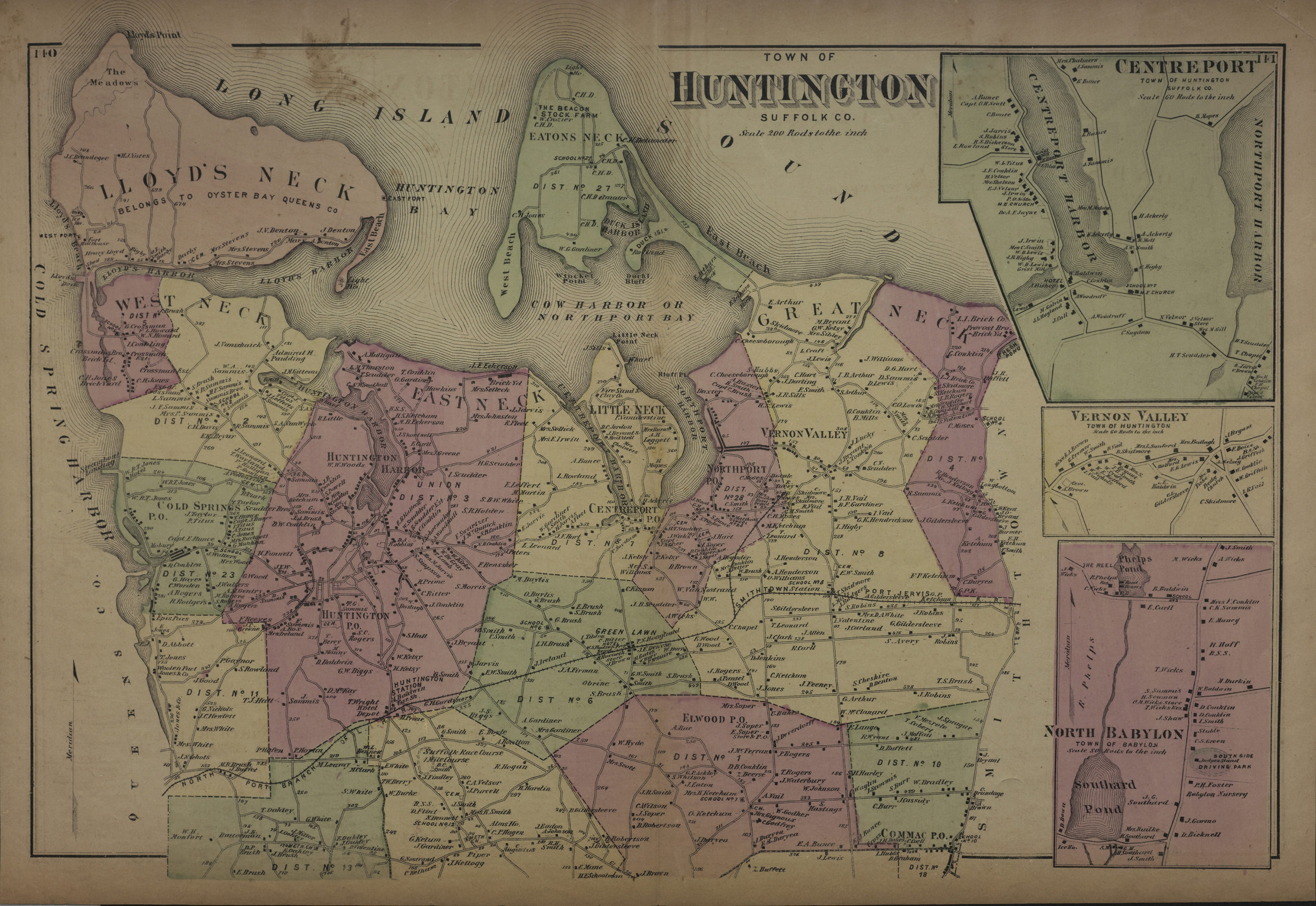

Town of Huntington, Suffolk Co [1873]
Cadastral map. Shows property (including buildings), names of landowners, and administrative divisions. Extracted from: Atlas of Long Island, New York. New York : Beers, Comstock & Cline, 1873, p. 139-142. Includes 3 insets. Insets: Centreport, town of Huntington, Suffolk Co. (Scale [1:11,880]. 60 rods to the in.) — Vernon Valley, town of Huntington (Scale [1:11,880]. 60 rods to the in.) — North Babylon, town of Babylon (Scale [1:3,960]. 20 rods to the in.). On verso: 5 ancillary maps. Ancillary maps: Amityville, town of Huntington, Suffolk Co. (Scale [1:7,200]. 600 ft. to the in.) — Cold Spring, town of Huntington, Suffolk Co. (Scale [1:7,920]. 20 rods to the in.) — Huntington Harbor, town of Huntington, Suffolk Co. (Scale [1:9,900]. 50 rods to the in.) — Northport, town of Huntington, Suffolk Co. (Scale [1:9,900]. 50 rods to the in.) — Deer Park, town of Babylon (Scale [1:11,880]. 60 rods to the in.).
Map area shown
Genre
Cadastral mapsRelation
Full catalog recordSize
39 × 45 cmDownload
Low Resolution Image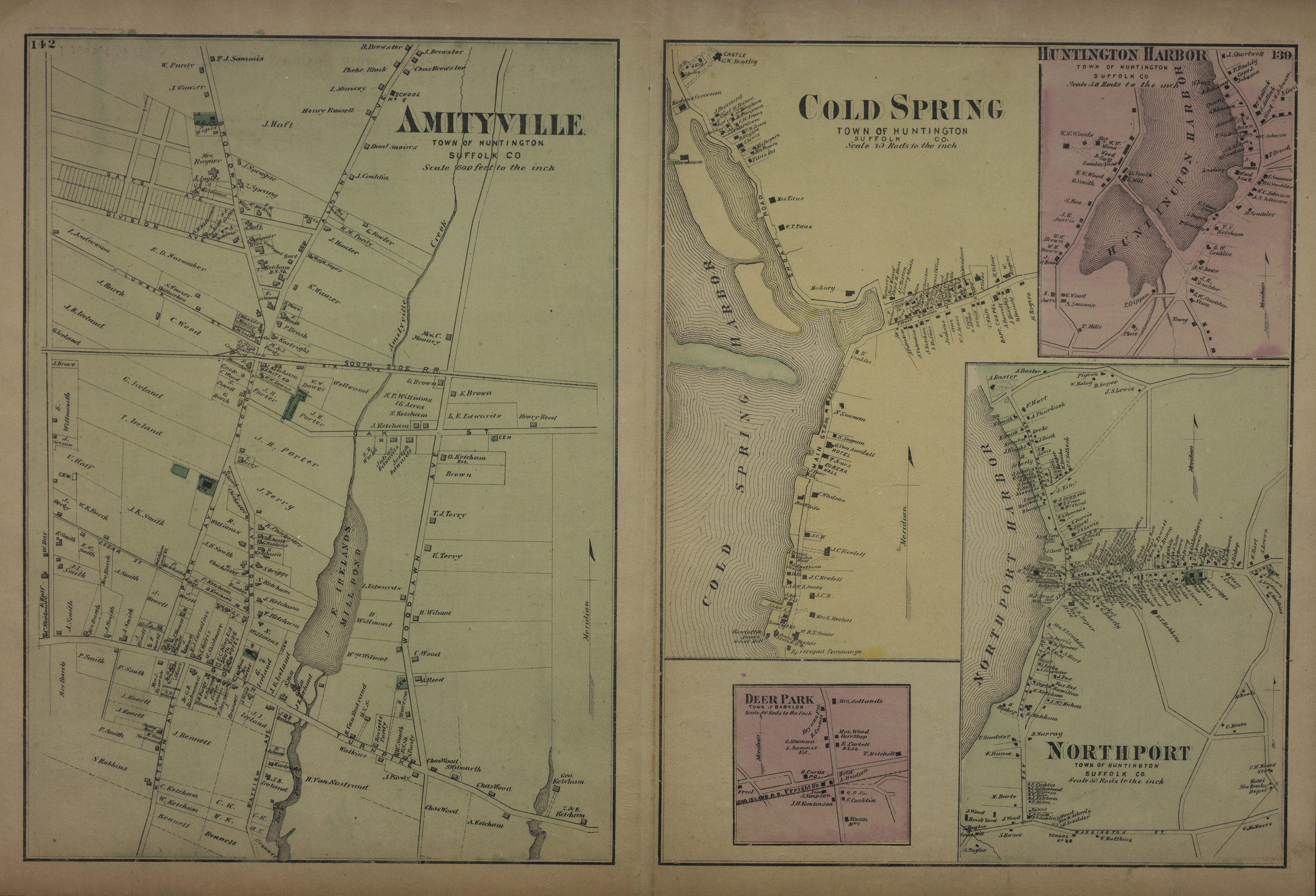
Creator
Beers, F. W.; Beers, Comstock & Cline,Publisher
Brooklyn Historical SocietyCitation
Town of Huntington, Suffolk Co; [1873], Map Collection, L.I.-[1873]t.Fl; Brooklyn Historical Society.Scale
Scale [1:39,600] 1 in to