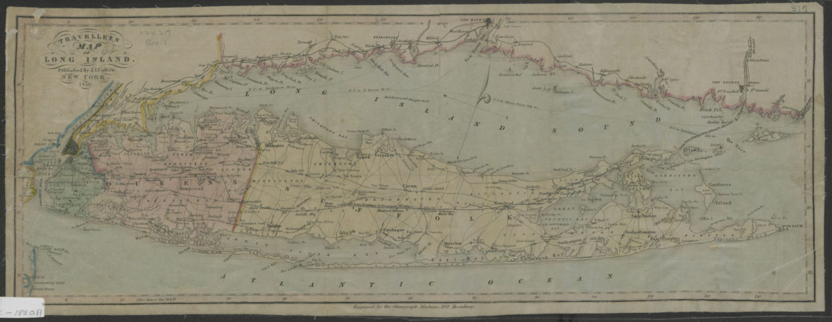
Traveller’s map of Long Island 1850
Map No. L.I.-1850.Fl
Also covers Long Island Sound and portions of New York City, eastern New Jersey, and the southern coast of Connecticut. Shows counties, railroads, and distances from New York City. Relief shown by hachures. Oriented with north to the upper right. “Engraved by the Omnigraph Machine, 192 Broadway.”
Places
Map area shown
Genre
Tourist mapsRelation
Full catalog recordSize
19 × 51 cmDownload
Low Resolution ImageCreator
Colton, J. H.,Publisher
Brooklyn Historical SocietyCitation
Traveller’s map of Long Island; 1850, Map Collection, L.I.-1850.Fl; Brooklyn Historical Society.Scale
Scale not givenLoading zoom image...