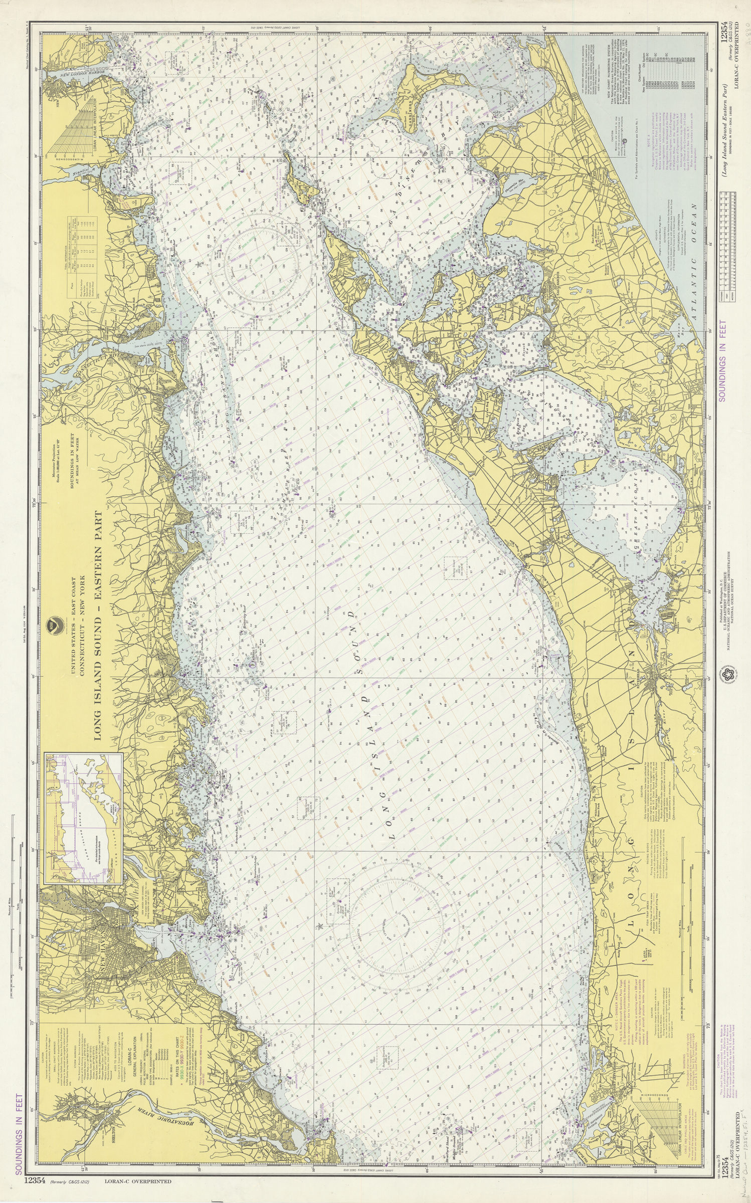
United States–east coast, Connecticut–New York, Long Island Sound, eastern part: National Ocean Survey 1975
Map No. Nautical chart-12354.Fl.Folio
“LORAN-C overprinted.” Depths shown by isolines and soundings. Relief shown by contours and spot heights. “Soundings in feet.” Includes tidal information and index to next larger scale charts. “12354.”
Map area shown
Genre
Bathymetric mapsRelation
Full catalog recordSize
68 × 114 cmDownload
Low Resolution Image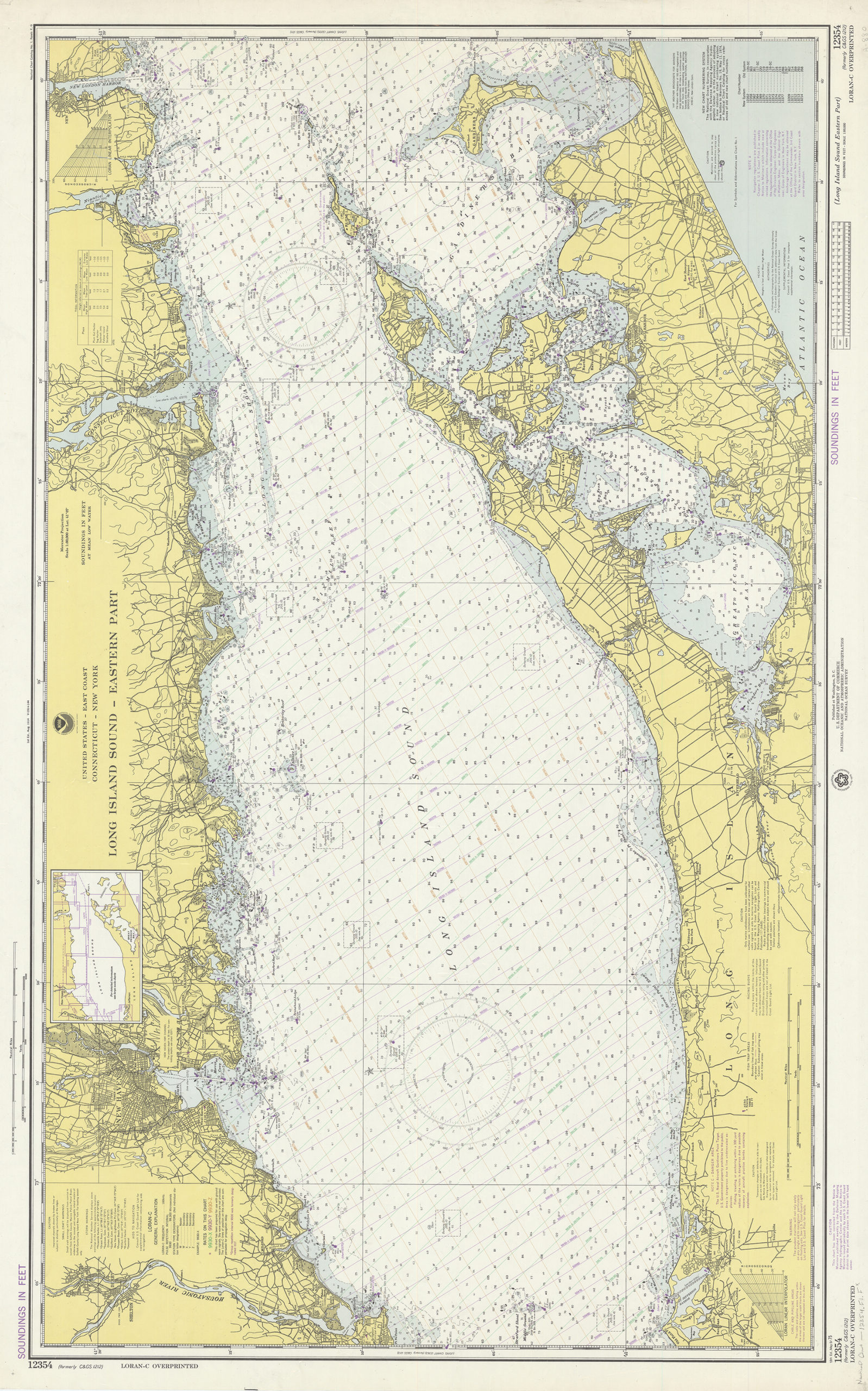
Creator
National Ocean Survey,Publisher
Brooklyn Historical SocietyCitation
United States–east coast, Connecticut–New York, Long Island Sound, eastern part: National Ocean Survey; 1975, Map Collection, Nautical chart-12354.Fl.Folio; Brooklyn Historical Society.Scale
Scale 1:80,000 at lat. 41Loading zoom image... 