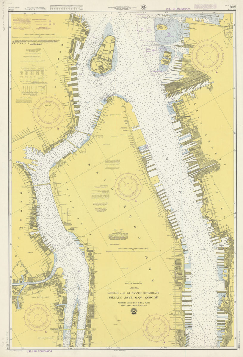
United States–east coast, New York and New Jersey, Hudson and East Rivers, Governors Island to 67th Street: National Ocean Survey 1974
Map No. Nautical Chart-12335.Fl.Folio
Depths shown by isolines and soundings. “Soundings in feet.” Includes tidal information. “12335 (formerly C&GS 745).”
Map area shown
Relation
Full catalog recordSize
113 × 76 cmDownload
Low Resolution Image
Creator
National Ocean Survey,Publisher
Brooklyn Historical SocietyCitation
United States–east coast, New York and New Jersey, Hudson and East Rivers, Governors Island to 67th Street: National Ocean Survey; 1974, Map Collection, Nautical Chart-12335.Fl.Folio; Brooklyn Historical Society.Scale
Scale 1:10,000Loading zoom image...