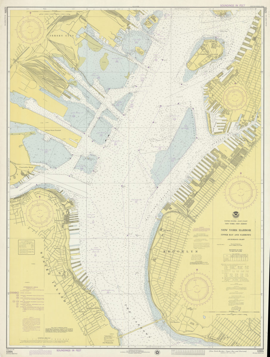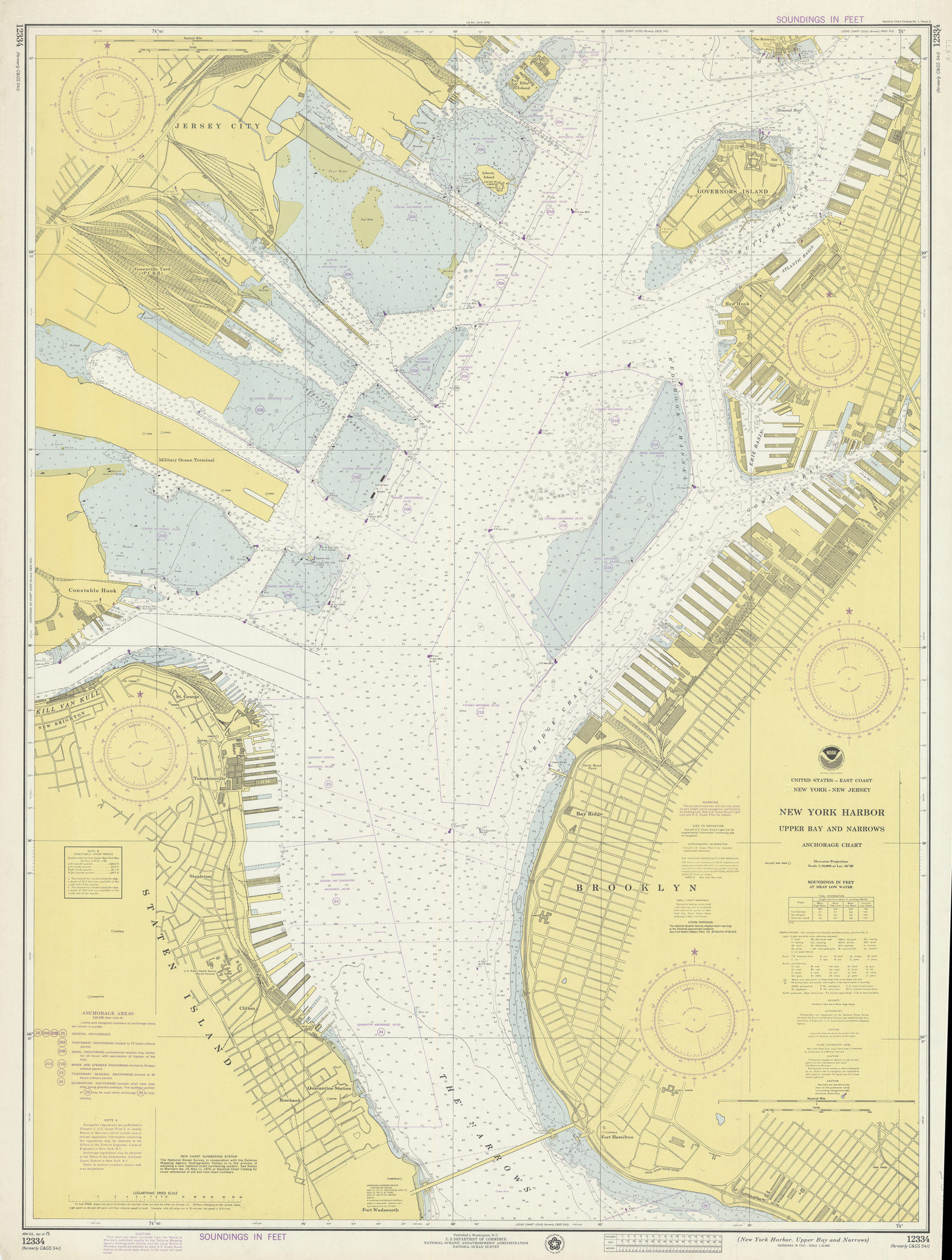
United States–east coast, New York–New Jersey, New York Harbor, Upper Bay and Narrows anchorage chart: Ocean Survey 1975
Map No. Nautical Chart-12334.Fl.Folio
Depths shown by isolines and soundings. “Soundings in feet.” Includes source diagram, tidal information, and table of channel depths. “12334 (formerly C&GS 541).”
Map area shown
Genre
Bathymetric mapsRelation
Full catalog recordSize
112 × 84 cmDownload
Low Resolution Image
Creator
National Ocean Survey,Publisher
Brooklyn Historical SocietyCitation
United States–east coast, New York–New Jersey, New York Harbor, Upper Bay and Narrows anchorage chart: Ocean Survey; 1975, Map Collection, Nautical Chart-12334.Fl.Folio; Brooklyn Historical Society.Scale
Scale 1:10,000 at lat. 40Loading zoom image...