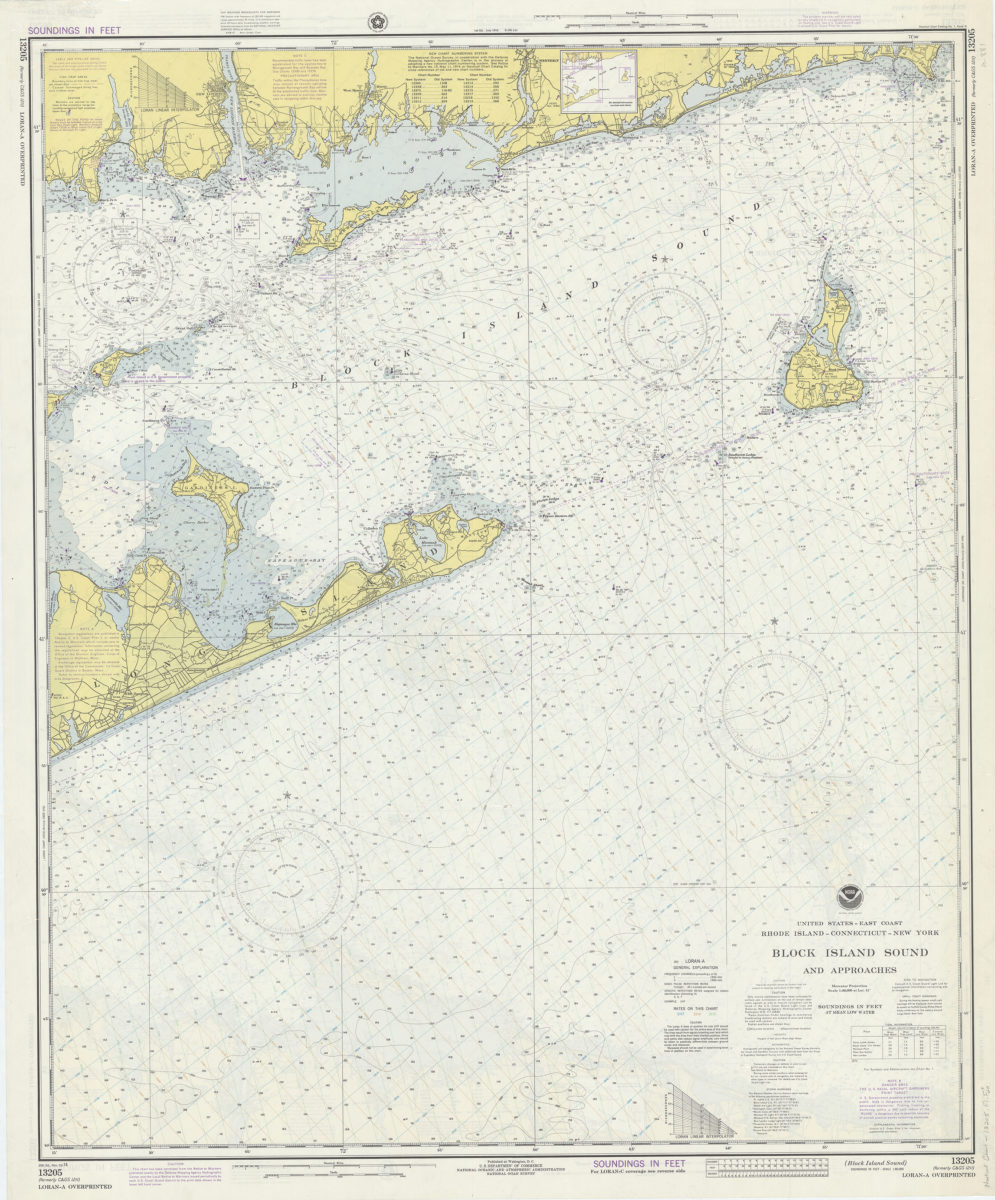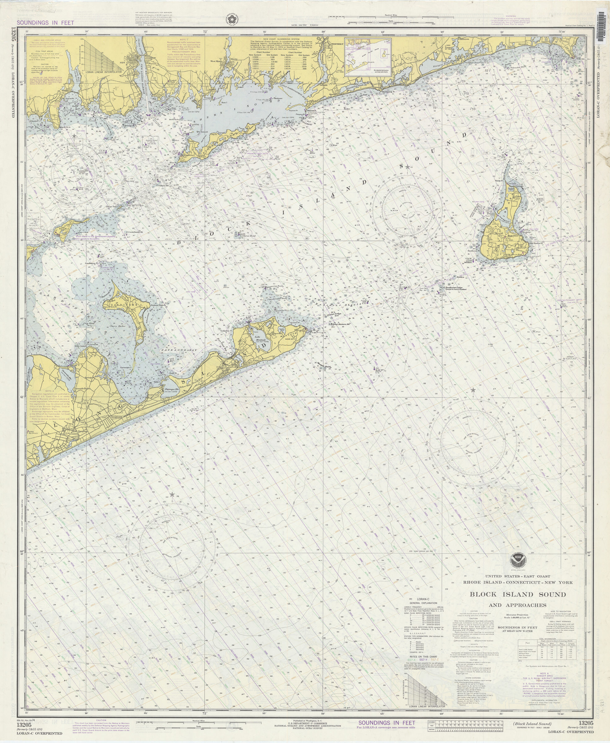
United States–east coast, Rhode Island–Connecticut–New York, Block Island Sound and approaches: National Ocean Survey 1974
Map No. Nautical chart-13205.Fl.Folio
“LORAN-A overprinted.” Depths shown by isolines and soundings. Relief shown by contours and spot heights. “Soundings in feet.” Includes text, new chart numbering system table and key map with reference numbers for larger scale maps of the area. “13205 (formerly C & GS 1211).” Same map with LORAN-C overprinted on verso.
Map area shown
Relation
Full catalog recordSize
100 × 83 cmDownload
Low Resolution Image
Creator
National Ocean Survey,Publisher
Brooklyn Historical SocietyCitation
United States–east coast, Rhode Island–Connecticut–New York, Block Island Sound and approaches: National Ocean Survey; 1974, Map Collection, Nautical chart-13205.Fl.Folio; Brooklyn Historical Society.Scale
Scale 1:80,000 at lat. 41Loading zoom image...