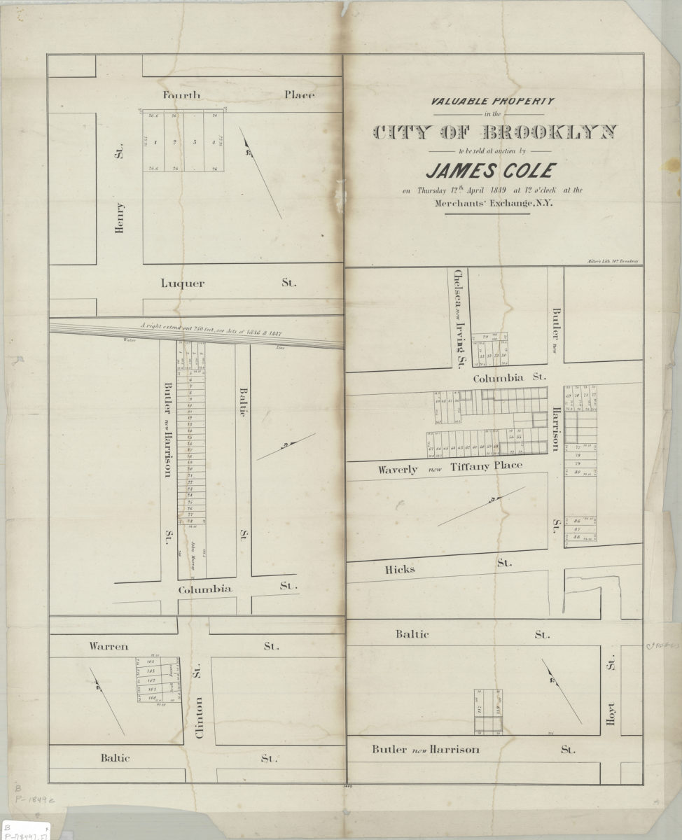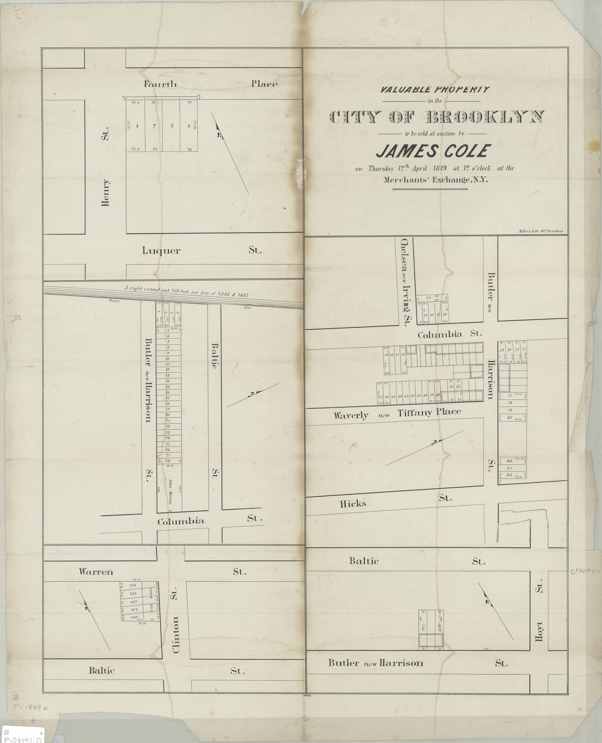
Valuable property in the city of Brooklyn to be sold at auction by James Cole on Thursday, 12th April, 1849, at 12 o’clock at the Merchants’ Exchange, N.Y. 1849
Map No. B P-[1849].Fl
Cadastral maps covering portions of modern-day Cobble Hill and Carroll Gardens. Maps show property (including lot numbers and dimensions), names of property owners, and water lines. Individual titles devised by cataloger. Orientations differ. “1400”–Lower center margin. [Map showing intersections of Henry St. with 4th Pl. and Luquer St.]. [Map showing intersections of Columbia St. with Baltic St. and Harrison St.]. [Map showing intersections of Clinton St. with Warren St. and Baltic St.]. [Map showing intersections of Hoyt St. with Baltic St. and Harrison St.]. [Map showing intersections of Harrison St. wth Columbia St., Tiffany Pl., and Hicks St.].
Subjects
Places
Map area shown
Genre
Cadastral mapsRelation
Full catalog recordSize
61 × 49 cmDownload
Low Resolution Image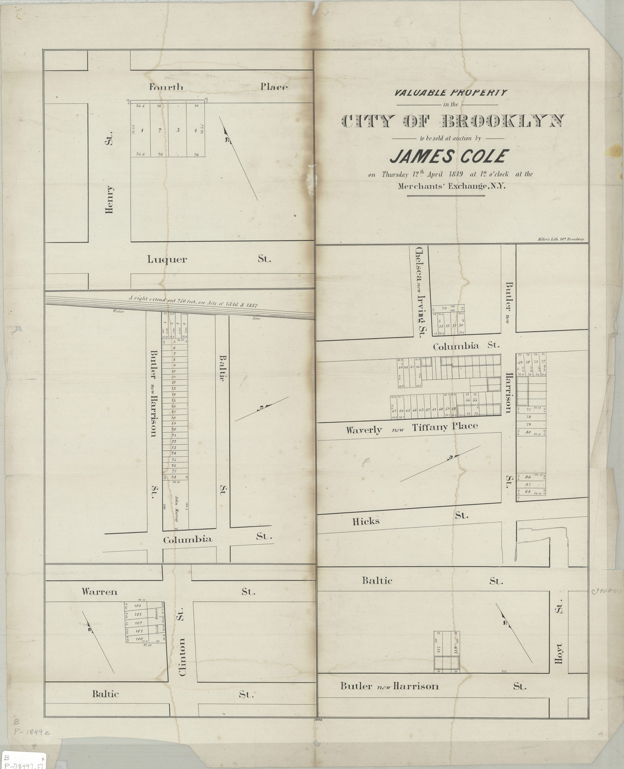
Creator
Miller & Co.,Publisher
Brooklyn Historical SocietyCitation
Valuable property in the city of Brooklyn to be sold at auction by James Cole on Thursday, 12th April, 1849, at 12 o’clock at the Merchants’ Exchange, N.Y.; 1849, Map Collection, B P-[1849].Fl; Brooklyn Historical Society.Scale
Scale not givenLoading zoom image...