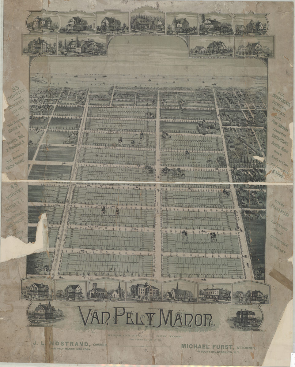
Van Pelt Manor, Kings County, New York [18??]
Map No. B P-[18--?]e.Fl
Cadastral map covering area north from Gravesend Bay to 76th St. and east from 18th Ave. to 20th Ave. (modern-day Bensonhurst and Bath Beach). Shows property (including lot numbers and buildings), and names of landowners. Relief show pictorially. Oriented with north to the bottom. Includes text and titled ill.
Subjects
Places
Map area shown
Relation
Full catalog recordSize
54 × 48 cmDownload
Low Resolution Image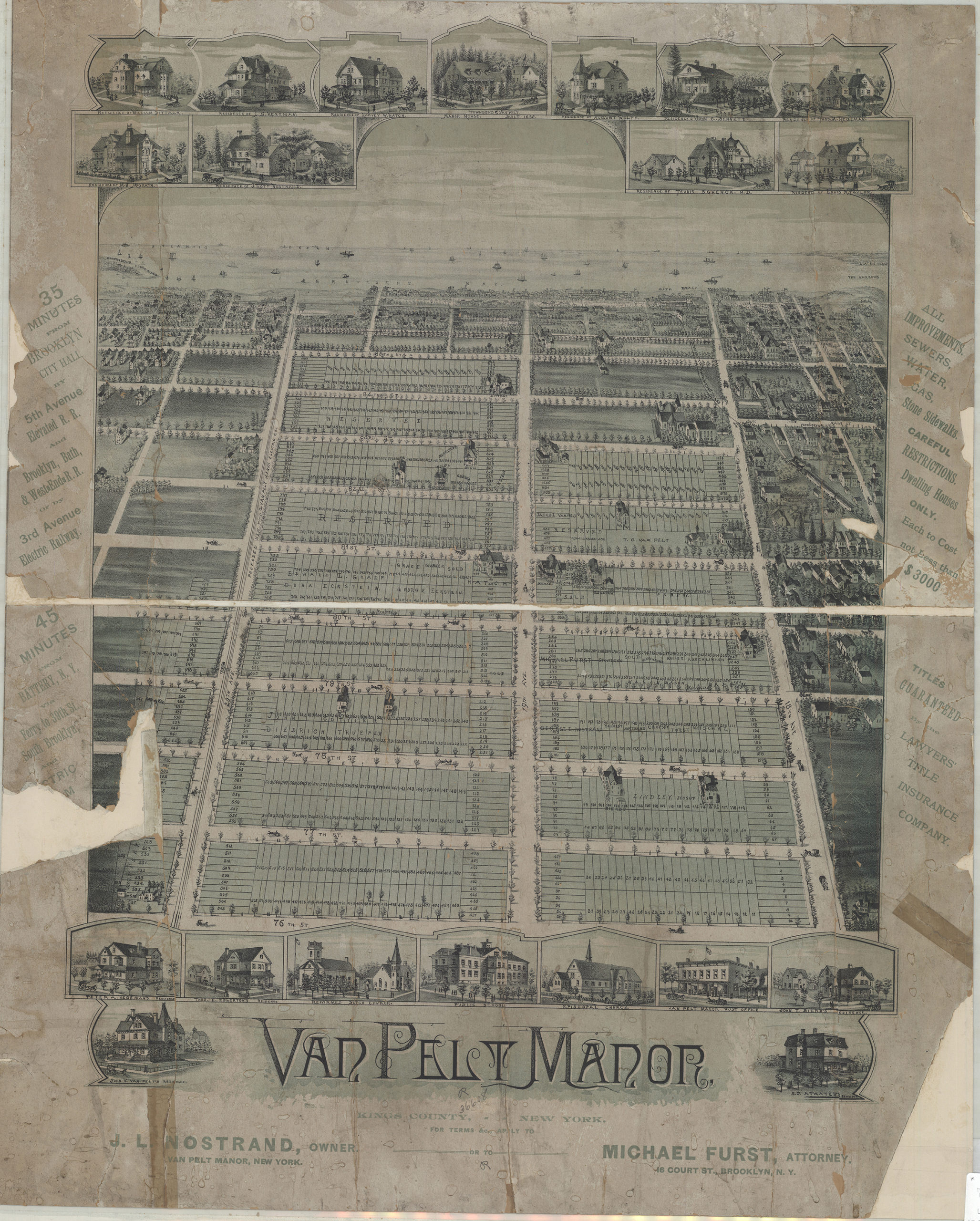
Creator
Publisher
Brooklyn Historical SocietyCitation
Van Pelt Manor, Kings County, New York; [18??], Map Collection, B P-[18--?]e.Fl; Brooklyn Historical Society.Scale
Scale not givenLoading zoom image...