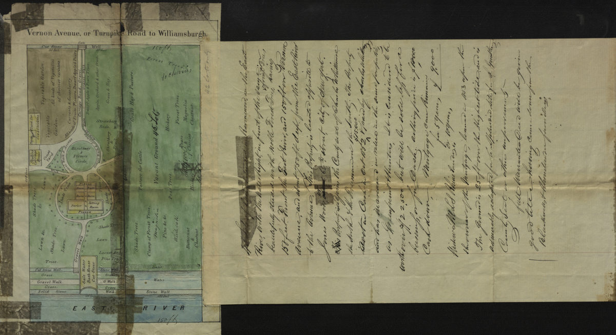
Vernon Avenue, or Turnpike Road to Williamsburgh [1853]
Map No. Q-[1853?].Fl
Covers a portion of Ravenswood in Queens County, from the East River inland 600 ft. Shows roads, buildings, and landscape details. Relief shown by hachures. Extracted from a larger map? Oriented with north to the lower left. Date of publication conjectured from accompanying note. Accompanying note describes property for sale in Ravenswood. BHS copy annotated in black ink.
Map area shown
Genre
Road mapsRelation
Full catalog recordSize
21 × 13 cmDownload
Low Resolution Image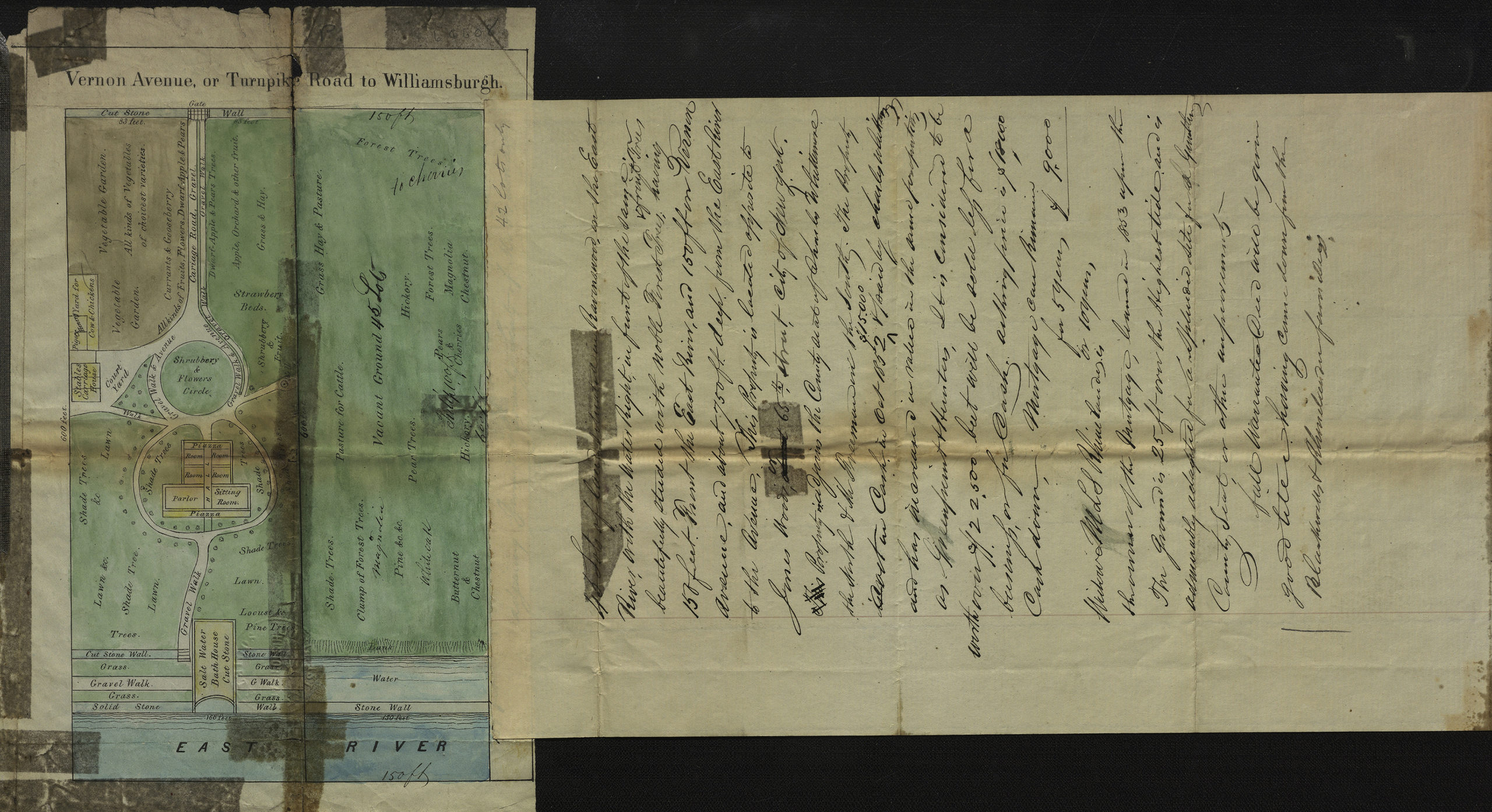
Creator
Publisher
Brooklyn Historical SocietyCitation
Vernon Avenue, or Turnpike Road to Williamsburgh; [1853], Map Collection, Q-[1853?].Fl; Brooklyn Historical Society.Scale
Scale not givenLoading zoom image...