
Village of Ft. Hamilton [1867-1891]
Map No. Bergen-1867-1891.Fl
Cadastral map. Shows property (including lot numbers and dimensions). Verso title. Oriented with north to the upper left. Originally 5 individual maps surveyed at different times likely drawn together on same sheet by T.G. Bergen and Van Brunt Bergen. Includes notes and calculations.
Map area shown
Relation
Full catalog recordSize
51 × 73 cmDownload
Low Resolution Image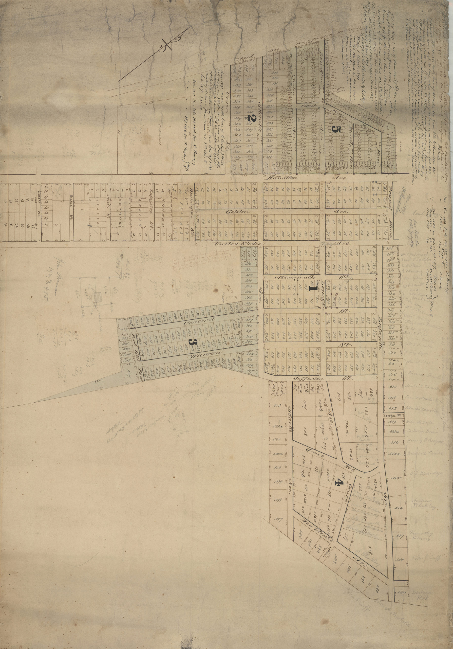
Creator
Bergen, Teunis G.; Bergen, Van Brunt,Publisher
Brooklyn Historical SocietyCitation
Village of Ft. Hamilton; [1867-1891], Map Collection, Bergen-1867-1891.Fl; Brooklyn Historical Society.Scale
Scale not givenLoading zoom image... 