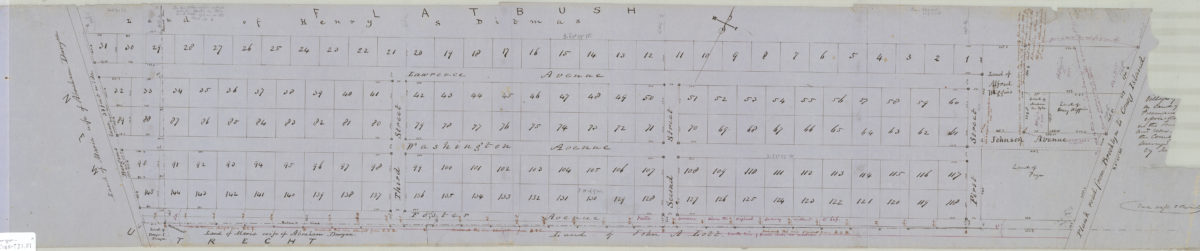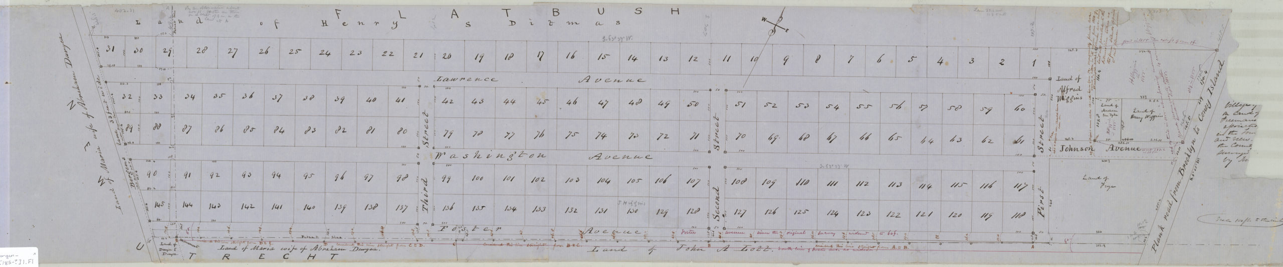
Village of Greenfield on David Johnson Farm, Flatbush [185?]
Map No. Bergen-[185-?]l.Fl
Cadastral map covering area bounded roughly by Lawrence Ave., Bergen’s Ln., Foster Ave., and the plank road from Brooklyn to Coney Island (modern-day Parkville). Shows property (including lot numbers and dimensions), and names of landowners. Verso title. Likely attributed to T.G. Bergen, based on handwriting on piece. Oriented with north to the upper right. Includes notes. BHS copy imperfect missing 14 x 6 cm. portion of upper right corner, including most of main map title. Cataloger unable to describe title without missing piece.
Subjects
Places
Map area shown
Relation
Full catalog recordSize
21 × 110 cmDownload
Low Resolution ImageCreator
Bergen, Teunis G., Bergen, Teunis G.,Publisher
Brooklyn Historical Society, Brooklyn Historical SocietyCitation
Village of Greenfield on David Johnson Farm, Flatbush; [185?], Map Collection, Bergen-[185-?]l.Fl; Brooklyn Historical Society.Scale
Scale [1:1,200] 1 in to 1Loading zoom image...